 |
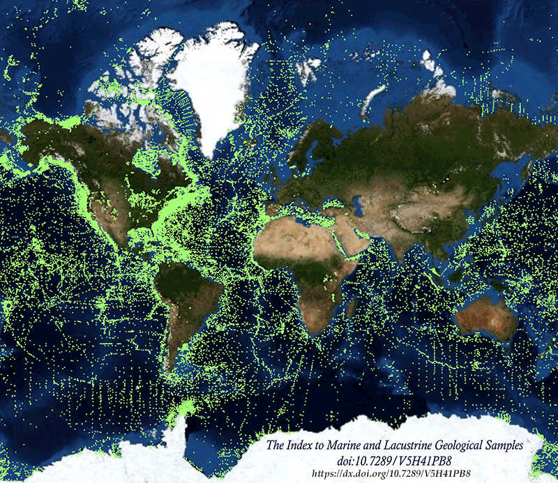
The Index to Marine and Lacustrine Geological Samples (IMLGS) describes and provides
access to ocean floor and lakebed rock and sediment samples curated by participating
institutional and government repositories in the U.S., Canada, the United Kingdom,
France, and Germany. Each curatorial facility prepares and submits data about their
own collection to NCEI for inclusion in the IMLGS. NCEI, on behalf of the Curator
community, maintains the IMLGS database and a dedicated web application for data discovery
and access. Physical material from most samples may be requested from the responsible
Curator for scientific research using contact information provided in IMLGS data listings.
As of July 2023, the IMLGS includes information for 228,785 discrete seabed and lakebed
cores, grabs, dredges, and drill holes worldwide. Minimum sample information required
for the IMLGS includes ship/platform name, cruise ID, sample ID, sampling device,
and latitude/longitude. Water depth, collection date, storage method, and principal
investigator are usually included. Core dimensions and depth to top and bottom of
interval is available for many core samples. Descriptions, comments, physiographic
province, lithology, texture, mineralogy, other components, glass remarks, metamorphism
information, weathering information, color, and geologic age are included for some
samples. An International Generic Sample Number (IGSN) is included, if available.
Links are also provided to related data and images at NCEI, partner institutions,
and to other sources of information including the System for Earth SAmple Registration
(SESAR) and the Rolling Deck to Repository (R2R). The IMLGS database was initially
designed by a group of Curators, in cooperation with NGDC (now NCEI), at a series
of meetings sponsored by the U.S. National Science Foundation (NSF) beginning in 1977.
The Curators group continues to meet annually to share best practices and oversee
the IMLGS database. |