| BLM/OCS Southern California Outer Continental Shelf Environmental Baseline Studies | spatialRepresentationInfo|
|---|---|
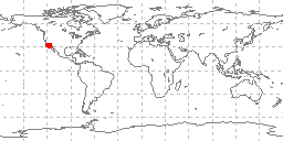
| а(MI_Metadata) ааааfileIdentifier: аgov.noaa.ngdc.mgg.geology:G02881 ааааhierarchyLevel: а(MD_ScopeCode)аdataset ааааcontact: а(CI_ResponsibleParty) ааааааааorganisationName: аNOAA National Centers for Environmental Information ааааааааcontactInfo: а(CI_Contact) ааааааааааааaddress: а(CI_Address) ааааааааааааааааelectronicMailAddress: аncei.info@noaa.gov ааааааааааааonlineResource: а(CI_OnlineResource) ааааааааааааааааlinkage: https://www.ncei.noaa.gov/contact ааааааааааааааааname: аNCEI Contact Information ааааааааааааааааdescription: аInformation for contacts at NCEI. ааааааааааааааааfunction: а(CI_OnLineFunctionCode)аinformation ааааааааrole: а(CI_RoleCode)аpointOfContact ааааdateStamp: а2020-04-21 ааааmetadataStandardName: аISO 19115-2 Geographic Information - Metadata - Part 2: Extensions for Imagery and Gridded Data ааааmetadataStandardVersion: аISO 19115-2:2009(E) return to top ааааspatialRepresentationInfo: а(MD_VectorSpatialRepresentation) ааааааааgeometricObjects: а(MD_GeometricObjects) ааааааааааааgeometricObjectType: а(MD_GeometricObjectTypeCode)аpoint return to top ааааreferenceSystemInfo: а(MD_ReferenceSystem) ааааааааreferenceSystemIdentifier: а(RS_Identifier) ааааааааааааauthority: а(CI_Citation) ааааааааааааааааtitle: аEuropean Petroleum Survey Group (EPSG) Geodetic Parameter Registry ааааааааааааааааdate: а(CI_Date) ааааааааааааааааааааdate: а2008-11-12 ааааааааааааааааааааdateType: а(CI_DateTypeCode)аpublication ааааааааааааааааcitedResponsibleParty: а(CI_ResponsibleParty) ааааааааааааааааааааorganisationName: аEuropean Petroleum Survey Group ааааааааааааааааааааcontactInfo: а(CI_Contact) ааааааааааааааааааааааааonlineResource: а(CI_OnlineResource) ааааааааааааааааааааааааааааlinkage: http://www.epsg-registry.org/ ааааааааааааааааааааааааааааname: аEuropean Petroleum Survey Group Geodetic Parameter Dataset ааааааааааааааааааааааааааааdescription: аRegistry that accesses the EPSG Geodetic Parameter Dataset, which is a structured dataset of Coordinate Reference Systems and Coordinate Transformations. ааааааааааааааааааааааааааааfunction: а(CI_OnLineFunctionCode)аsearch ааааааааааааааааааааrole: (inapplicable) ааааааааааааcode: аurn:ogc:def:crs:EPSG:4326 ааааааааааааversion: а6.18.3 return to top ааааidentificationInfo: а(MD_DataIdentification) ааааааааcitation: а(CI_Citation) ааааааааааааtitle: аBLM/OCS Southern California Outer Continental Shelf Environmental Baseline Studies ааааааааааааdate: а(CI_Date) ааааааааааааааааdate: а1977-08-10 ааааааааааааааааdateType: а(CI_DateTypeCode)аpublication ааааааааааааdate: а(CI_Date) ааааааааааааааааdate: а1977-08-10 ааааааааааааааааdateType: а(CI_DateTypeCode)аrevision ааааааааааааedition: аFirst ааааааааааааcitedResponsibleParty: а(CI_ResponsibleParty) ааааааааааааааааindividualName: аJohn Wilson ааааааааааааааааorganisationName: аScience Applications, Inc. ааааааааааааааааrole: а(CI_RoleCode)аauthor ааааааааааааcitedResponsibleParty: а(CI_ResponsibleParty) ааааааааааааааааorganisationName: аNOAA National Centers for Environmental Information ааааааааааааааааrole: а(CI_RoleCode)аpublisher ааааааааааааpresentationForm: а(CI_PresentationFormCode)аtableDigital ааааааааааааseries: а(CI_Series) ааааааааааааааааname: аMarine Geology and Geophysics (MGG) ааааааааааааааааissueIdentification: аMGG64995001/BLM/OCS/Southern California Baseline Studies ааааааааааааotherCitationDetails: аData produced by Science Applications, Inc., prime contractor on the Bureau of Land Management/Outer Continental Shelf - Southern California Studies (BLM/OCS) ааааааааabstract: аData in this file were produced by Science Applications, Inc., prime contractor on the Bureau of Land Management/Outer Continental Shelf - Southern California Studies (BLM/OCS). Data consist of six data files (benthic sediment characteristics, benthic sediment hydrocarbons, intertidal sediment hydrocarbons, intertidal sediment trace metals, benthic sediment trace metals, and intertidal sediment characteristics). Data are derived from 801 grab and box core samples from the sea floor offshore Southern California. Original documentation have been scanned as images to a .PDF document. The data were received on August 19, 1977. Some documentation has been transcribed to an ASCII readme file. Additional data codes and documentation are in poor, extremely hard to read condition. There are known problems in these data files, including truncation of records past the 80th column in the first file (Benthic Sediment Characteristics). Other problems exist in device codes and analyses that were unable to be resolved by multiple exchanges with the contributors. Additional problems may exist, including deviations from the specified formats. ааааааааpurpose: аenvironmental studies ааааааааcredit: аScience Applications, Inc., with funding from the NOAA and BLM Outer Continental Shelf Assessment Program. ааааааааstatus: а(MD_ProgressCode)аcompleted ааааааааstatus: а(MD_ProgressCode)аhistoricalArchive ааааааааpointOfContact: а(CI_ResponsibleParty) ааааааааааааorganisationName: аNOAA National Centers for Environmental Information ааааааааааааcontactInfo: а(CI_Contact) ааааааааааааааааaddress: а(CI_Address) ааааааааааааааааааааelectronicMailAddress: аncei.info@noaa.gov ааааааааааааааааonlineResource: а(CI_OnlineResource) ааааааааааааааааааааlinkage: https://www.ncei.noaa.gov/contact ааааааааааааааааааааname: аNCEI Contact Information ааааааааааааааааааааdescription: аInformation for contacts at NCEI. ааааааааааааааааааааfunction: а(CI_OnLineFunctionCode)аinformation ааааааааааааrole: а(CI_RoleCode)аpointOfContact ааааааааpointOfContact: а(CI_ResponsibleParty) ааааааааааааorganisationName: аNOAA National Centers for Environmental Information ааааааааааааpositionName: аMarine Geology Data Manager ааааааааааааcontactInfo: а(CI_Contact) ааааааааааааааааaddress: а(CI_Address) ааааааааааааааааааааdeliveryPoint: а325 Broadway, Mail Code E/NE42 ааааааааааааааааааааcity: аBoulder ааааааааааааааааааааadministrativeArea: аCO ааааааааааааааааааааpostalCode: а80305-3328 ааааааааааааааааааааcountry: аUSA ааааааааааааааааааааelectronicMailAddress: аgeology.info@noaa.gov ааааааааааааrole: а(CI_RoleCode)аpointOfContact ааааааааresourceMaintenance: а(MD_MaintenanceInformation) ааааааааааааmaintenanceAndUpdateFrequency: а(MD_MaintenanceFrequencyCode)аnotPlanned ааааааааааааmaintenanceNote: аCompleted data set, no additions planned. ааааааааgraphicOverview: а(MD_BrowseGraphic) ааааааааааааfileName: https://www.ngdc.noaa.gov/mgg/image/geolin/preview64995001.gif ааааааааааааfileDescription: аsample locations in study area ааааааааааааfileType: аGIF ааааааааdescriptiveKeywords: а(MD_Keywords) ааааааааааааkeyword: аOCS > Outer Continental Shelf Program ааааааааааааkeyword: аICSU-WDS > International Council for Science - World Data System ааааааааааааtype: а(MD_KeywordTypeCode)аproject ааааааааааааthesaurusName: а(CI_Citation) ааааааааааааааааtitle: аGlobal Change Master Directory (GCMD) Project Keywords ааааааааааааааааdate: а(CI_Date) ааааааааааааааааааааdate: а2020-01-09 ааааааааааааааааааааdateType: а(CI_DateTypeCode)аpublication ааааааааааааааааedition: а9.1 ааааааааааааааааcitedResponsibleParty: а(CI_ResponsibleParty) ааааааааааааааааааааorganisationName: аNASA Goddard Space Flight Center, Earth Science Data and Information System ааааааааааааааааааааcontactInfo: а(CI_Contact) ааааааааааааааааааааааааonlineResource: а(CI_OnlineResource) ааааааааааааааааааааааааааааlinkage: https://www.earthdata.nasa.gov/learn/find-data/idn/gcmd-keywords ааааааааааааааааааааааааааааname: аGlobal Change Master Directory (GCMD) Keywords ааааааааааааааааааааааааааааdescription: аThe information provided on this page seeks to define how the GCMD Keywords are structured, used and accessed. It also provides information on how users can participate in the further development of the keywords. ааааааааааааааааааааааааааааfunction: а(CI_OnLineFunctionCode)аinformation ааааааааааааааааааааrole: а(CI_RoleCode)аcustodian ааааааааdescriptiveKeywords: а(MD_Keywords) ааааааааааааkeyword: ааааааааааааааAnchor: аhttp://www.nodc.noaa.gov/cgi-bin/OAS/prd/project/details/184аOCS-SOUTHERN CALIFORNIA ааааааааааааkeyword: аOCS-SOUTHERN CALIFORNIA ааааааааааааtype: а(MD_KeywordTypeCode)аproject ааааааааааааthesaurusName: а(CI_Citation) ааааааааааааааааtitle: аNODC PROJECT NAMES THESAURUS ааааааааааааааааdate: (inapplicable) ааааааааdescriptiveKeywords: а(MD_Keywords) ааааааааааааkeyword: аScientific archives ааааааааааааkeyword: аElectronic records ааааааааааааkeyword: аOceanography ааааааааааааkeyword: аOcean bottom ааааааааааааkeyword: аGeology ааааааааааааkeyword: аSubmarine geology ааааааааааааkeyword: аMarine sediments ааааааааааааtype: а(MD_KeywordTypeCode)аtheme ааааааааааааthesaurusName: а(CI_Citation) ааааааааааааааааtitle: аLibrary of Congress Subject Headings ааааааааааааааааdate: (unknown) ааааааааааааааааcitedResponsibleParty: а(CI_ResponsibleParty) ааааааааааааааааааааorganisationName: аUS Library of Congress ааааааааааааааааааааcontactInfo: а(CI_Contact) ааааааааааааааааааааааааonlineResource: а(CI_OnlineResource) ааааааааааааааааааааааааааааlinkage: http://id.loc.gov/authorities/subjects ааааааааааааааааааааааааааааprotocol: аhttp ааааааааааааааааааааааааааааapplicationProfile: аweb browser ааааааааааааааааааааааааааааname: аLibrary of Congress Subject Headings (LCSH) ааааааааааааааааааааааааааааdescription: аThe Library of Congress Subject Headings (LCSH) are part of a Linked Data Service, actively maintained since 1898 to catalog materials held at the Library of Congress. ааааааааааааааааааааааааааааfunction: а(CI_OnLineFunctionCode)аinformation ааааааааааааааааааааrole: а(CI_RoleCode)аresourceProvider ааааааааdescriptiveKeywords: а(MD_Keywords) ааааааааааааkeyword: аMarine geology ааааааааааааtype: а(MD_KeywordTypeCode)аtheme ааааааааааааthesaurusName: а(CI_Citation) ааааааааааааааааtitle: аSeaDataNet Common Vocabularies ааааааааааааааааdate: (unknown) ааааааааааааааааcitedResponsibleParty: а(CI_ResponsibleParty) ааааааааааааааааааааorganisationName: аSeaDataNet ааааааааааааааааааааcontactInfo: а(CI_Contact) ааааааааааааааааааааааааonlineResource: а(CI_OnlineResource) ааааааааааааааааааааааааааааlinkage: http://www.seadatanet.org/Standards-Software/Common-Vocabularies ааааааааааааааааааааааааааааprotocol: аhttp ааааааааааааааааааааааааааааapplicationProfile: аweb browser ааааааааааааааааааааааааааааname: аSeaDataNet Common Vocabularies ааааааааааааааааааааааааааааdescription: аThe SeaDataNet Vocabulary Server is populated with lists describing a wide range of entities relevant to marine metadata and data such as parameters, sea area names, platform classes, instrument types, and so on. ааааааааааааааааааааааааааааfunction: а(CI_OnLineFunctionCode)аinformation ааааааааааааааааааааrole: а(CI_RoleCode)аresourceProvider ааааааааdescriptiveKeywords: а(MD_Keywords) ааааааааааааkeyword: аSea-floor characteristics ааааааааааааtype: а(MD_KeywordTypeCode)аtheme ааааааааааааthesaurusName: а(CI_Citation) ааааааааааааааааtitle: аUSGS Science Topics ааааааааааааааааdate: (unknown) ааааааааааааааааcitedResponsibleParty: а(CI_ResponsibleParty) ааааааааааааааааааааorganisationName: аUS Geological Survey ааааааааааааааааааааcontactInfo: а(CI_Contact) ааааааааааааааааааааааааonlineResource: а(CI_OnlineResource) ааааааааааааааааааааааааааааlinkage: https://www2.usgs.gov/science/about/ ааааааааааааааааааааааааааааprotocol: аhttp ааааааааааааааааааааааааааааapplicationProfile: аweb browser ааааааааааааааааааааааааааааname: аUSGS Thesaurus ааааааааааааааааааааааааааааdescription: аThe USGS Thesaurus contains thematic terms for categorizing information resources intended to support finding and understanding scientific information. ааааааааааааааааааааааааааааfunction: а(CI_OnLineFunctionCode)аinformation ааааааааааааааааааааrole: а(CI_RoleCode)аresourceProvider ааааааааdescriptiveKeywords: а(MD_Keywords) ааааааааааааkeyword: аEarth Science > OCEANS > Marine Sediments ааааааааааааkeyword: аEarth Science > Oceans > Marine Sediments > Sediment Chemistry ааааааааааааkeyword: аEarth Science > Oceans > Marine Sediments > Sediment Composition ааааааааааааkeyword: аEarth Science > Oceans > Marine Sediments > Sedimentation ааааааааааааkeyword: аEarth Science > Oceans > Marine Sediments > Geotechnical Properties ааааааааааааkeyword: аEarth Science > Biosphere > Aquatic Ecosystems > Benthic Habitat ааааааааааааkeyword: аEarth Science > Solid Earth > Rocks/Minerals/Crystals > Trace Elements ааааааааааааtype: а(MD_KeywordTypeCode)аtheme ааааааааааааthesaurusName: а(CI_Citation) ааааааааааааааааtitle: аGlobal Change Master Directory (GCMD) Science Keywords ааааааааааааааааdate: а(CI_Date) ааааааааааааааааааааdate: а2020-01-09 ааааааааааааааааааааdateType: а(CI_DateTypeCode)аpublication ааааааааааааааааedition: а9.1 ааааааааааааааааcitedResponsibleParty: а(CI_ResponsibleParty) ааааааааааааааааааааorganisationName: аNASA Goddard Space Flight Center, Earth Science Data and Information System ааааааааааааааааааааcontactInfo: а(CI_Contact) ааааааааааааааааааааааааonlineResource: а(CI_OnlineResource) ааааааааааааааааааааааааааааlinkage: https://www.earthdata.nasa.gov/learn/find-data/idn/gcmd-keywords ааааааааааааааааааааааааааааname: аGlobal Change Master Directory (GCMD) Keywords ааааааааааааааааааааааааааааdescription: аThe information provided on this page seeks to define how the GCMD Keywords are structured, used and accessed. It also provides information on how users can participate in the further development of the keywords. ааааааааааааааааааааааааааааfunction: а(CI_OnLineFunctionCode)аinformation ааааааааааааааааааааrole: а(CI_RoleCode)аcustodian ааааааааdescriptiveKeywords: а(MD_Keywords) ааааааааааааkeyword: аIn Situ Ocean-based Platforms > Ships ааааааааааааtype: а(MD_KeywordTypeCode)аplatform ааааааааааааthesaurusName: а(CI_Citation) ааааааааааааааааtitle: аGlobal Change Master Directory (GCMD) Platform Keywords ааааааааааааааааdate: а(CI_Date) ааааааааааааааааааааdate: а2020-01-09 ааааааааааааааааааааdateType: а(CI_DateTypeCode)аpublication ааааааааааааааааedition: а9.1 ааааааааааааааааcitedResponsibleParty: а(CI_ResponsibleParty) ааааааааааааааааааааorganisationName: аNASA Goddard Space Flight Center, Earth Science Data and Information System ааааааааааааааааааааcontactInfo: а(CI_Contact) ааааааааааааааааааааааааonlineResource: а(CI_OnlineResource) ааааааааааааааааааааааааааааlinkage: https://www.earthdata.nasa.gov/learn/find-data/idn/gcmd-keywords ааааааааааааааааааааааааааааname: аGlobal Change Master Directory (GCMD) Keywords ааааааааааааааааааааааааааааdescription: аThe information provided on this page seeks to define how the GCMD Keywords are structured, used and accessed. It also provides information on how users can participate in the further development of the keywords. ааааааааааааааааааааааааааааfunction: а(CI_OnLineFunctionCode)аinformation ааааааааааааааааааааrole: а(CI_RoleCode)аcustodian ааааааааdescriptiveKeywords: а(MD_Keywords) ааааааааааааkeyword: аIn Situ/Laboratory Instruments > Corers > Coring Devices ааааааааааааkeyword: аIn Situ/Laboratory Instruments > Corers > Sediment Corers ааааааааааааtype: а(MD_KeywordTypeCode)аinstrument ааааааааааааthesaurusName: а(CI_Citation) ааааааааааааааааtitle: аGlobal Change Master Directory (GCMD) Instrument Keywords ааааааааааааааааdate: а(CI_Date) ааааааааааааааааааааdate: а2020-01-09 ааааааааааааааааааааdateType: а(CI_DateTypeCode)аpublication ааааааааааааааааedition: а9.1 ааааааааааааааааcitedResponsibleParty: а(CI_ResponsibleParty) ааааааааааааааааааааorganisationName: аNASA Goddard Space Flight Center, Earth Science Data and Information System ааааааааааааааааааааcontactInfo: а(CI_Contact) ааааааааааааааааааааааааonlineResource: а(CI_OnlineResource) ааааааааааааааааааааааааааааlinkage: https://www.earthdata.nasa.gov/learn/find-data/idn/gcmd-keywords ааааааааааааааааааааааааааааname: аGlobal Change Master Directory (GCMD) Keywords ааааааааааааааааааааааааааааdescription: аThe information provided on this page seeks to define how the GCMD Keywords are structured, used and accessed. It also provides information on how users can participate in the further development of the keywords. ааааааааааааааааааааааааааааfunction: а(CI_OnLineFunctionCode)аinformation ааааааааааааааааааааrole: а(CI_RoleCode)аcustodian ааааааааdescriptiveKeywords: а(MD_Keywords) ааааааааааааkeyword: аCIESIN > Environmental Protection > Resource Management ааааааааааааkeyword: аCIESIN > Environmental Protection > Environmental Monitoring ааааааааааааtype: а(MD_KeywordTypeCode)аtheme ааааааааааааthesaurusName: а(CI_Citation) ааааааааааааааааtitle: аCIESIN Keyword Thesaurus ааааааааааааааааdate: (unknown) ааааааааdescriptiveKeywords: а(MD_Keywords) ааааааааааааkeyword: аDOC/NOAA/NESDIS/NCEI > National Centers for Environmental Information, NESDIS, NOAA, U.S. Department of Commerce ааааааааааааkeyword: аDOC/NOAA/NESDIS/NGDC > National Geophysical Data Center, NESDIS, NOAA, U.S. Department of Commerce ааааааааааааtype: а(MD_KeywordTypeCode)аdataCenter ааааааааааааthesaurusName: а(CI_Citation) ааааааааааааааааtitle: аGlobal Change Master Directory (GCMD) Data Center Keywords ааааааааааааааааdate: а(CI_Date) ааааааааааааааааааааdate: а2020-01-09 ааааааааааааааааааааdateType: а(CI_DateTypeCode)аpublication ааааааааааааааааedition: а9.1 ааааааааааааааааcitedResponsibleParty: а(CI_ResponsibleParty) ааааааааааааааааааааorganisationName: аNASA Goddard Space Flight Center, Earth Science Data and Information System ааааааааааааааааааааcontactInfo: а(CI_Contact) ааааааааааааааааааааааааonlineResource: а(CI_OnlineResource) ааааааааааааааааааааааааааааlinkage: https://www.earthdata.nasa.gov/learn/find-data/idn/gcmd-keywords ааааааааааааааааааааааааааааname: аGlobal Change Master Directory (GCMD) Keywords ааааааааааааааааааааааааааааdescription: аThe information provided on this page seeks to define how the GCMD Keywords are structured, used and accessed. It also provides information on how users can participate in the further development of the keywords. ааааааааааааааааааааааааааааfunction: а(CI_OnLineFunctionCode)аinformation ааааааааааааааааааааrole: а(CI_RoleCode)аcustodian ааааааааdescriptiveKeywords: а(MD_Keywords) ааааааааааааkeyword: аOcean > Pacific Ocean ааааааааааааkeyword: аVertical Location >Sea Floor ааааааааааааtype: а(MD_KeywordTypeCode)аplace ааааааааааааthesaurusName: а(CI_Citation) ааааааааааааааааtitle: аGlobal Change Master Directory (GCMD) Location Keywords ааааааааааааааааdate: а(CI_Date) ааааааааааааааааааааdate: а2020-01-09 ааааааааааааааааааааdateType: а(CI_DateTypeCode)аpublication ааааааааааааааааedition: а9.1 ааааааааааааааааcitedResponsibleParty: а(CI_ResponsibleParty) ааааааааааааааааааааorganisationName: аNASA Goddard Space Flight Center, Earth Science Data and Information System ааааааааааааааааааааcontactInfo: а(CI_Contact) ааааааааааааааааааааааааonlineResource: а(CI_OnlineResource) ааааааааааааааааааааааааааааlinkage: https://www.earthdata.nasa.gov/learn/find-data/idn/gcmd-keywords ааааааааааааааааааааааааааааname: аGlobal Change Master Directory (GCMD) Keywords ааааааааааааааааааааааааааааdescription: аThe information provided on this page seeks to define how the GCMD Keywords are structured, used and accessed. It also provides information on how users can participate in the further development of the keywords. ааааааааааааааааааааааааааааfunction: а(CI_OnLineFunctionCode)аinformation ааааааааааааааааааааrole: а(CI_RoleCode)аcustodian ааааааааresourceConstraints: а(MD_LegalConstraints) ааааааааааааaccessConstraints: а(MD_RestrictionCode)аotherRestrictions ааааааааааааotherConstraints: аDistribution liability: NOAA and NCEI make no warranty, expressed or implied, regarding these data, nor does the fact of distribution constitute such a warranty. NOAA and NCEI cannot assume liability for any damages caused by any errors or omissions in these data. If appropriate, NCEI can only certify that the data it distributes are an authentic copy of the records that were accepted for inclusion in the NCEI archives. ааааааааresourceConstraints: а(MD_LegalConstraints) ааааааааааааuseConstraints: а(MD_RestrictionCode)аotherRestrictions ааааааааааааotherConstraints: аUse liability: NOAA and NCEI cannot provide any warranty as to the accuracy, reliability, or completeness of furnished data. Users assume responsibility to determine the usability of these data. The user is responsible for the results of any application of this data for other than its intended purpose. ааааааааresourceConstraints: а(MD_LegalConstraints) ааааааааааааuseLimitation: а(MD_RestrictionCode)аotherRestrictions ааааааааааааotherConstraints: аCite as: John Wilson. 1977: BLM/OCS Southern California Outer Continental Shelf Environmental Baseline Studies. NOAA National Centers for Environmental Information. Accessed [date]. ааааааааresourceConstraints: а(MD_Constraints) ааааааааааааuseLimitation: аProduced by the NOAA National Centers for Environmental Information. Not subject to copyright protection within the United States. ааааааааresourceConstraints: а(MD_LegalConstraints) ааааааааааааuseConstraints: а(MD_RestrictionCode)аotherRestrictions ааааааааааааotherConstraints: аWhile every effort has been made to ensure that these data are accurate and reliable within the limits of the current state of the art, NOAA cannot assume liability for any damages caused by any errors or omissions in the data, nor as a result of the failure of the data to function on a particular system. NOAA makes no warranty, expressed or implied, nor does the fact of distribution constitute such a warranty. ааааааааresourceConstraints: а(MD_SecurityConstraints) ааааааааааааclassification: а(MD_ClassificationCode)аunclassified ааааааааresourceConstraints: а(MD_LegalConstraints) ааааааааааааaccessConstraints: а(MD_RestrictionCode)аotherRestrictions ааааааааааааotherConstraints: аAccess to this dataset is unrestricted. ааааааааaggregationInfo: а(MD_AggregateInformation) ааааааааааааaggregateDataSetName: а(CI_Citation) ааааааааааааааааtitle: аThe NGDC Seafloor Sediment Grain Size Database ааааааааааааааааdate: а(CI_Date) ааааааааааааааааааааdate: а1976-12-31 ааааааааааааааааааааdateType: а(CI_DateTypeCode)аpublication ааааааааааааааааidentifier: а(MD_Identifier) ааааааааааааааааааааcode: ааааааааааааааааааааааAnchor: аDOIаdoi:10.7289/V5G44N6W ааааааааааааааааcitedResponsibleParty: а(CI_ResponsibleParty) ааааааааааааааааааааorganisationName: аNational Geophysical Data Center, NOAA ааааааааааааааааааааrole: а(CI_RoleCode)аauthor ааааааааааааааааcitedResponsibleParty: а(CI_ResponsibleParty) ааааааааааааааааааааorganisationName: (inapplicable) ааааааааааааааааааааcontactInfo: а(CI_Contact) ааааааааааааааааааааааааonlineResource: а(CI_OnlineResource) ааааааааааааааааааааааааааааlinkage: https://doi.org/10.7289/V5G44N6W ааааааааааааааааааааааааааааprotocol: аWWW:LINK-1.0-http--link ааааааааааааааааааааааааааааapplicationProfile: аWeb Browser ааааааааааааааааааааааааааааname: аRelated database (doi:10.7289/V5G44N6W) ааааааааааааааааааааааааааааdescription: аThis database contains related grain size data. ааааааааааааааааааааааааааааfunction: а(CI_OnLineFunctionCode)аinformation ааааааааааааааааааааrole: (inapplicable) ааааааааааааааааotherCitationDetails: аNational Geophysical Data Center (1976): The NGDC Seafloor Sediment Grain Size Database. NOAA National Centers for Environmental Information. doi:10.7289/V5G44N6W ааааааааааааassociationType: а(DS_AssociationTypeCode)аcrossReference ааааааааааааinitiativeType: а(DS_InitiativeTypeCode)аproject ааааааааaggregationInfo: а(MD_AggregateInformation) ааааааааааааaggregateDataSetName: а(CI_Citation) ааааааааааааааааtitle: аNCEI Marine Geology Data Archive ааааааааааааааааdate: а(CI_Date) ааааааааааааааааааааdate: а1977-12-31 ааааааааааааааааааааdateType: а(CI_DateTypeCode) ааааааааааааааааcitedResponsibleParty: а(CI_ResponsibleParty) ааааааааааааааааааааorganisationName: аNOAA National Centers for Environmental Information ааааааааааааааааааааrole: а(CI_RoleCode)аresourceProvider ааааааааааааааааcitedResponsibleParty: а(CI_ResponsibleParty) ааааааааааааааааааааorganisationName: (inapplicable) ааааааааааааааааааааcontactInfo: а(CI_Contact) ааааааааааааааааааааааааonlineResource: а(CI_OnlineResource) ааааааааааааааааааааааааааааlinkage: https://data.noaa.gov/metaview/page?xml=NOAA/NESDIS/NGDC/Collection/iso/xml/Marine_Geology.xml&view=getDataView&header=none ааааааааааааааааааааааааааааprotocol: аWWW:LINK-1.0-http--link ааааааааааааааааааааааааааааapplicationProfile: аWeb Browser ааааааааааааааааааааааааааааname: аParent Archive ааааааааааааааааааааааааааааdescription: аInformation about the Marine Geology Data Archive at NCEI. ааааааааааааааааааааааааааааfunction: а(CI_OnLineFunctionCode)аinformation ааааааааааааааааааааrole: (inapplicable) ааааааааааааassociationType: а(DS_AssociationTypeCode)аlargerWorkCitation ааааааааааааinitiativeType: а(DS_InitiativeTypeCode)аcollection ааааааааaggregationInfo: а(MD_AggregateInformation) ааааааааааааaggregateDataSetName: а(CI_Citation) ааааааааааааааааtitle: аNOAA/NCEI Marine Geology WAF ааааааааааааааааdate: а(CI_Date) ааааааааааааааааааааdate: а2015-10-05 ааааааааааааааааааааdateType: а(CI_DateTypeCode) ааааааааааааааааcitedResponsibleParty: а(CI_ResponsibleParty) ааааааааааааааааааааorganisationName: аNOAA National Centers for Environmental Information ааааааааааааааааааааrole: а(CI_RoleCode)аauthor ааааааааааааааааcitedResponsibleParty: а(CI_ResponsibleParty) ааааааааааааааааааааorganisationName: (inapplicable) ааааааааааааааааааааcontactInfo: а(CI_Contact) ааааааааааааааааааааааааonlineResource: а(CI_OnlineResource) ааааааааааааааааааааааааааааlinkage: https://data.noaa.gov/waf/NOAA/NESDIS/NGDC/MGG/Geology/iso/ ааааааааааааааааааааааааааааprotocol: аWWW:LINK-1.0-http--link ааааааааааааааааааааааааааааapplicationProfile: аWeb Browser ааааааааааааааааааааааааааааname: аMarine geology metadata records. ааааааааааааааааааааааааааааfunction: а(CI_OnLineFunctionCode)аsearch ааааааааааааааааааааrole: (inapplicable) ааааааааааааassociationType: а(DS_AssociationTypeCode)аcrossReference ааааааааааааinitiativeType: а(DS_InitiativeTypeCode)аcollection ааааааааspatialRepresentationType: а(MD_SpatialRepresentationTypeCode)аvector ааааааааspatialResolution: (missing) а(MD_Resolution) ааааааааааааlevelOfDetail: аVertical resolution is 1 meter and horizontal resolution is .001 degree. ааааааааlanguage: ааааааааааLanguageCode: аeng; USA ааааааааcharacterSet: а(MD_CharacterSetCode)аUTF8 ааааааааtopicCategory: а(MD_TopicCategoryCode)аgeoscientificInformation ааааааааtopicCategory: а(MD_TopicCategoryCode)аoceans ааааааааenvironmentDescription: аNative Dataset Environment: ASCII text ааааааааextent: а(EX_Extent) ааааааааааааdescription: аOffshore Southern California ааааааааааааgeographicElement: а(EX_GeographicBoundingBox) ааааааааааааааааwestBoundLongitude: а-120.533 ааааааааааааааааeastBoundLongitude: а-117.251 ааааааааааааааааsouthBoundLatitude: а30.666 ааааааааааааааааnorthBoundLatitude: а34.411 ааааааааааааtemporalElement: а(EX_TemporalExtent) ааааааааааааааааextent: ааааааааааааааааааTimePeriod: ааааааааааааааааааааdescription: аPublication Date ааааааааааааааааааааbeginPosition: а1975-9-8 ааааааааааааааааааааendPosition: а1976-5-7 ааааааааааааverticalElement: а(EX_VerticalExtent) ааааааааааааааааminimumValue: ааааааааааааааааааReal: а-200 ааааааааааааааааmaximumValue: ааааааааааааааааааReal: а0 ааааааааааааааааverticalCRS: (missing) ааааааааsupplementalInformation: аDue to quality concerns, these data were not added to the historic NGDC Seafloor Sediment Grain Size Database, and are only available in their original form. Vertical extent is not known, continental shelf return to top ааааcontentInfo: а(MD_CoverageDescription) ааааааааattributeDescription: ааааааааааRecordType: аThe Latitude and Longitude (point) from which a sample of sediment or rock was collected from the sea floor or a lakebed. ааааааааcontentType: а(MD_CoverageContentTypeCode)аpoint ааааааааdimension: а(MD_Band) ааааааааааааsequenceIdentifier: ааааааааааааааMemberName: ааааааааааааааааaName: аLatitude ааааааааааааааааattributeType: (unknown) ааааааааааааdescriptor: аDistance measured north or south from the equator. Distance north is positive, distance south is negative. ааааааааааааmaxValue: ааааааааааааааReal: а90.00000 ааааааааааааminValue: ааааааааааааааReal: а-90.00000 ааааааааааааunits: ааааааааааааааUnitDefinition: ааааааааааааааааidentifier: аdecimal degrees ааааааааааааааааname: аdecimal degrees ааааааааdimension: а(MD_Band) ааааааааааааsequenceIdentifier: ааааааааааааааMemberName: ааааааааааааааааaName: аLongitude ааааааааааааааааattributeType: (unknown) ааааааааааааdescriptor: аLongitude is measured from the Prime Meridian (which is the north/south line that runs through Greenwich, England), values measured east are positive and values measured west are negative. ааааааааааааmaxValue: ааааааааааааааReal: а180.00000 ааааааааааааminValue: ааааааааааааааReal: а-180.00000 ааааааааааааunits: ааааааааааааааUnitDefinition: ааааааааааааааааidentifier: аdecimal degrees ааааааааааааааааname: аdecimal degrees return to top ааааcontentInfo: а(MD_FeatureCatalogueDescription) ааааааааcomplianceCode: аfalse ааааааааincludedWithDataset: аtrue ааааааааfeatureTypes: ааааааааааLocalName: ааааааааfeatureCatalogueCitation: а(CI_Citation) ааааааааааааtitle: аDocumentation for the BLM/OCS/Southern California Baseline Studies dataset. ааааааааааааdate: а(CI_Date) ааааааааааааааааdate: а1976-01-01 ааааааааааааааааdateType: а(CI_DateTypeCode)аcreation ааааааааааааotherCitationDetails: аEntities and attributes are completely described in a text file accompanying the dataset on download. return to top ааааdistributionInfo: а(MD_Distribution) ааааааааdistributor: а(MD_Distributor) ааааааааааааdistributorContact: а(CI_ResponsibleParty) ааааааааааааааааorganisationName: аNOAA National Centers for Environmental Information ааааааааааааааааcontactInfo: а(CI_Contact) ааааааааааааааааааааaddress: а(CI_Address) ааааааааааааааааааааааааelectronicMailAddress: аncei.info@noaa.gov ааааааааааааааааааааonlineResource: а(CI_OnlineResource) ааааааааааааааааааааааааlinkage: https://www.ncei.noaa.gov/contact ааааааааааааааааааааааааname: аNCEI Contact Information ааааааааааааааааааааааааdescription: аInformation for contacts at NCEI. ааааааааааааааааааааааааfunction: а(CI_OnLineFunctionCode)аinformation ааааааааааааааааrole: а(CI_RoleCode)аdistributor ааааааааааааdistributionOrderProcess: а(MD_StandardOrderProcess) ааааааааааааааааfees: аIn most cases, electronic downloads of the data are free. However, fees may apply for custom orders, data certifications, copies of analog materials, and data distribution on physical media. ааааааааааааааааorderingInstructions: аContact NCEI for other distribution options and instructions. ааааааааааааdistributorFormat: а(MD_Format) ааааааааааааааааname: аASCII ааааааааааааааааversion: аUTF-8 ааааааааааааааааspecification: аAmerican Standard Code for Information Interchange (ASCII) text format. ааааааааааааdistributorFormat: а(MD_Format) ааааааааааааааааname: аtar.gz ааааааааааааааааversion: аunknown ааааааааааааааааspecification: аcompressed tape archive (tar) file ааааааааааааdistributorFormat: а(MD_Format) ааааааааааааааааname: аPDF ааааааааааааааааversion: (unknown) ааааааааааааааааspecification: аAdobe Portable Document Format (PDF). ааааааааааааdistributorTransferOptions: а(MD_DigitalTransferOptions) ааааааааааааааааonLine: а(CI_OnlineResource) ааааааааааааааааааааlinkage: https://data.noaa.gov/metaview/page?xml=NOAA/NESDIS/NGDC/MGG/Geology/iso/xml/G02881.xml&view=getDataView&header=none ааааааааааааааааааааprotocol: аWWW:LINK-1.0-http--link ааааааааааааааааааааapplicationProfile: аWeb Browser ааааааааааааааааааааname: аMetadata Landing Page ааааааааааааааааааааdescription: аInformation about the data set, all access options, and complete documentation. ааааааааааааааааааааfunction: а(CI_OnLineFunctionCode)аinformation ааааааааааааdistributorTransferOptions: а(MD_DigitalTransferOptions) ааааааааааааааааonLine: а(CI_OnlineResource) ааааааааааааааааааааlinkage: https://www.ngdc.noaa.gov/mgg/geology/data/g02881/ ааааааааааааааааааааprotocol: аWWW:LINK-1.0-http--link ааааааааааааааааааааapplicationProfile: аWeb Browser ааааааааааааааааааааname: аData files and documentation ааааааааааааааааааааdescription: аDownload data files and documentation ааааааааааааааааааааfunction: а(CI_OnLineFunctionCode)аdownload ааааааааааааdistributorTransferOptions: а(MD_DigitalTransferOptions) ааааааааааааааааonLine: а(CI_OnlineResource) ааааааааааааааааааааlinkage: https://www.ngdc.noaa.gov/mgg/geology/data/g02881/readme.txt ааааааааааааааааааааprotocol: аWWW:LINK-1.0-http--link ааааааааааааааааааааapplicationProfile: аWeb Browser ааааааааааааааааааааname: аReadme file ааааааааааааааааааааdescription: аData set information summary, followed by record format and field contents for all data types. ааааааааааааааааааааfunction: а(CI_OnLineFunctionCode)аinformation return to top ааааdataQualityInfo: а(DQ_DataQuality) ааааааааscope: а(DQ_Scope) ааааааааааааlevel: а(MD_ScopeCode)аdataset ааааааааааааextent: а#boundingExtent ааааааааааааlevelDescription: а(MD_ScopeDescription) ааааааааааааааааdataset: аgov.noaa.ngdc.mgg.geology:G02881 ааааааааreport: а(DQ_AbsoluteExternalPositionalAccuracy) ааааааааааааnameOfMeasure: аHorizontal Positional Accuracy ааааааааааааmeasureDescription: (unknown) ааааааааааааevaluationMethodDescription: аThe horizontal accuracy of data values is approximately .001 degree of latitude/longitude. ааааааааааааresult: (unknown) ааааааааreport: а(DQ_QuantitativeAttributeAccuracy) ааааааааааааnameOfMeasure: аReliability ааааааааааааmeasureDescription: аGrain size data from this data set were run through algorithm to sum phi weight percentages, and due to quality concerns raised during the process, were not added to the historic NGDC Seafloor Sediment Grain Size Database. Grain size analyses from this data set are only available in their original form. ааааааааааааevaluationMethodDescription: аQuality control was performed by the originator. NCEI performed basic out-of-range location testing. ааааааааааааresult: (unknown) ааааааааlineage: а(LI_Lineage) ааааааааааааstatement: аGrain size analyses from this data set were not reformatted to the 073 format for addition to the NGDC Seafloor Sediment Grain Size Database due to quality concerns. Data were contributed by the originator to NOAA's former National Oceanographic Data Center (NODC) and may be part of a larger compilation archived as oceanographic data by NCEI. Data were received in September of 1977 on nine track magnetic tape in EBCDIC form as five files of 130 character records blocked to 2600 characters per block. The tape contained 2, 580 records, there were 1,066 sample header records, but all but 801 were duplicated. Francis Mitchel of NODC noted on transmission that the data were probably not usable. ааааааааааааprocessStep: а(LI_ProcessStep) ааааааааааааааааdescription: аFrom 1975 through the 1980s, most sediment data collected as part of offshore environmental baseline and/or habitat studies were part of a suite of measurements sent to NODC or NODC liasons. NODC data managers, primarily Francis Mitchel, then sent the sediment-related data (e.g., physical properties, composition, geochemstry, mineralogy) to the former NGDC as the authoritative archive and distribution point for sediment data. Many sediment analyses and descriptions, however, were maintained by NODC as benthic habitat data, and some additional sediment data were duplicated between the NODC and NGDC archives. ааааааааааааааааdateTime: ааааааааааааааааааDateTime: а1977-08-10T00:00:00 ааааааааааааsource: а(LI_Source) ааааааааааааааааdescription: аJohn Wilson Science Applications, Inc. return to top ааааdataQualityInfo: а(DQ_DataQuality) ааааааааscope: а(DQ_Scope) ааааааааааааlevel: а(MD_ScopeCode)аrepository ааааааааааааlevelDescription: а(MD_ScopeDescription) ааааааааааааааааother: аNOAA National Centers for Environmental Information ааааааааlineage: а(LI_Lineage) ааааааааааааprocessStep: а(LE_ProcessStep) ааааааааааааааааdescription: аNOAA created the National Centers for Environmental Information (NCEI) by merging NOAA's National Climatic Data Center (NCDC), National Geophysical Data Center (NGDC), and National Oceanographic Data Center (NODC), including the National Coastal Data Development Center (NCDDC), per the Consolidated and Further Continuing Appropriations Act, 2015, Public Law 113-235. NCEI launched publicly on April 22, 2015. ааааааааааааааааdateTime: ааааааааааааааааааDateTime: а2015-04-22T00:00:00 return to top ааааmetadataMaintenance: а(MD_MaintenanceInformation) ааааааааmaintenanceAndUpdateFrequency: а(MD_MaintenanceFrequencyCode)аasNeeded ааааааааmaintenanceNote: аModified for compliance to NCEI Template v1.2. return to top ааааacquisitionInformation: а(MI_AcquisitionInformation) ааааааааinstrument: а(MI_Instrument) ааааааааааааidentifier: а(MD_Identifier) ааааааааааааааааcode: аvarious ааааааааааааtype: (unknown) ааааааааааааdescription: аgrab/dredge, box cores ааааааааplatform: а(MI_Platform) ааааааааааааidentifier: а(MD_Identifier) ааааааааааааааааcode: аIn Situ Ocean-based Platforms > SHIPS ааааааааааааdescription: аVarious ocean-based and lake-based ships, boats, remotely operated vehicles, submersibles, and other unspecified types of platforms ааааааааааааinstrument: (inapplicable) | |