The MAFLA (Mississippi, Alabama, Florida) Study, Grain Size Analyses
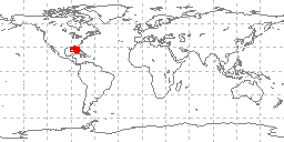 sample locations in study area
The MAFLA (Mississippi, Alabama, Florida) Study was funded by NOAA as part of the
Outer Continental Shelf Program. Dr. L.J. Doyle produced grain size analyses in the
historic 073 format for 2,168 sea floor samples collected on multiple cruises (MAFLA
cruises 2, 10, 11, 29, 39, 14, 21, and MAFLA DM1 and DM2) conducted in the Gulf of
Mexico from May 16, 1974 through February 20, 1978. Data include collecting institution,
ship, cruise, sample id, latitude/longitude, date of collection, water depth, sampling
device, method of analysis, sample weight, sampled interval, raw weight percentages
of sediment, within a given phi range. Some samples also have percentages of total
gravel, sand, silt, clay, and statistical measurements such as mean, median, skewness,
kurtosis, and standard deviation of grain size. These data are part of the larger
NCEI digital grain size database.
- Cite as: L. J. Doyle. 1985: The MAFLA (Mississippi, Alabama, Florida) Study, Grain Size Analyses. First. NOAA National Centers for Environmental Information. Accessed [date].
- ID not available.
gov.noaa.ngdc.mgg.geology:G02890
| Download Data |
|
| Distribution Formats |
|
| Ordering Instructions | Contact NCEI for other distribution options and instructions. |
| Distributor | NOAA National Centers for Environmental Information ncei.info@noaa.gov |
| Dataset Point of Contact | NOAA National Centers for Environmental Information ncei.info@noaa.gov |
| Dataset Point of Contact | Marine Geology Data Manager NOAA National Centers for Environmental Information geology.info@noaa.gov |
| Coverage Description | Gulf of Mexico offshore Mississippi, Alabama, and Florida |
| Time Period | 1974-05-16 to 1978-02-20 |
| Spatial Reference System | urn:ogc:def:crs:EPSG:4326 |
| Spatial Bounding Box Coordinates |
West:-88.949
East:-82.248
South:25.647
North:30.305
|
| Spatial Coverage Map | |
| General Documentation |
|
| Associated Resources |
|
| Publication Dates |
|
| Edition | First |
| Data Presentation Form | Digital table - digital representation of facts or figures systematically displayed,
especially in columns |
| Dataset Progress Status | Complete - production of the data has been completed Historical archive - data has been stored in an offline storage facility |
| Data Update Frequency | Not planned - Completed data set, no additions planned. |
| Supplemental Information |
minimal documentation, added to NGDC grainsize database
|
| Purpose | environmental research |
| Use Limitations |
|
| Dataset Citation |
|
| Cited Authors |
|
| Publishers |
|
| Acknowledgments |
|
| Theme keywords | Library of Congress Subject Headings
|
| Data Center keywords | Global Change Master Directory (GCMD) Data Center Keywords
|
| Platform keywords | Global Change Master Directory (GCMD) Platform Keywords
|
| Instrument keywords | Global Change Master Directory (GCMD) Instrument Keywords
|
| Place keywords | Global Change Master Directory (GCMD) Location Keywords
|
| Project keywords | Global Change Master Directory (GCMD) Project Keywords
|
| Use Constraints |
|
| Access Constraints |
|
| Other Constraints | Cite as: L. J. Doyle. 1985: The MAFLA (Mississippi, Alabama, Florida) Study, Grain Size Analyses. First. NOAA National Centers for Environmental Information. Accessed [date]. |
| Fees |
|
| Lineage Statement | These data were contributed by the originator to NOAA's former National Oceanographic Data Center (NODC) and may be part of a larger compilation archived as oceanographic data by NCEI. Data were contributed on nine track magnetic tape in ASCII form, as 80 character records blocked to 4800 characters/block. Ten files of MAFLA data were followed by additional STOCS data on the tape, as described in a separate metadata record. Data files included cruises MAFLA002, MAFLA010, MAFLA011, MAFLA014, MAFLA021, MAFLA029, MAFLA039, MAFLADM1, MAFLADM2, and MAFLADM4 - 15,175 records of 073 grain size data with no significant errors, so they were added to the NGDC Seafloor Sediment Grain Size Database. |
| Processing Environment | Native Dataset Environment: ASCII text |
| Source Datasets |
| Processing Steps |
|
| Instrument |
|
| Platform |
|
Last Modified: 2020-04-21
For questions about the information on this page, please email:ncei.info@noaa.gov