| Northern Gulf Littoral Initiative (NGLI), Geology and Physical Properties of Marine Sediments in the N.E. Gulf of Mexico: Data Report | spatialRepresentationInfo|
|---|---|
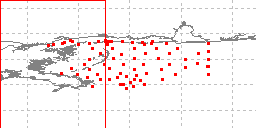
| а(MI_Metadata) ааааfileIdentifier: аgov.noaa.ngdc.mgg.geology:G02123 ааааhierarchyLevel: а(MD_ScopeCode)аdataset ааааcontact: а(CI_ResponsibleParty) ааааааааorganisationName: аNOAA National Centers for Environmental Information ааааааааcontactInfo: а(CI_Contact) ааааааааааааaddress: а(CI_Address) ааааааааааааааааelectronicMailAddress: аncei.info@noaa.gov ааааааааааааonlineResource: а(CI_OnlineResource) ааааааааааааааааlinkage: https://www.ncei.noaa.gov/contact ааааааааааааааааname: аNCEI Contact Information ааааааааааааааааdescription: аInformation for contacts at NCEI. ааааааааааааааааfunction: а(CI_OnLineFunctionCode)аinformation ааааааааrole: а(CI_RoleCode)аpointOfContact ааааdateStamp: а2020-04-21 ааааmetadataStandardName: аISO 19115-2 Geographic Information - Metadata - Part 2: Extensions for Imagery and Gridded Data ааааmetadataStandardVersion: аISO 19115-2:2009(E) return to top ааааspatialRepresentationInfo: а(MD_VectorSpatialRepresentation) ааааааааgeometricObjects: а(MD_GeometricObjects) ааааааааааааgeometricObjectType: а(MD_GeometricObjectTypeCode)аpoint return to top ааааreferenceSystemInfo: а(MD_ReferenceSystem) ааааааааreferenceSystemIdentifier: а(RS_Identifier) ааааааааааааauthority: а(CI_Citation) ааааааааааааааааtitle: аEuropean Petroleum Survey Group (EPSG) Geodetic Parameter Registry ааааааааааааааааdate: а(CI_Date) ааааааааааааааааааааdate: а2008-11-12 ааааааааааааааааааааdateType: а(CI_DateTypeCode)аpublication ааааааааааааааааcitedResponsibleParty: а(CI_ResponsibleParty) ааааааааааааааааааааorganisationName: аEuropean Petroleum Survey Group ааааааааааааааааааааcontactInfo: а(CI_Contact) ааааааааааааааааааааааааonlineResource: а(CI_OnlineResource) ааааааааааааааааааааааааааааlinkage: http://www.epsg-registry.org/ ааааааааааааааааааааааааааааname: аEuropean Petroleum Survey Group Geodetic Parameter Dataset ааааааааааааааааааааааааааааdescription: аRegistry that accesses the EPSG Geodetic Parameter Dataset, which is a structured dataset of Coordinate Reference Systems and Coordinate Transformations. ааааааааааааааааааааааааааааfunction: а(CI_OnLineFunctionCode)аsearch ааааааааааааааааааааrole: (inapplicable) ааааааааааааcode: аurn:ogc:def:crs:EPSG:4326 ааааааааааааversion: а6.18.3 return to top ааааidentificationInfo: а(MD_DataIdentification) ааааааааcitation: а(CI_Citation) ааааааааааааtitle: аNorthern Gulf Littoral Initiative (NGLI), Geology and Physical Properties of Marine Sediments in the N.E. Gulf of Mexico: Data Report ааааааааааааdate: а(CI_Date) ааааааааааааааааdate: а2001-12-31 ааааааааааааааааdateType: а(CI_DateTypeCode)аpublication ааааааааааааdate: а(CI_Date) ааааааааааааааааdate: а2001-12-31 ааааааааааааааааdateType: а(CI_DateTypeCode)аrevision ааааааааааааcitedResponsibleParty: а(CI_ResponsibleParty) ааааааааааааааааindividualName: аSawyer, William B. ааааааааааааааааorganisationName: аU.S. Naval Research Laboratory (NRL) ааааааааааааааааrole: а(CI_RoleCode)аauthor ааааааааааааcitedResponsibleParty: а(CI_ResponsibleParty) ааааааааааааааааindividualName: аVaughan, Chad ааааааааааааааааorganisationName: аU.S. Naval Research Laboratory (NRL) ааааааааааааааааrole: а(CI_RoleCode)аauthor ааааааааааааcitedResponsibleParty: а(CI_ResponsibleParty) ааааааааааааааааindividualName: аLavoie, Dawn ааааааааааааааааorganisationName: аU.S. Naval Research Laboratory (NRL) ааааааааааааааааrole: а(CI_RoleCode)аauthor ааааааааааааcitedResponsibleParty: а(CI_ResponsibleParty) ааааааааааааааааindividualName: аFurukawa, Yoko ааааааааааааааааorganisationName: аU.S. Naval Research Laboratory (NRL) ааааааааааааааааrole: а(CI_RoleCode)аauthor ааааааааааааcitedResponsibleParty: а(CI_ResponsibleParty) ааааааааааааааааindividualName: аCarnaggio, Nancy ааааааааааааааааorganisationName: аU.S. Naval Research Laboratory (NRL) ааааааааааааааааrole: а(CI_RoleCode)аauthor ааааааааааааcitedResponsibleParty: а(CI_ResponsibleParty) ааааааааааааааааindividualName: аMaclean, Jennifer ааааааааааааааааorganisationName: аU.S. Naval Research Laboratory (NRL) ааааааааааааааааrole: а(CI_RoleCode)аauthor ааааааааааааcitedResponsibleParty: а(CI_ResponsibleParty) ааааааааааааааааindividualName: аEdward Populis ааааааааааааааааorganisationName: аU.S. Naval Research Laboratory (NRL) ааааааааааааааааrole: а(CI_RoleCode)аauthor ааааааааааааcitedResponsibleParty: а(CI_ResponsibleParty) ааааааааааааааааorganisationName: аNOAA National Centers for Environmental Information ааааааааааааааааrole: а(CI_RoleCode)аpublisher ааааааааааааpresentationForm: а(CI_PresentationFormCode)аtableDigital ааааааааааааseries: а(CI_Series) ааааааааааааааааname: аMarine Geology and Geophysics (MGG) ааааааааааааааааissueIdentification: аMGG09925001 ааааааааabstract: аThe Northern Gulf Littoral Initiative (NGLI), Geology and Physical Properties of Marine Sediments in the N.E. gulf of Mexico: Data Report, was produced by the U.S. Naval Research Laboratory (NRL) with sponsorship by the Naval Oceanographic Office, in July 2001. It is report NRL/Mr-MM/7430--01-8548. Sediment cores and grab samples were collected inthe N.E. Gulf of Mexico for the purpose of categorizing the seafloor environment. This report presents results of shore-based analyses performed on the cores and grab samples. Interpretive results are not included. The unopened cores were continuously logged with a multisensor core logger, X-rayed for internal structure identification, and subsequently split open where the core material was tested for mass physical and mechanical properties. This CD data report contains spreadsheets that include: the logged data (compressional wave velocity, bulk density by gamma-ray attenuation, derived porosity and acoustic impedance), the laboratory determined properties (natural water content, undrained shear strength, and particle size distribution parameters), core and grab sample photos, and maps of the surficial sediment properties. ааааааааpurpose: аresearch and defense ааааааааcredit: аWilliam B. Sawyer, et al., U.S. Naval Research Laboratory (NRL) ааааааааstatus: а(MD_ProgressCode)аcompleted ааааааааstatus: а(MD_ProgressCode)аhistoricalArchive ааааааааpointOfContact: а(CI_ResponsibleParty) ааааааааааааorganisationName: аNOAA National Centers for Environmental Information ааааааааааааcontactInfo: а(CI_Contact) ааааааааааааааааaddress: а(CI_Address) ааааааааааааааааааааelectronicMailAddress: аncei.info@noaa.gov ааааааааааааааааonlineResource: а(CI_OnlineResource) ааааааааааааааааааааlinkage: https://www.ncei.noaa.gov/contact ааааааааааааааааааааname: аNCEI Contact Information ааааааааааааааааааааdescription: аInformation for contacts at NCEI. ааааааааааааааааааааfunction: а(CI_OnLineFunctionCode)аinformation ааааааааааааrole: а(CI_RoleCode)аpointOfContact ааааааааpointOfContact: а(CI_ResponsibleParty) ааааааааааааorganisationName: аNOAA National Centers for Environmental Information ааааааааааааpositionName: аMarine Geology Data Manager ааааааааааааcontactInfo: а(CI_Contact) ааааааааааааааааaddress: а(CI_Address) ааааааааааааааааааааdeliveryPoint: а325 Broadway, Mail Code E/NE42 ааааааааааааааааааааcity: аBoulder ааааааааааааааааааааadministrativeArea: аCO ааааааааааааааааааааpostalCode: а80305-3328 ааааааааааааааааааааcountry: аUSA ааааааааааааааааааааelectronicMailAddress: аgeology.info@noaa.gov ааааааааааааrole: а(CI_RoleCode)аpointOfContact ааааааааresourceMaintenance: а(MD_MaintenanceInformation) ааааааааааааmaintenanceAndUpdateFrequency: а(MD_MaintenanceFrequencyCode)аnotPlanned ааааааааааааmaintenanceNote: аCompleted data set, no additions planned. ааааааааgraphicOverview: а(MD_BrowseGraphic) ааааааааааааfileName: https://www.ngdc.noaa.gov/mgg/image/geolin/preview09925001.gif ааааааааааааfileDescription: аsample locations in study area ааааааааааааfileType: аGIF ааааааааdescriptiveKeywords: а(MD_Keywords) ааааааааааааkeyword: аUnknown ааааааааааааkeyword: аICSU-WDS > International Council for Science - World Data System ааааааааааааtype: а(MD_KeywordTypeCode)аproject ааааааааааааthesaurusName: а(CI_Citation) ааааааааааааааааtitle: аGlobal Change Master Directory (GCMD) Project Keywords ааааааааааааааааdate: а(CI_Date) ааааааааааааааааааааdate: а2020-01-09 ааааааааааааааааааааdateType: а(CI_DateTypeCode)аpublication ааааааааааааааааedition: а9.1 ааааааааааааааааcitedResponsibleParty: а(CI_ResponsibleParty) ааааааааааааааааааааorganisationName: аNASA Goddard Space Flight Center, Earth Science Data and Information System ааааааааааааааааааааcontactInfo: а(CI_Contact) ааааааааааааааааааааааааonlineResource: а(CI_OnlineResource) ааааааааааааааааааааааааааааlinkage: https://www.earthdata.nasa.gov/learn/find-data/idn/gcmd-keywords ааааааааааааааааааааааааааааname: аGlobal Change Master Directory (GCMD) Keywords ааааааааааааааааааааааааааааdescription: аThe information provided on this page seeks to define how the GCMD Keywords are structured, used and accessed. It also provides information on how users can participate in the further development of the keywords. ааааааааааааааааааааааааааааfunction: а(CI_OnLineFunctionCode)аinformation ааааааааааааааааааааrole: а(CI_RoleCode)аcustodian ааааааааdescriptiveKeywords: а(MD_Keywords) ааааааааааааkeyword: аScientific archives ааааааааааааkeyword: аElectronic records ааааааааааааkeyword: аOceanography ааааааааааааkeyword: аOcean bottom ааааааааааааkeyword: аGeology ааааааааааааkeyword: аSubmarine geology ааааааааааааkeyword: аMarine sediments ааааааааааааtype: а(MD_KeywordTypeCode)аtheme ааааааааааааthesaurusName: а(CI_Citation) ааааааааааааааааtitle: аLibrary of Congress Subject Headings ааааааааааааааааdate: (unknown) ааааааааааааааааcitedResponsibleParty: а(CI_ResponsibleParty) ааааааааааааааааааааorganisationName: аUS Library of Congress ааааааааааааааааааааcontactInfo: а(CI_Contact) ааааааааааааааааааааааааonlineResource: а(CI_OnlineResource) ааааааааааааааааааааааааааааlinkage: http://id.loc.gov/authorities/subjects ааааааааааааааааааааааааааааprotocol: аhttp ааааааааааааааааааааааааааааapplicationProfile: аweb browser ааааааааааааааааааааааааааааname: аLibrary of Congress Subject Headings (LCSH) ааааааааааааааааааааааааааааdescription: аThe Library of Congress Subject Headings (LCSH) are part of a Linked Data Service, actively maintained since 1898 to catalog materials held at the Library of Congress. ааааааааааааааааааааааааааааfunction: а(CI_OnLineFunctionCode)аinformation ааааааааааааааааааааrole: а(CI_RoleCode)аresourceProvider ааааааааdescriptiveKeywords: а(MD_Keywords) ааааааааааааkeyword: аMarine geology ааааааааааааtype: а(MD_KeywordTypeCode)аtheme ааааааааааааthesaurusName: а(CI_Citation) ааааааааааааааааtitle: аSeaDataNet Common Vocabularies ааааааааааааааааdate: (unknown) ааааааааааааааааcitedResponsibleParty: а(CI_ResponsibleParty) ааааааааааааааааааааorganisationName: аSeaDataNet ааааааааааааааааааааcontactInfo: а(CI_Contact) ааааааааааааааааааааааааonlineResource: а(CI_OnlineResource) ааааааааааааааааааааааааааааlinkage: http://www.seadatanet.org/Standards-Software/Common-Vocabularies ааааааааааааааааааааааааааааprotocol: аhttp ааааааааааааааааааааааааааааapplicationProfile: аweb browser ааааааааааааааааааааааааааааname: аSeaDataNet Common Vocabularies ааааааааааааааааааааааааааааdescription: аThe SeaDataNet Vocabulary Server is populated with lists describing a wide range of entities relevant to marine metadata and data such as parameters, sea area names, platform classes, instrument types, and so on. ааааааааааааааааааааааааааааfunction: а(CI_OnLineFunctionCode)аinformation ааааааааааааааааааааrole: а(CI_RoleCode)аresourceProvider ааааааааdescriptiveKeywords: а(MD_Keywords) ааааааааааааkeyword: аSea-floor characteristics ааааааааааааtype: а(MD_KeywordTypeCode)аtheme ааааааааааааthesaurusName: а(CI_Citation) ааааааааааааааааtitle: аUSGS Science Topics ааааааааааааааааdate: (unknown) ааааааааааааааааcitedResponsibleParty: а(CI_ResponsibleParty) ааааааааааааааааааааorganisationName: аUS Geological Survey ааааааааааааааааааааcontactInfo: а(CI_Contact) ааааааааааааааааааааааааonlineResource: а(CI_OnlineResource) ааааааааааааааааааааааааааааlinkage: https://www2.usgs.gov/science/about/ ааааааааааааааааааааааааааааprotocol: аhttp ааааааааааааааааааааааааааааapplicationProfile: аweb browser ааааааааааааааааааааааааааааname: аUSGS Thesaurus ааааааааааааааааааааааааааааdescription: аThe USGS Thesaurus contains thematic terms for categorizing information resources intended to support finding and understanding scientific information. ааааааааааааааааааааааааааааfunction: а(CI_OnLineFunctionCode)аinformation ааааааааааааааааааааrole: а(CI_RoleCode)аresourceProvider ааааааааdescriptiveKeywords: а(MD_Keywords) ааааааааааааkeyword: аEarth Science > Oceans > Marine Sediments > Geotechnical Properties ааааааааааааkeyword: аEarth Science > Oceans > Marine Sediments > Sedimentation ааааааааааааkeyword: аEarth Science > Oceans > Marine Sediments > Sediment Composition ааааааааааааkeyword: аEarth Science > Oceans > Marine Sediments > Sedimentary Textures ааааааааааааkeyword: аEarth Science > Oceans > Marine Sediments ааааааааааааkeyword: аEarth Science > Biosphere > Aquatic Ecosystems > Benthic Habitat ааааааааааааkeyword: аEarth Science > Solid Earth > Rocks/Minerals/Crystals > Sediments ааааааааааааtype: а(MD_KeywordTypeCode)аtheme ааааааааааааthesaurusName: а(CI_Citation) ааааааааааааааааtitle: аGlobal Change Master Directory (GCMD) Science Keywords ааааааааааааааааdate: а(CI_Date) ааааааааааааааааааааdate: а2020-01-09 ааааааааааааааааааааdateType: а(CI_DateTypeCode)аpublication ааааааааааааааааedition: а9.1 ааааааааааааааааcitedResponsibleParty: а(CI_ResponsibleParty) ааааааааааааааааааааorganisationName: аNASA Goddard Space Flight Center, Earth Science Data and Information System ааааааааааааааааааааcontactInfo: а(CI_Contact) ааааааааааааааааааааааааonlineResource: а(CI_OnlineResource) ааааааааааааааааааааааааааааlinkage: https://www.earthdata.nasa.gov/learn/find-data/idn/gcmd-keywords ааааааааааааааааааааааааааааname: аGlobal Change Master Directory (GCMD) Keywords ааааааааааааааааааааааааааааdescription: аThe information provided on this page seeks to define how the GCMD Keywords are structured, used and accessed. It also provides information on how users can participate in the further development of the keywords. ааааааааааааааааааааааааааааfunction: а(CI_OnLineFunctionCode)аinformation ааааааааааааааааааааrole: а(CI_RoleCode)аcustodian ааааааааdescriptiveKeywords: а(MD_Keywords) ааааааааааааkeyword: аIn Situ Ocean-based Platforms > Ships ааааааааааааtype: а(MD_KeywordTypeCode)аplatform ааааааааааааthesaurusName: а(CI_Citation) ааааааааааааааааtitle: аGlobal Change Master Directory (GCMD) Platform Keywords ааааааааааааааааdate: а(CI_Date) ааааааааааааааааааааdate: а2020-01-09 ааааааааааааааааааааdateType: а(CI_DateTypeCode)аpublication ааааааааааааааааedition: а9.1 ааааааааааааааааcitedResponsibleParty: а(CI_ResponsibleParty) ааааааааааааааааааааorganisationName: аNASA Goddard Space Flight Center, Earth Science Data and Information System ааааааааааааааааааааcontactInfo: а(CI_Contact) ааааааааааааааааааааааааonlineResource: а(CI_OnlineResource) ааааааааааааааааааааааааааааlinkage: https://www.earthdata.nasa.gov/learn/find-data/idn/gcmd-keywords ааааааааааааааааааааааааааааname: аGlobal Change Master Directory (GCMD) Keywords ааааааааааааааааааааааааааааdescription: аThe information provided on this page seeks to define how the GCMD Keywords are structured, used and accessed. It also provides information on how users can participate in the further development of the keywords. ааааааааааааааааааааааааааааfunction: а(CI_OnLineFunctionCode)аinformation ааааааааааааааааааааrole: а(CI_RoleCode)аcustodian ааааааааdescriptiveKeywords: а(MD_Keywords) ааааааааааааkeyword: аIn Situ/Laboratory Instruments > Photon/Optical Detectors > Cameras ааааааааааааkeyword: аIn Situ/Laboratory Instruments > Corers > Coring Devices ааааааааааааkeyword: аIn Situ/Laboratory Instruments > Samplers > Dredging Devices ааааааааааааkeyword: аIn Situ/Laboratory Instruments > Samplers > Grabbers/Traps/Collectors > Grab Samplers ааааааааааааtype: а(MD_KeywordTypeCode)аinstrument ааааааааааааthesaurusName: а(CI_Citation) ааааааааааааааааtitle: аGlobal Change Master Directory (GCMD) Instrument Keywords ааааааааааааааааdate: а(CI_Date) ааааааааааааааааааааdate: а2020-01-09 ааааааааааааааааааааdateType: а(CI_DateTypeCode)аpublication ааааааааааааааааedition: а9.1 ааааааааааааааааcitedResponsibleParty: а(CI_ResponsibleParty) ааааааааааааааааааааorganisationName: аNASA Goddard Space Flight Center, Earth Science Data and Information System ааааааааааааааааааааcontactInfo: а(CI_Contact) ааааааааааааааааааааааааonlineResource: а(CI_OnlineResource) ааааааааааааааааааааааааааааlinkage: https://www.earthdata.nasa.gov/learn/find-data/idn/gcmd-keywords ааааааааааааааааааааааааааааname: аGlobal Change Master Directory (GCMD) Keywords ааааааааааааааааааааааааааааdescription: аThe information provided on this page seeks to define how the GCMD Keywords are structured, used and accessed. It also provides information on how users can participate in the further development of the keywords. ааааааааааааааааааааааааааааfunction: а(CI_OnLineFunctionCode)аinformation ааааааааааааааааааааrole: а(CI_RoleCode)аcustodian ааааааааdescriptiveKeywords: а(MD_Keywords) ааааааааааааkeyword: аDOC/NOAA/NESDIS/NCEI > National Centers for Environmental Information, NESDIS, NOAA, U.S. Department of Commerce ааааааааааааkeyword: аDOC/NOAA/NESDIS/NGDC > National Geophysical Data Center, NESDIS, NOAA, U.S. Department of Commerce ааааааааааааtype: а(MD_KeywordTypeCode)аdataCenter ааааааааааааthesaurusName: а(CI_Citation) ааааааааааааааааtitle: аGlobal Change Master Directory (GCMD) Data Center Keywords ааааааааааааааааdate: а(CI_Date) ааааааааааааааааааааdate: а2020-01-09 ааааааааааааааааааааdateType: а(CI_DateTypeCode)аpublication ааааааааааааааааedition: а9.1 ааааааааааааааааcitedResponsibleParty: а(CI_ResponsibleParty) ааааааааааааааааааааorganisationName: аNASA Goddard Space Flight Center, Earth Science Data and Information System ааааааааааааааааааааcontactInfo: а(CI_Contact) ааааааааааааааааааааааааonlineResource: а(CI_OnlineResource) ааааааааааааааааааааааааааааlinkage: https://www.earthdata.nasa.gov/learn/find-data/idn/gcmd-keywords ааааааааааааааааааааааааааааname: аGlobal Change Master Directory (GCMD) Keywords ааааааааааааааааааааааааааааdescription: аThe information provided on this page seeks to define how the GCMD Keywords are structured, used and accessed. It also provides information on how users can participate in the further development of the keywords. ааааааааааааааааааааааааааааfunction: а(CI_OnLineFunctionCode)аinformation ааааааааааааааааааааrole: а(CI_RoleCode)аcustodian ааааааааdescriptiveKeywords: а(MD_Keywords) ааааааааааааkeyword: аOcean > Atlantic Ocean > NORTH ATLANTIC OCEAN > GULF OF MEXICO ааааааааааааkeyword: аVertical Location >Sea Floor ааааааааааааtype: а(MD_KeywordTypeCode)аplace ааааааааааааthesaurusName: а(CI_Citation) ааааааааааааааааtitle: аGlobal Change Master Directory (GCMD) Location Keywords ааааааааааааааааdate: а(CI_Date) ааааааааааааааааааааdate: а2020-01-09 ааааааааааааааааааааdateType: а(CI_DateTypeCode)аpublication ааааааааааааааааedition: а9.1 ааааааааааааааааcitedResponsibleParty: а(CI_ResponsibleParty) ааааааааааааааааааааorganisationName: аNASA Goddard Space Flight Center, Earth Science Data and Information System ааааааааааааааааааааcontactInfo: а(CI_Contact) ааааааааааааааааааааааааonlineResource: а(CI_OnlineResource) ааааааааааааааааааааааааааааlinkage: https://www.earthdata.nasa.gov/learn/find-data/idn/gcmd-keywords ааааааааааааааааааааааааааааname: аGlobal Change Master Directory (GCMD) Keywords ааааааааааааааааааааааааааааdescription: аThe information provided on this page seeks to define how the GCMD Keywords are structured, used and accessed. It also provides information on how users can participate in the further development of the keywords. ааааааааааааааааааааааааааааfunction: а(CI_OnLineFunctionCode)аinformation ааааааааааааааааааааrole: а(CI_RoleCode)аcustodian ааааааааresourceConstraints: а(MD_LegalConstraints) ааааааааааааaccessConstraints: а(MD_RestrictionCode)аotherRestrictions ааааааааааааotherConstraints: аDistribution liability: NOAA and NCEI make no warranty, expressed or implied, regarding these data, nor does the fact of distribution constitute such a warranty. NOAA and NCEI cannot assume liability for any damages caused by any errors or omissions in these data. If appropriate, NCEI can only certify that the data it distributes are an authentic copy of the records that were accepted for inclusion in the NCEI archives. ааааааааresourceConstraints: а(MD_LegalConstraints) ааааааааааааuseConstraints: а(MD_RestrictionCode)аotherRestrictions ааааааааааааotherConstraints: аUse liability: NOAA and NCEI cannot provide any warranty as to the accuracy, reliability, or completeness of furnished data. Users assume responsibility to determine the usability of these data. The user is responsible for the results of any application of this data for other than its intended purpose. ааааааааresourceConstraints: а(MD_LegalConstraints) ааааааааааааuseLimitation: а(MD_RestrictionCode)аotherRestrictions ааааааааааааotherConstraints: аCite as: Sawyer, William B., Chad Vaughan, Dawn Lavoie, Yoko Furukawa, Nancy Carnaggio, Jennifer Maclean, and Edward Populis. 2001. Northern Gulf Littoral Initiative (NGLI), Geology and Physical Properties of Marine Sediments in the N.E. Gulf of Mexico: Data Report. Report NRL/MR-MM/7430--01-8548, U.S. Naval Research Laboratory, Washington, DC, 12 pages., and cite NCEI as the source of the data. ааааааааresourceConstraints: а(MD_Constraints) ааааааааааааuseLimitation: аProduced by the NOAA National Centers for Environmental Information. Not subject to copyright protection within the United States. ааааааааresourceConstraints: а(MD_LegalConstraints) ааааааааааааuseConstraints: а(MD_RestrictionCode)аotherRestrictions ааааааааааааotherConstraints: аWhile every effort has been made to ensure that these data are accurate and reliable within the limits of the current state of the art, NOAA cannot assume liability for any damages caused by any errors or omissions in the data, nor as a result of the failure of the data to function on a particular system. NOAA makes no warranty, expressed or implied, nor does the fact of distribution constitute such a warranty. ааааааааresourceConstraints: а(MD_SecurityConstraints) ааааааааааааclassification: а(MD_ClassificationCode)аunclassified ааааааааresourceConstraints: а(MD_LegalConstraints) ааааааааааааaccessConstraints: а(MD_RestrictionCode)аotherRestrictions ааааааааааааotherConstraints: аAccess to this dataset is unrestricted. ааааааааaggregationInfo: а(MD_AggregateInformation) ааааааааааааaggregateDataSetName: а(CI_Citation) ааааааааааааааааtitle: аNorthern Gulf Littoral Initiative (NGLI), Geology and Physical Properties of Marine Sediments in the N.E. Gulf of Mexico: Data Report ааааааааааааааааdate: а(CI_Date) ааааааааааааааааааааdate: а2001-12-31 ааааааааааааааааааааdateType: а(CI_DateTypeCode)аpublication ааааааааааааааааcitedResponsibleParty: а(CI_ResponsibleParty) ааааааааааааааааааааorganisationName: аU.S. Naval Research Laboratory ааааааааааааааааааааrole: а(CI_RoleCode)аauthor ааааааааааааааааcitedResponsibleParty: а(CI_ResponsibleParty) ааааааааааааааааааааorganisationName: (inapplicable) ааааааааааааааааааааcontactInfo: а(CI_Contact) ааааааааааааааааааааааааonlineResource: а(CI_OnlineResource) ааааааааааааааааааааааааааааlinkage: https://apps.dtic.mil/sti/pdfs/ADA393657.pdf ааааааааааааааааааааааааааааprotocol: аWWW:LINK-1.0-http--link ааааааааааааааааааааааааааааapplicationProfile: аWeb Browser ааааааааааааааааааааааааааааname: аReport NRL/MR-MM/7430--01-8548 ааааааааааааааааааааааааааааfunction: а(CI_OnLineFunctionCode)аinformation ааааааааааааааааааааrole: (inapplicable) ааааааааааааааааotherCitationDetails: аSawyer, William B., Chad Vaughan, Dawn Lavoie, Yoko Furukawa, Nancy Carnaggio, Jennifer Maclean, and Edward Populis, 2001, Northern Gulf Littoral Initiative (NGLI), Geology and Physical Properties of Marine Sediments in the N.E. Gulf of Mexico: Data Report. Report NRL/MR-MM/7430--01-8548, U.S. Naval Research Laboratory, Washington, DC, 12 pages. ааааааааааааassociationType: а(DS_AssociationTypeCode)аcrossReference ааааааааааааinitiativeType: а(DS_InitiativeTypeCode)аproject ааааааааaggregationInfo: а(MD_AggregateInformation) ааааааааааааaggregateDataSetName: а(CI_Citation) ааааааааааааааааtitle: аThe NGDC Seafloor Sediment Grain Size Database ааааааааааааааааdate: а(CI_Date) ааааааааааааааааааааdate: а1976-12-31 ааааааааааааааааааааdateType: а(CI_DateTypeCode)аpublication ааааааааааааааааidentifier: а(MD_Identifier) ааааааааааааааааааааcode: ааааааааааааааааааааааAnchor: аDOIаdoi:10.7289/V5G44N6W ааааааааааааааааcitedResponsibleParty: а(CI_ResponsibleParty) ааааааааааааааааааааorganisationName: аNational Geophysical Data Center, NOAA ааааааааааааааааааааrole: а(CI_RoleCode)аauthor ааааааааааааааааcitedResponsibleParty: а(CI_ResponsibleParty) ааааааааааааааааааааorganisationName: (inapplicable) ааааааааааааааааааааcontactInfo: а(CI_Contact) ааааааааааааааааааааааааonlineResource: а(CI_OnlineResource) ааааааааааааааааааааааааааааlinkage: https://doi.org/10.7289/V5G44N6W ааааааааааааааааааааааааааааprotocol: аWWW:LINK-1.0-http--link ааааааааааааааааааааааааааааapplicationProfile: аWeb Browser ааааааааааааааааааааааааааааname: аRelated database (doi:10.7289/V5G44N6W) ааааааааааааааааааааааааааааdescription: аThis database contains related grain size data. ааааааааааааааааааааааааааааfunction: а(CI_OnLineFunctionCode)аinformation ааааааааааааааааааааrole: (inapplicable) ааааааааааааааааotherCitationDetails: аNational Geophysical Data Center (1976): The NGDC Seafloor Sediment Grain Size Database. NOAA National Centers for Environmental Information. doi:10.7289/V5G44N6W ааааааааааааassociationType: а(DS_AssociationTypeCode)аcrossReference ааааааааааааinitiativeType: а(DS_InitiativeTypeCode)аproject ааааааааaggregationInfo: а(MD_AggregateInformation) ааааааааааааaggregateDataSetName: а(CI_Citation) ааааааааааааааааtitle: аNCEI Marine Geology Data Archive ааааааааааааааааdate: а(CI_Date) ааааааааааааааааааааdate: а1977-12-31 ааааааааааааааааааааdateType: а(CI_DateTypeCode) ааааааааааааааааcitedResponsibleParty: а(CI_ResponsibleParty) ааааааааааааааааааааorganisationName: аNOAA National Centers for Environmental Information ааааааааааааааааааааrole: а(CI_RoleCode)аresourceProvider ааааааааааааааааcitedResponsibleParty: а(CI_ResponsibleParty) ааааааааааааааааааааorganisationName: (inapplicable) ааааааааааааааааааааcontactInfo: а(CI_Contact) ааааааааааааааааааааааааonlineResource: а(CI_OnlineResource) ааааааааааааааааааааааааааааlinkage: https://data.noaa.gov/metaview/page?xml=NOAA/NESDIS/NGDC/Collection/iso/xml/Marine_Geology.xml&view=getDataView&header=none ааааааааааааааааааааааааааааprotocol: аWWW:LINK-1.0-http--link ааааааааааааааааааааааааааааapplicationProfile: аWeb Browser ааааааааааааааааааааааааааааname: аParent Archive ааааааааааааааааааааааааааааdescription: аInformation about the Marine Geology Data Archive at NCEI. ааааааааааааааааааааааааааааfunction: а(CI_OnLineFunctionCode)аinformation ааааааааааааааааааааrole: (inapplicable) ааааааааааааassociationType: а(DS_AssociationTypeCode)аlargerWorkCitation ааааааааааааinitiativeType: а(DS_InitiativeTypeCode)аcollection ааааааааaggregationInfo: а(MD_AggregateInformation) ааааааааааааaggregateDataSetName: а(CI_Citation) ааааааааааааааааtitle: аNOAA/NCEI Marine Geology WAF ааааааааааааааааdate: а(CI_Date) ааааааааааааааааааааdate: а2015-10-05 ааааааааааааааааааааdateType: а(CI_DateTypeCode) ааааааааааааааааcitedResponsibleParty: а(CI_ResponsibleParty) ааааааааааааааааааааorganisationName: аNOAA National Centers for Environmental Information ааааааааааааааааааааrole: а(CI_RoleCode)аauthor ааааааааааааааааcitedResponsibleParty: а(CI_ResponsibleParty) ааааааааааааааааааааorganisationName: (inapplicable) ааааааааааааааааааааcontactInfo: а(CI_Contact) ааааааааааааааааааааааааonlineResource: а(CI_OnlineResource) ааааааааааааааааааааааааааааlinkage: https://data.noaa.gov/waf/NOAA/NESDIS/NGDC/MGG/Geology/iso/ ааааааааааааааааааааааааааааprotocol: аWWW:LINK-1.0-http--link ааааааааааааааааааааааааааааapplicationProfile: аWeb Browser ааааааааааааааааааааааааааааname: аMarine geology metadata records. ааааааааааааааааааааааааааааfunction: а(CI_OnLineFunctionCode)аsearch ааааааааааааааааааааrole: (inapplicable) ааааааааааааassociationType: а(DS_AssociationTypeCode)аcrossReference ааааааааааааinitiativeType: а(DS_InitiativeTypeCode)аcollection ааааааааspatialRepresentationType: а(MD_SpatialRepresentationTypeCode)аvector ааааааааspatialResolution: (missing) а(MD_Resolution) ааааааааааааlevelOfDetail: аVertical resolution is 1 meter and horizontal resolution is .001 degree. ааааааааlanguage: ааааааааааLanguageCode: аeng; USA ааааааааcharacterSet: а(MD_CharacterSetCode)аUTF8 ааааааааtopicCategory: а(MD_TopicCategoryCode)аgeoscientificInformation ааааааааtopicCategory: а(MD_TopicCategoryCode)аoceans ааааааааenvironmentDescription: аNative Dataset Environment: ASCII text ааааааааextent: а(EX_Extent) ааааааааааааdescription: аNorthern Gulf of Mexico ааааааааааааgeographicElement: а(EX_GeographicBoundingBox) ааааааааааааааааwestBoundLongitude: а-89.474 ааааааааааааааааeastBoundLongitude: а-87.75 ааааааааааааааааsouthBoundLatitude: а29.0256 ааааааааааааааааnorthBoundLatitude: а30.284 ааааааааааааtemporalElement: а(EX_TemporalExtent) ааааааааааааааааextent: ааааааааааааааааааTimePeriod: ааааааааааааааааааааdescription: аPublication Date ааааааааааааааааааааbeginPosition: а20010101 ааааааааааааааааааааendPosition: а20011231 ааааааааааааverticalElement: а(EX_VerticalExtent) ааааааааааааааааminimumValue: ааааааааааааааааааReal: а-1338 ааааааааааааааааmaximumValue: ааааааааааааааааааReal: а-3 ааааааааааааааааverticalCRS: (missing) ааааааааsupplementalInformation: аData from this report are available online from NCEI, on CD-ROM from the Naval Research Laboratory, and also online from the U.S. Naval Research Laboratory (http://www7430.nrlssc.navy.mil/facilities/coresedlab/NGLI.htm) as NRL Multi-Media Report NRL/MR-MM/7430--01-8548. return to top ааааcontentInfo: а(MD_CoverageDescription) ааааааааattributeDescription: ааааааааааRecordType: аThe Latitude and Longitude (point) from which a sample of sediment or rock was collected from the sea floor or a lakebed. ааааааааcontentType: а(MD_CoverageContentTypeCode)аpoint ааааааааdimension: а(MD_Band) ааааааааааааsequenceIdentifier: ааааааааааааааMemberName: ааааааааааааааааaName: аLatitude ааааааааааааааааattributeType: (unknown) ааааааааааааdescriptor: аDistance measured north or south from the equator. Distance north is positive, distance south is negative. ааааааааааааmaxValue: ааааааааааааааReal: а90.00000 ааааааааааааminValue: ааааааааааааааReal: а-90.00000 ааааааааааааunits: ааааааааааааааUnitDefinition: ааааааааааааааааidentifier: аdecimal degrees ааааааааааааааааname: аdecimal degrees ааааааааdimension: а(MD_Band) ааааааааааааsequenceIdentifier: ааааааааааааааMemberName: ааааааааааааааааaName: аLongitude ааааааааааааааааattributeType: (unknown) ааааааааааааdescriptor: аLongitude is measured from the Prime Meridian (which is the north/south line that runs through Greenwich, England), values measured east are positive and values measured west are negative. ааааааааааааmaxValue: ааааааааааааааReal: а180.00000 ааааааааааааminValue: ааааааааааааааReal: а-180.00000 ааааааааааааunits: ааааааааааааааUnitDefinition: ааааааааааааааааidentifier: аdecimal degrees ааааааааааааааааname: аdecimal degrees return to top ааааcontentInfo: а(MD_FeatureCatalogueDescription) ааааааааcomplianceCode: аfalse ааааааааincludedWithDataset: аtrue ааааааааfeatureTypes: ааааааааааLocalName: ааааааааfeatureCatalogueCitation: а(CI_Citation) ааааааааааааtitle: аDocumentation for the Northern Gulf Littoral Initiative (NGLI), Geology and Physical Properties of Marine Sediments in the N.E. Gulf of Mexico: Data Report dataset. ааааааааааааdate: а(CI_Date) ааааааааааааааааdate: а2001-12-31 ааааааааааааааааdateType: а(CI_DateTypeCode)аcreation ааааааааааааotherCitationDetails: аEntities and attributes are completely described in a text file accompanying the dataset on download. return to top ааааdistributionInfo: а(MD_Distribution) ааааааааdistributor: а(MD_Distributor) ааааааааааааdistributorContact: а(CI_ResponsibleParty) ааааааааааааааааorganisationName: аNOAA National Centers for Environmental Information ааааааааааааааааcontactInfo: а(CI_Contact) ааааааааааааааааааааaddress: а(CI_Address) ааааааааааааааааааааааааelectronicMailAddress: аncei.info@noaa.gov ааааааааааааааааааааonlineResource: а(CI_OnlineResource) ааааааааааааааааааааааааlinkage: https://www.ncei.noaa.gov/contact ааааааааааааааааааааааааname: аNCEI Contact Information ааааааааааааааааааааааааdescription: аInformation for contacts at NCEI. ааааааааааааааааааааааааfunction: а(CI_OnLineFunctionCode)аinformation ааааааааааааааааrole: а(CI_RoleCode)аdistributor ааааааааааааdistributionOrderProcess: а(MD_StandardOrderProcess) ааааааааааааааааfees: аIn most cases, electronic downloads of the data are free. However, fees may apply for custom orders, data certifications, copies of analog materials, and data distribution on physical media. ааааааааааааааааorderingInstructions: аContact NCEI for other distribution options and instructions. ааааааааааааdistributorFormat: а(MD_Format) ааааааааааааааааname: аXLS ааааааааааааааааversion: (unknown) ааааааааааааdistributorFormat: а(MD_Format) ааааааааааааааааname: аGRD ааааааааааааааааversion: (unknown) ааааааааааааdistributorFormat: а(MD_Format) ааааааааааааааааname: аGIF ааааааааааааааааversion: (unknown) ааааааааааааdistributorFormat: а(MD_Format) ааааааааааааааааname: аJPEG ааааааааааааааааversion: (unknown) ааааааааааааdistributorFormat: а(MD_Format) ааааааааааааааааname: аPNG ааааааааааааааааversion: (unknown) ааааааааааааdistributorFormat: а(MD_Format) ааааааааааааааааname: аPDF ааааааааааааааааversion: (unknown) ааааааааааааdistributorTransferOptions: а(MD_DigitalTransferOptions) ааааааааааааааааonLine: а(CI_OnlineResource) ааааааааааааааааааааlinkage: https://data.noaa.gov/metaview/page?xml=NOAA/NESDIS/NGDC/MGG/Geology/iso/xml/G02123.xml&view=getDataView&header=none ааааааааааааааааааааprotocol: аWWW:LINK-1.0-http--link ааааааааааааааааааааapplicationProfile: аWeb Browser ааааааааааааааааааааname: аMetadata Landing Page ааааааааааааааааааааdescription: аInformation about the data set, all access options, and complete documentation. ааааааааааааааааааааfunction: а(CI_OnLineFunctionCode)аinformation ааааааааааааdistributorTransferOptions: а(MD_DigitalTransferOptions) ааааааааааааааааonLine: а(CI_OnlineResource) ааааааааааааааааааааlinkage: https://www.ngdc.noaa.gov/mgg/geology/data/g02123/ ааааааааааааааааааааprotocol: аWWW:LINK-1.0-http--link ааааааааааааааааааааapplicationProfile: аWeb Browser ааааааааааааааааааааname: аData files and documentation ааааааааааааааааааааdescription: аAccess to originator's data files and documentation. ааааааааааааааааааааfunction: а(CI_OnLineFunctionCode)аdownload return to top ааааdataQualityInfo: а(DQ_DataQuality) ааааааааscope: а(DQ_Scope) ааааааааааааlevel: а(MD_ScopeCode)аdataset ааааааааааааextent: а#boundingExtent ааааааааааааlevelDescription: а(MD_ScopeDescription) ааааааааааааааааdataset: аgov.noaa.ngdc.mgg.geology:G02123 ааааааааreport: а(DQ_AbsoluteExternalPositionalAccuracy) ааааааааааааnameOfMeasure: аHorizontal Positional Accuracy ааааааааааааmeasureDescription: (unknown) ааааааааааааevaluationMethodDescription: аThe horizontal accuracy of data values is approximately .001 degree of latitude/longitude. ааааааааааааresult: (unknown) ааааааааreport: а(DQ_QuantitativeAttributeAccuracy) ааааааааааааnameOfMeasure: аReliability ааааааааааааmeasureDescription: (unknown) ааааааааааааevaluationMethodDescription: аQuality control was performed by the originator. NGDC performed basic out-of-range location testing. ааааааааааааresult: (unknown) ааааааааlineage: а(LI_Lineage) ааааааааааааstatement: аlineage prior to transfer to NCEI is unknown ааааааааааааprocessStep: а(LI_ProcessStep) ааааааааааааааааdescription: аReceived data from originator ааааааааааааааааdateTime: ааааааааааааааааааDateTime: а2001-01-01T00:00:00 ааааааааааааsource: а(LI_Source) ааааааааааааааааdescription: аWilliam B. Sawyer, Chad Vaughan, Dawn Lavoie, Yoko Furukawa, Nancy Carnaggio, Jennifer Maclean, Eddie Populis U.S. Naval Research Laboratory (NRL) return to top ааааdataQualityInfo: а(DQ_DataQuality) ааааааааscope: а(DQ_Scope) ааааааааааааlevel: а(MD_ScopeCode)аrepository ааааааааааааlevelDescription: а(MD_ScopeDescription) ааааааааааааааааother: аNOAA National Centers for Environmental Information ааааааааlineage: а(LI_Lineage) ааааааааааааprocessStep: а(LE_ProcessStep) ааааааааааааааааdescription: аNOAA created the National Centers for Environmental Information (NCEI) by merging NOAA's National Climatic Data Center (NCDC), National Geophysical Data Center (NGDC), and National Oceanographic Data Center (NODC), including the National Coastal Data Development Center (NCDDC), per the Consolidated and Further Continuing Appropriations Act, 2015, Public Law 113-235. NCEI launched publicly on April 22, 2015. ааааааааааааааааdateTime: ааааааааааааааааааDateTime: а2015-04-22T00:00:00 return to top ааааmetadataMaintenance: а(MD_MaintenanceInformation) ааааааааmaintenanceAndUpdateFrequency: а(MD_MaintenanceFrequencyCode)аasNeeded ааааааааmaintenanceNote: аModified for compliance to NCEI Template v1.2. return to top ааааacquisitionInformation: а(MI_AcquisitionInformation) ааааааааinstrument: а(MI_Instrument) ааааааааааааidentifier: а(MD_Identifier) ааааааааааааааааcode: аIn Situ/Laboratory Instruments ааааааааааааtype: аinstrument ааааааааааааdescription: аInstrument Type: Sea floor and lakebed geologic sampling (coring, drilling, dredging, trawling, and/or grab sampling devices) and/or in situ measurements (cameras, visual observations, and/or recorders/loggers) ааааааааplatform: а(MI_Platform) ааааааааааааidentifier: а(RS_Identifier) ааааааааааааааааcode: аPelican ааааааааааааdescription: (unknown) ааааааааааааinstrument: а(MI_Instrument) ааааааааааааааааidentifier: а(MD_Identifier) ааааааааааааааааааааcode: аIn Situ/Laboratory Instruments ааааааааааааааааtype: аinstrument ааааааааааааааааdescription: аInstrument Type: Sea floor and lakebed geologic sampling (coring, drilling, dredging, trawling, and/or grab sampling devices) and/or in situ measurements (cameras, visual observations, and/or recorders/loggers) | |