National Marine Fisheries Service Grain Size Data from the Baltimore Canyon Trough
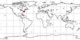 sample locations in study area
Grain size analyses produced by Robert Reid of the NOAA National Marine Fisheries
Service for the NOAA/BLM Outer Continental Shelf Mid-Atlantic Project, Baltimore Canyon
Trough Area. Grain size analyses were originally contributed in the historic NODC
003 format for 113 sea floor samples collected from May 22-27, 1974 by the Mt. Mitchell
on cruise BC7401. Data include collecting institution, ship, cruise, sample id, latitude/longitude,
date of collection, water depth, sampling device, method of analysis, sample weight,
sampled interval, raw weight percentages of sediment, within a given phi range. Some
samples also have percentages of total gravel, sand, silt, clay, and statistical measurements
such as mean, median, skewness, kurtosis, and standard deviation of grain size. These
data are part of the larger NGDC digital grain size database.
- Cite as: Robert Reid and Virginia Institute of Marine Sciences (VIMS). 1982: National Marine Fisheries Service Grain Size Data from the Baltimore Canyon Trough. NOAA National Centers for Environmental Information. Accessed [date].
- ID not available.
gov.noaa.ngdc.mgg.geology:G02897
| Download Data |
|
| Distribution Formats |
|
| Ordering Instructions | Contact NCEI for other distribution options and instructions. |
| Distributor | NOAA National Centers for Environmental Information ncei.info@noaa.gov |
| Dataset Point of Contact | NOAA National Centers for Environmental Information ncei.info@noaa.gov |
| Dataset Point of Contact | Marine Geology Data Manager NOAA National Centers for Environmental Information geology.info@noaa.gov |
| Coverage Description | Northern Atlantic Ocean, Baltimore Canyon Trough |
| Time Period | 1974-05-22 to 1974-05-27 |
| Spatial Reference System | urn:ogc:def:crs:EPSG:4326 |
| Spatial Bounding Box Coordinates |
West:-73.63
East:-70.021
South:38.636
North:39.513
|
| Spatial Coverage Map | |
| General Documentation |
|
| Associated Resources |
|
| Publication Dates |
|
| Edition | First |
| Data Presentation Form | Digital table - digital representation of facts or figures systematically displayed,
especially in columns |
| Dataset Progress Status | Complete - production of the data has been completed Historical archive - data has been stored in an offline storage facility |
| Data Update Frequency | Not planned - Completed data set, no additions planned. |
| Supplemental Information |
grain size data in the 073 format, added to the NGDC grainsize database
|
| Purpose | environmental research |
| Use Limitations |
|
| Dataset Citation |
|
| Cited Authors |
|
| Publishers |
|
| Acknowledgments |
|
| Theme keywords | Library of Congress Subject Headings
|
| Data Center keywords | Global Change Master Directory (GCMD) Data Center Keywords
|
| Platform keywords | Global Change Master Directory (GCMD) Platform Keywords
|
| Instrument keywords | Global Change Master Directory (GCMD) Instrument Keywords
|
| Place keywords | Global Change Master Directory (GCMD) Location Keywords
|
| Project keywords | Global Change Master Directory (GCMD) Project Keywords
|
| Use Constraints |
|
| Access Constraints |
|
| Other Constraints | Cite as: Robert Reid and Virginia Institute of Marine Sciences (VIMS). 1982: National Marine Fisheries Service Grain Size Data from the Baltimore Canyon Trough. NOAA National Centers for Environmental Information. Accessed [date]. |
| Fees |
|
| Lineage Statement | These data were contributed by the originator to NOAA's former National Oceanographic Data Center (NODC) and may be part of a larger compilation archived as oceanographic data by NCEI. Data were received from NODC in the historic 003 format and translated to the 073 grain size format and added to the digital grain size database. Data were received on nine track magnetic tape in ASCII form, record size 109, blocking 9592 characters/block, as two files: 1) tape label; 2) 003 sediment data for cruise BC7401, the NODC unique identifier assigned was TR3655. |
| Processing Environment | Native Dataset Environment: ASCII text |
| Source Datasets |
| Processing Steps |
|
| Instrument |
|
| Platform |
|
Last Modified: 2020-04-21
For questions about the information on this page, please email:ncei.info@noaa.gov