| Archive of Geosample Data and Information from the U.S. Extended Continental Shelf (ECS) Project. | spatialRepresentationInfo|
|---|---|
| а(MI_Metadata) ааааfileIdentifier: аgov.noaa.ngdc.mgg.geology:archived-data_ECS-samples-repository ааааhierarchyLevel: а(MD_ScopeCode)аdataset ааааcontact: а(CI_ResponsibleParty) ааааааааorganisationName: аNOAA National Centers for Environmental Information ааааааааcontactInfo: а(CI_Contact) ааааааааааааaddress: а(CI_Address) ааааааааааааааааelectronicMailAddress: аncei.info@noaa.gov ааааааааааааonlineResource: а(CI_OnlineResource) ааааааааааааааааlinkage: https://www.ncei.noaa.gov/contact ааааааааааааааааname: аNCEI Contact Information ааааааааааааааааdescription: аInformation for contacts at NCEI. ааааааааааааааааfunction: а(CI_OnLineFunctionCode)аinformation ааааааааrole: а(CI_RoleCode)аpointOfContact ааааdateStamp: а2020-04-21 ааааmetadataStandardName: аISO 19115-2 Geographic Information - Metadata - Part 2: Extensions for Imagery and Gridded Data ааааmetadataStandardVersion: аISO 19115-2:2009(E) return to top ааааspatialRepresentationInfo: а(MD_VectorSpatialRepresentation) ааааааааgeometricObjects: а(MD_GeometricObjects) ааааааааааааgeometricObjectType: а(MD_GeometricObjectTypeCode)аpoint return to top ааааreferenceSystemInfo: а(MD_ReferenceSystem) ааааааааreferenceSystemIdentifier: а(RS_Identifier) ааааааааааааauthority: а(CI_Citation) ааааааааааааааааtitle: аEuropean Petroleum Survey Group (EPSG) Geodetic Parameter Registry ааааааааааааааааdate: а(CI_Date) ааааааааааааааааааааdate: а2008-11-12 ааааааааааааааааааааdateType: а(CI_DateTypeCode)аpublication ааааааааааааааааcitedResponsibleParty: а(CI_ResponsibleParty) ааааааааааааааааааааorganisationName: аEuropean Petroleum Survey Group ааааааааааааааааааааcontactInfo: а(CI_Contact) ааааааааааааааааааааааааonlineResource: а(CI_OnlineResource) ааааааааааааааааааааааааааааlinkage: http://www.epsg-registry.org/ ааааааааааааааааааааааааааааname: аEuropean Petroleum Survey Group Geodetic Parameter Dataset ааааааааааааааааааааааааааааdescription: аRegistry that accesses the EPSG Geodetic Parameter Dataset, which is a structured dataset of Coordinate Reference Systems and Coordinate Transformations. ааааааааааааааааааааааааааааfunction: а(CI_OnLineFunctionCode)аsearch ааааааааааааааааааааrole: (inapplicable) ааааааааааааcode: аurn:ogc:def:crs:EPSG:4326 ааааааааааааversion: а6.18.3 return to top ааааidentificationInfo: а(MD_DataIdentification) ааааааааcitation: а(CI_Citation) ааааааааааааtitle: аArchive of Geosample Data and Information from the U.S. Extended Continental Shelf (ECS) Project. ааааааааааааdate: а(CI_Date) ааааааааааааааааdate: а2008-12-31 ааааааааааааааааdateType: а(CI_DateTypeCode)аpublication ааааааааааааdate: а(CI_Date) ааааааааааааааааdate: а2015-09-14 ааааааааааааааааdateType: а(CI_DateTypeCode)аrevision ааааааааааааidentifier: а(MD_Identifier) ааааааааааааааааauthority: а(CI_Citation) ааааааааааааааааааааtitle: аInternational DOI Foundation (IDF) ааааааааааааааааааааdate: (inapplicable) ааааааааааааааааcode: ааааааааааааааааааAnchor: аDOIаdoi:10.7289/V5GF0RG9 ааааааааааааidentifier: а(MD_Identifier) ааааааааааааааааauthority: а(CI_Citation) ааааааааааааааааааааtitle: аNOAA National Centers for Environmental Information ааааааааааааааааааааdate: (inapplicable) ааааааааааааааааcode: аNCEI Metadata ID: gov.noaa.ngdc.mgg.geology:archived-data_ECS-samples-repository ааааааааааааcitedResponsibleParty: а(CI_ResponsibleParty) ааааааааааааааааindividualName: аDr. Andy Armstrong ааааааааааааааааorganisationName: аNOAA/University of New Hampshire Joint Hydrographic Center ааааааааааааааааpositionName: аCo-Director NOAA/UNH Joint Hydrographic Center ааааааааааааааааrole: а(CI_RoleCode)аoriginator ааааааааааааcitedResponsibleParty: а(CI_ResponsibleParty) ааааааааааааааааindividualName: аDr. John A. Barron ааааааааааааааааorganisationName: аU.S. Geological Survey, Pacific Coastal and Marine Science Center ааааааааааааааааpositionName: аScientist ааааааааааааааааrole: а(CI_RoleCode)аoriginator ааааааааааааcitedResponsibleParty: а(CI_ResponsibleParty) ааааааааааааааааindividualName: аDr. Ginger Barth ааааааааааааааааorganisationName: аU.S. Geological Survey, Pacific Coastal and Marine Science Center ааааааааааааааааpositionName: аScientist ааааааааааааааааrole: а(CI_RoleCode)аoriginator ааааааааааааcitedResponsibleParty: а(CI_ResponsibleParty) ааааааааааааааааindividualName: аDr. Kelley Brumley ааааааааааааааааorganisationName: аStanford University ааааааааааааааааpositionName: аformer graduate student ааааааааааааааааrole: а(CI_RoleCode)аoriginator ааааааааааааcitedResponsibleParty: а(CI_ResponsibleParty) ааааааааааааааааindividualName: аBrian Buczkowski ааааааааааааааааorganisationName: аU.S. Geological Survey, Woods Hole Coastal and Marine Science Center ааааааааааааааааpositionName: аCollections Manager, USGS East Coast Sample Repository ааааааааааааааааcontactInfo: а(CI_Contact) ааааааааааааааааааааphone: а(CI_Telephone) ааааааааааааааааааааааааvoice: а508 457-2361 ааааааааааааааааааааaddress: а(CI_Address) ааааааааааааааааааааааааdeliveryPoint: аUSGS 384 Woods Hole Road ааааааааааааааааааааааааcity: аWoods Hole ааааааааааааааааааааааааadministrativeArea: аMA ааааааааааааааааааааааааpostalCode: а02543 ааааааааааааааааааааааааcountry: аUSA ааааааааааааааааааааааааelectronicMailAddress: аbbuczkowski@usgs.gov ааааааааааааааааrole: а(CI_RoleCode)аoriginator ааааааааааааcitedResponsibleParty: а(CI_ResponsibleParty) ааааааааааааааааindividualName: аDr. Brian E. Edwards ааааааааааааааааorganisationName: аU.S. Geological Survey, Pacific Coastal and Marine Science Center ааааааааааааааааpositionName: аUSGS Emeritus Scientist ааааааааааааааааrole: а(CI_RoleCode)аoriginator ааааааааааааcitedResponsibleParty: а(CI_ResponsibleParty) ааааааааааааааааindividualName: аDr. James Hein ааааааааааааааааorganisationName: аU.S. Geological Survey, Pacific Coastal and Marine Science Center ааааааааааааааааpositionName: аSenior Scientist ааааааааааааааааrole: а(CI_RoleCode)аoriginator ааааааааааааcitedResponsibleParty: а(CI_ResponsibleParty) ааааааааааааааааindividualName: аDr. Tom Lorenson ааааааааааааааааorganisationName: аU.S. Geological Survey, Pacific Coastal and Marine Science Center ааааааааааааааааpositionName: аScientist ааааааааааааааааrole: а(CI_RoleCode)аoriginator ааааааааааааcitedResponsibleParty: а(CI_ResponsibleParty) ааааааааааааааааindividualName: аDr. Larry Mayer ааааааааааааааааorganisationName: аUniversity of New Hampshire Center for Coastal and Ocean Mapping (CCOM) and NOAA/University of New Hampshire Joint Hydrographic Center (JHC) ааааааааааааааааpositionName: аCCOM Director/JHC Co-Director ааааааааааааааааrole: а(CI_RoleCode)аoriginator ааааааааааааcitedResponsibleParty: а(CI_ResponsibleParty) ааааааааааааааааindividualName: аDr. Mary McGann ааааааааааааааааorganisationName: аU.S. Geological Survey, Pacific Coastal and Marine Science Center ааааааааааааааааpositionName: аScientist ааааааааааааааааrole: а(CI_RoleCode)аoriginator ааааааааааааcitedResponsibleParty: а(CI_ResponsibleParty) ааааааааааааааааindividualName: аDr. John Pohlman ааааааааааааааааorganisationName: аU.S. Geological Survey, Pacific Coastal and Marine Science Center ааааааааааааааааpositionName: аScientist ааааааааааааааааrole: а(CI_RoleCode)аoriginator ааааааааааааcitedResponsibleParty: а(CI_ResponsibleParty) ааааааааааааааааindividualName: аDr. Matthew Salisbury ааааааааааааааааorganisationName: аGeological Survey of Canada ааааааааааааааааpositionName: аSenior Researcher ааааааааааааааааrole: а(CI_RoleCode)аoriginator ааааааааааааcitedResponsibleParty: а(CI_ResponsibleParty) ааааааааааааааааorganisationName: аU.S. Extended Continental Shelf Project (ECS) ааааааааааааааааrole: а(CI_RoleCode)аsponsor ааааааааааааcitedResponsibleParty: а(CI_ResponsibleParty) ааааааааааааааааorganisationName: аU.S. Extended Continental Shelf Project (ECS) ааааааааааааааааrole: а(CI_RoleCode)аauthor ааааааааааааcitedResponsibleParty: а(CI_ResponsibleParty) ааааааааааааааааorganisationName: аNOAA National Centers for Environmental Information ааааааааааааааааrole: а(CI_RoleCode)аcustodian ааааааааааааcitedResponsibleParty: а(CI_ResponsibleParty) ааааааааааааааааorganisationName: аNOAA National Centers for Environmental Information ааааааааааааааааrole: а(CI_RoleCode)аpublisher ааааааааааааpresentationForm: а(CI_PresentationFormCode)аtableDigital ааааааааааааpresentationForm: а(CI_PresentationFormCode)аimageDigital ааааааааааааotherCitationDetails: аGeosample data stewarded by the ECS Project Office/ECS Information Management System are accessible via the Index to Marine and Lacustrine Geological Samples (IMLGS) database. The IMLGS is a collaboration between NCEI and multiple institutions (some supported by NSF) and government agencies, created by the institutions to offer common data about, and discovery/access to geological samples in their sample repository collections. The purpose of the IMLGS is to promote new research on existing samples. The database is maintained by NCEI under the guidance of a Curators Consortium, composed of representatives from the partner institutions. ааааааааabstract: аGeological samples collected as part of the U.S. Extended Continental Shelf (ECS) Project are curated by the U.S. Geological Survey, a partner in the ECS Project. To date, dredges and cores have been collected from the Arctic Ocean floor, and small sediment samples have also been collected from the Bering Sea. According to ECS policy, application can be made by qualified researchers to the ECS Samples Curator to obtain portions of these samples for study. Related sample data, information, and images generated at sea, during ECS post-cruise working parties, and other research results are available for public access via the ECS Information Management System (ECS IMS) website maintained by NOAA's NCEI. Both ECS samples and related data are searchable through the Index to Marine and Lacustrine Geological Samples (IMLGS) database maintained by NCEI. ааааааааpurpose: аThe first priority for geologic samples collected as part of the U.S. ECS Project is their application to delineating the U.S. ECS, however the ECS Task Force recognizes the important scientific value of these samples and encourages their study and the open publication of related scientific findings. The purpose of adding information about the ECS geological samples collection to the IMLGS is to promote new research on existing samples. ааааааааcredit: аSamples were collected as part of the interagency ECS Project. ааааааааstatus: а(MD_ProgressCode)аonGoing ааааааааstatus: а(MD_ProgressCode)аhistoricalArchive ааааааааpointOfContact: а(CI_ResponsibleParty) ааааааааааааorganisationName: аNOAA National Centers for Environmental Information ааааааааааааcontactInfo: а(CI_Contact) ааааааааааааааааaddress: а(CI_Address) ааааааааааааааааааааelectronicMailAddress: аncei.info@noaa.gov ааааааааааааааааonlineResource: а(CI_OnlineResource) ааааааааааааааааааааlinkage: https://www.ncei.noaa.gov/contact ааааааааааааааааааааname: аNCEI Contact Information ааааааааааааааааааааdescription: аInformation for contacts at NCEI. ааааааааааааааааааааfunction: а(CI_OnLineFunctionCode)аinformation ааааааааааааrole: а(CI_RoleCode)аpointOfContact ааааааааpointOfContact: а(CI_ResponsibleParty) ааааааааааааorganisationName: аNOAA National Centers for Environmental Information ааааааааааааpositionName: аMarine Geology Data Manager ааааааааааааcontactInfo: а(CI_Contact) ааааааааааааааааaddress: а(CI_Address) ааааааааааааааааааааdeliveryPoint: а325 Broadway, Mail Code E/NE42 ааааааааааааааааааааcity: аBoulder ааааааааааааааааааааadministrativeArea: аCO ааааааааааааааааааааpostalCode: а80305-3328 ааааааааааааааааааааcountry: аUSA ааааааааааааааааааааelectronicMailAddress: аgeology.info@noaa.gov ааааааааааааrole: а(CI_RoleCode)аpointOfContact ааааааааresourceMaintenance: а(MD_MaintenanceInformation) ааааааааааааmaintenanceAndUpdateFrequency: а(MD_MaintenanceFrequencyCode)аirregular ааааааааааааmaintenanceNote: аECS core data are collected infrequently, no new samples have been collected since 2012. ааааааааgraphicOverview: а(MD_BrowseGraphic) ааааааааааааfileName: https://www.ngdc.noaa.gov/mgg/image/ECSsampleLocations.png ааааааааааааfileDescription: аimage of sea floor sample locations ааааааааааааfileType: аPNG ааааааааdescriptiveKeywords: а(MD_Keywords) ааааааааааааkeyword: аDatabases ааааааааааааkeyword: аScientific archives ааааааааааааkeyword: аElectronic records ааааааааааааkeyword: аOcean bottom ааааааааааааkeyword: аGeology ааааааааааааkeyword: аSubmarine geology ааааааааааааkeyword: аMarine sediments ааааааааааааtype: а(MD_KeywordTypeCode)аtheme ааааааааааааthesaurusName: а(CI_Citation) ааааааааааааааааtitle: аLibrary of Congress Subject Headings ааааааааааааааааdate: (unknown) ааааааааааааааааcitedResponsibleParty: а(CI_ResponsibleParty) ааааааааааааааааааааorganisationName: аUS Library of Congress ааааааааааааааааааааcontactInfo: а(CI_Contact) ааааааааааааааааааааааааonlineResource: а(CI_OnlineResource) ааааааааааааааааааааааааааааlinkage: http://id.loc.gov/authorities/subjects ааааааааааааааааааааааааааааprotocol: аhttp ааааааааааааааааааааааааааааapplicationProfile: аweb browser ааааааааааааааааааааааааааааname: аLibrary of Congress Subject Headings (LCSH) ааааааааааааааааааааааааааааdescription: аThe Library of Congress Subject Headings (LCSH) are part of a Linked Data Service, actively maintained since 1898 to catalog materials held at the Library of Congress. ааааааааааааааааааааааааааааfunction: а(CI_OnLineFunctionCode)аinformation ааааааааааааааааааааrole: а(CI_RoleCode)аresourceProvider ааааааааdescriptiveKeywords: а(MD_Keywords) ааааааааааааkeyword: аMarine geology ааааааааааааkeyword: аRock and sediment lithology and mineralogy ааааааааааааtype: а(MD_KeywordTypeCode)аtheme ааааааааааааthesaurusName: а(CI_Citation) ааааааааааааааааtitle: аSeaDataNet Common Vocabularies ааааааааааааааааdate: (unknown) ааааааааааааааааcitedResponsibleParty: а(CI_ResponsibleParty) ааааааааааааааааааааorganisationName: аSeaDataNet ааааааааааааааааааааcontactInfo: а(CI_Contact) ааааааааааааааааааааааааonlineResource: а(CI_OnlineResource) ааааааааааааааааааааааааааааlinkage: http://www.seadatanet.org/Standards-Software/Common-Vocabularies ааааааааааааааааааааааааааааprotocol: аhttp ааааааааааааааааааааааааааааapplicationProfile: аweb browser ааааааааааааааааааааааааааааname: аSeaDataNet Common Vocabularies ааааааааааааааааааааааааааааdescription: аThe SeaDataNet Vocabulary Server is populated with lists describing a wide range of entities relevant to marine metadata and data such as parameters, sea area names, platform classes, instrument types, and so on. ааааааааааааааааааааааааааааfunction: а(CI_OnLineFunctionCode)аinformation ааааааааааааааааааааrole: а(CI_RoleCode)аresourceProvider ааааааааdescriptiveKeywords: а(MD_Keywords) ааааааааааааkeyword: аSea-floor characteristics ааааааааааааtype: а(MD_KeywordTypeCode)аtheme ааааааааааааthesaurusName: а(CI_Citation) ааааааааааааааааtitle: аUSGS Science Topics ааааааааааааааааdate: (unknown) ааааааааааааааааcitedResponsibleParty: а(CI_ResponsibleParty) ааааааааааааааааааааorganisationName: аUS Geological Survey ааааааааааааааааааааcontactInfo: а(CI_Contact) ааааааааааааааааааааааааonlineResource: а(CI_OnlineResource) ааааааааааааааааааааааааааааlinkage: https://www2.usgs.gov/science/about/ ааааааааааааааааааааааааааааprotocol: аhttp ааааааааааааааааааааааааааааapplicationProfile: аweb browser ааааааааааааааааааааааааааааname: аUSGS Thesaurus ааааааааааааааааааааааааааааdescription: аThe USGS Thesaurus contains thematic terms for categorizing information resources intended to support finding and understanding scientific information. ааааааааааааааааааааааааааааfunction: а(CI_OnLineFunctionCode)аinformation ааааааааааааааааааааrole: а(CI_RoleCode)аresourceProvider ааааааааdescriptiveKeywords: а(MD_Keywords) ааааааааааааkeyword: аEarth Science > Oceans > Marine Sediments ааааааааааааkeyword: аEarth Science > Oceans > Marine Sediments > Sediment Composition ааааааааааааtype: а(MD_KeywordTypeCode)аtheme ааааааааааааthesaurusName: а(CI_Citation) ааааааааааааааааtitle: аGlobal Change Master Directory (GCMD) Science Keywords ааааааааааааааааdate: а(CI_Date) ааааааааааааааааааааdate: а2020-01-09 ааааааааааааааааааааdateType: а(CI_DateTypeCode)аpublication ааааааааааааааааedition: а9.1 ааааааааааааааааcitedResponsibleParty: а(CI_ResponsibleParty) ааааааааааааааааааааorganisationName: аNASA Goddard Space Flight Center, Earth Science Data and Information System ааааааааааааааааааааcontactInfo: а(CI_Contact) ааааааааааааааааааааааааonlineResource: а(CI_OnlineResource) ааааааааааааааааааааааааааааlinkage: https://www.earthdata.nasa.gov/learn/find-data/idn/gcmd-keywords ааааааааааааааааааааааааааааname: аGlobal Change Master Directory (GCMD) Keywords ааааааааааааааааааааааааааааdescription: аThe information provided on this page seeks to define how the GCMD Keywords are structured, used and accessed. It also provides information on how users can participate in the further development of the keywords. ааааааааааааааааааааааааааааfunction: а(CI_OnLineFunctionCode)аinformation ааааааааааааааааааааrole: а(CI_RoleCode)аcustodian ааааааааdescriptiveKeywords: а(MD_Keywords) ааааааааааааkeyword: аIn Situ Ocean-based Platforms > Ships ааааааааааааtype: а(MD_KeywordTypeCode)аplatform ааааааааааааthesaurusName: а(CI_Citation) ааааааааааааааааtitle: аGlobal Change Master Directory (GCMD) Platform Keywords ааааааааааааааааdate: а(CI_Date) ааааааааааааааааааааdate: а2020-01-09 ааааааааааааааааааааdateType: а(CI_DateTypeCode)аpublication ааааааааааааааааedition: а9.1 ааааааааааааааааcitedResponsibleParty: а(CI_ResponsibleParty) ааааааааааааааааааааorganisationName: аNASA Goddard Space Flight Center, Earth Science Data and Information System ааааааааааааааааааааcontactInfo: а(CI_Contact) ааааааааааааааааааааааааonlineResource: а(CI_OnlineResource) ааааааааааааааааааааааааааааlinkage: https://www.earthdata.nasa.gov/learn/find-data/idn/gcmd-keywords ааааааааааааааааааааааааааааname: аGlobal Change Master Directory (GCMD) Keywords ааааааааааааааааааааааааааааdescription: аThe information provided on this page seeks to define how the GCMD Keywords are structured, used and accessed. It also provides information on how users can participate in the further development of the keywords. ааааааааааааааааааааааааааааfunction: а(CI_OnLineFunctionCode)аinformation ааааааааааааааааааааrole: а(CI_RoleCode)аcustodian ааааааааdescriptiveKeywords: а(MD_Keywords) ааааааааааааkeyword: аIn Situ/Laboratory Instruments > Samplers > Dredging Devices ааааааааааааkeyword: аIn Situ/Laboratory Instruments > Corers > Coring Devices ааааааааааааkeyword: аIn Situ/Laboratory Instruments > Corers > Sediment Corers ааааааааааааtype: а(MD_KeywordTypeCode)аinstrument ааааааааааааthesaurusName: а(CI_Citation) ааааааааааааааааtitle: аGlobal Change Master Directory (GCMD) Instrument Keywords ааааааааааааааааdate: а(CI_Date) ааааааааааааааааааааdate: а2020-01-09 ааааааааааааааааааааdateType: а(CI_DateTypeCode)аpublication ааааааааааааааааedition: а9.1 ааааааааааааааааcitedResponsibleParty: а(CI_ResponsibleParty) ааааааааааааааааааааorganisationName: аNASA Goddard Space Flight Center, Earth Science Data and Information System ааааааааааааааааааааcontactInfo: а(CI_Contact) ааааааааааааааааааааааааonlineResource: а(CI_OnlineResource) ааааааааааааааааааааааааааааlinkage: https://www.earthdata.nasa.gov/learn/find-data/idn/gcmd-keywords ааааааааааааааааааааааааааааname: аGlobal Change Master Directory (GCMD) Keywords ааааааааааааааааааааааааааааdescription: аThe information provided on this page seeks to define how the GCMD Keywords are structured, used and accessed. It also provides information on how users can participate in the further development of the keywords. ааааааааааааааааааааааааааааfunction: а(CI_OnLineFunctionCode)аinformation ааааааааааааааааааааrole: а(CI_RoleCode)аcustodian ааааааааdescriptiveKeywords: а(MD_Keywords) ааааааааааааkeyword: аIMLGS ааааааааааааtype: а(MD_KeywordTypeCode)аproject ааааааааааааthesaurusName: а(CI_Citation) ааааааааааааааааtitle: аGlobal Change Master Directory (GCMD) Project Keywords ааааааааааааааааdate: а(CI_Date) ааааааааааааааааааааdate: а2020-01-09 ааааааааааааааааааааdateType: а(CI_DateTypeCode)аpublication ааааааааааааааааedition: а9.1 ааааааааааааааааcitedResponsibleParty: а(CI_ResponsibleParty) ааааааааааааааааааааorganisationName: аNASA Goddard Space Flight Center, Earth Science Data and Information System ааааааааааааааааааааcontactInfo: а(CI_Contact) ааааааааааааааааааааааааonlineResource: а(CI_OnlineResource) ааааааааааааааааааааааааааааlinkage: https://www.earthdata.nasa.gov/learn/find-data/idn/gcmd-keywords ааааааааааааааааааааааааааааname: аGlobal Change Master Directory (GCMD) Keywords ааааааааааааааааааааааааааааdescription: аThe information provided on this page seeks to define how the GCMD Keywords are structured, used and accessed. It also provides information on how users can participate in the further development of the keywords. ааааааааааааааааааааааааааааfunction: а(CI_OnLineFunctionCode)аinformation ааааааааааааааааааааrole: а(CI_RoleCode)аcustodian ааааааааdescriptiveKeywords: а(MD_Keywords) ааааааааааааkeyword: аDOC/NOAA/NESDIS/NCEI > National Centers for Environmental Information, NESDIS, NOAA, U.S. Department of Commerce ааааааааааааkeyword: аDOC/NOAA/NESDIS/NGDC > National Geophysical Data Center, NESDIS, NOAA, U.S. Department of Commerce ааааааааааааtype: а(MD_KeywordTypeCode)аdataCentre ааааааааааааthesaurusName: а(CI_Citation) ааааааааааааааааtitle: аGlobal Change Master Directory (GCMD) Data Center Keywords ааааааааааааааааdate: а(CI_Date) ааааааааааааааааааааdate: а2020-01-09 ааааааааааааааааааааdateType: а(CI_DateTypeCode)аpublication ааааааааааааааааedition: а9.1 ааааааааааааааааcitedResponsibleParty: а(CI_ResponsibleParty) ааааааааааааааааааааorganisationName: аNASA Goddard Space Flight Center, Earth Science Data and Information System ааааааааааааааааааааcontactInfo: а(CI_Contact) ааааааааааааааааааааааааonlineResource: а(CI_OnlineResource) ааааааааааааааааааааааааааааlinkage: https://www.earthdata.nasa.gov/learn/find-data/idn/gcmd-keywords ааааааааааааааааааааааааааааname: аGlobal Change Master Directory (GCMD) Keywords ааааааааааааааааааааааааааааdescription: аThe information provided on this page seeks to define how the GCMD Keywords are structured, used and accessed. It also provides information on how users can participate in the further development of the keywords. ааааааааааааааааааааааааааааfunction: а(CI_OnLineFunctionCode)аinformation ааааааааааааааааааааrole: а(CI_RoleCode)аcustodian ааааааааdescriptiveKeywords: а(MD_Keywords) ааааааааааааkeyword: аGeographic Region > Global Ocean ааааааааааааkeyword: аVertical Location >Sea Floor ааааааааааааkeyword: аOcean > Arctic Ocean ааааааааааааtype: а(MD_KeywordTypeCode)аplace ааааааааааааthesaurusName: а(CI_Citation) ааааааааааааааааtitle: аGlobal Change Master Directory (GCMD) Location Keywords ааааааааааааааааdate: а(CI_Date) ааааааааааааааааааааdate: а2020-01-09 ааааааааааааааааааааdateType: а(CI_DateTypeCode)аpublication ааааааааааааааааedition: а9.1 ааааааааааааааааcitedResponsibleParty: а(CI_ResponsibleParty) ааааааааааааааааааааorganisationName: аNASA Goddard Space Flight Center, Earth Science Data and Information System ааааааааааааааааааааcontactInfo: а(CI_Contact) ааааааааааааааааааааааааonlineResource: а(CI_OnlineResource) ааааааааааааааааааааааааааааlinkage: https://www.earthdata.nasa.gov/learn/find-data/idn/gcmd-keywords ааааааааааааааааааааааааааааname: аGlobal Change Master Directory (GCMD) Keywords ааааааааааааааааааааааааааааdescription: аThe information provided on this page seeks to define how the GCMD Keywords are structured, used and accessed. It also provides information on how users can participate in the further development of the keywords. ааааааааааааааааааааааааааааfunction: а(CI_OnLineFunctionCode)аinformation ааааааааааааааааааааrole: а(CI_RoleCode)аcustodian ааааааааresourceConstraints: а(MD_LegalConstraints) ааааааааааааaccessConstraints: а(MD_RestrictionCode)аotherRestrictions ааааааааааааotherConstraints: аDistribution liability: NOAA and NCEI make no warranty, expressed or implied, regarding these data, nor does the fact of distribution constitute such a warranty. NOAA and NCEI cannot assume liability for any damages caused by any errors or omissions in these data. If appropriate, NCEI can only certify that the data it distributes are an authentic copy of the records that were accepted for inclusion in the NCEI archives. ааааааааresourceConstraints: а(MD_LegalConstraints) ааааааааааааuseConstraints: а(MD_RestrictionCode)аotherRestrictions ааааааааааааotherConstraints: аUse liability: NOAA and NCEI cannot provide any warranty as to the accuracy, reliability, or completeness of furnished data. Users assume responsibility to determine the usability of these data. The user is responsible for the results of any application of this data for other than its intended purpose. ааааааааresourceConstraints: а(MD_LegalConstraints) ааааааааааааuseLimitation: а(MD_RestrictionCode)аotherRestrictions ааааааааааааotherConstraints: аCite as: U.S. Extended Continental Shelf Project (ECS). 2008: Archive of Geosample Data and Information from the U.S. Extended Continental Shelf (ECS) Project. NOAA National Centers for Environmental Information. https://doi.org/10.7289/V5GF0RG9. Accessed [date]. ааааааааresourceConstraints: а(MD_LegalConstraints) ааааааааааааuseConstraints: а(MD_RestrictionCode)аotherRestrictions ааааааааааааotherConstraints: аPlease consult the ECS Samples Curator before proposing research on any sample. ааааааааresourceConstraints: а(MD_LegalConstraints) ааааааааааааaccessConstraints: а(MD_RestrictionCode)аotherRestrictions ааааааааааааotherConstraints: аSample loan requires completion of ECS forms as specified in the ECS Data and Samples Policy. Sample data and images are available online for free download, following a moratorium period. ааааааааresourceConstraints: а(MD_Constraints) ааааааааааааuseLimitation: аProduced by the NOAA National Centers for Environmental Information. Not subject to copyright protection within the United States. ааааааааresourceConstraints: а(MD_LegalConstraints) ааааааааааааuseConstraints: а(MD_RestrictionCode)аotherRestrictions ааааааааааааotherConstraints: аWhile every effort has been made to ensure that these data are accurate and reliable within the limits of the current state of the art, NOAA cannot assume liability for any damages caused by any errors or omissions in the data, nor as a result of the failure of the data to function on a particular system. NOAA makes no warranty, expressed or implied, nor does the fact of distribution constitute such a warranty. ааааааааresourceConstraints: а(MD_SecurityConstraints) ааааааааааааclassification: а(MD_ClassificationCode)аunclassified ааааааааaggregationInfo: а(MD_AggregateInformation) ааааааааааааaggregateDataSetName: а(CI_Citation) ааааааааааааааааtitle: аU.S. ECS Project Information Management System Website ааааааааааааааааdate: а(CI_Date) ааааааааааааааааааааdate: а2015-09-14 ааааааааааааааааааааdateType: а(CI_DateTypeCode) ааааааааааааааааidentifier: а(MD_Identifier) ааааааааааааааааааааcode: ааааааааааааааааааааааAnchor: аECS Information Management SystemаECS Information Management System ааааааааааааааааcitedResponsibleParty: а(CI_ResponsibleParty) ааааааааааааааааааааorganisationName: аThe ECS IMS website includes information on partners, data and sample policies, and access to all available data types. ааааааааааааааааааааrole: а(CI_RoleCode)аresourceProvider ааааааааааааааааcitedResponsibleParty: а(CI_ResponsibleParty) ааааааааааааааааааааorganisationName: (inapplicable) ааааааааааааааааааааcontactInfo: а(CI_Contact) ааааааааааааааааааааааааonlineResource: а(CI_OnlineResource) ааааааааааааааааааааааааааааlinkage: https://www.ngdc.noaa.gov/mgg/ecs/ ааааааааааааааааааааааааааааprotocol: аWWW:LINK-1.0-http--link ааааааааааааааааааааааааааааapplicationProfile: аWeb Browser ааааааааааааааааааааааааааааname: аAssociated policies and forms ааааааааааааааааааааааааааааdescription: аU.S. Extended Continental Shelf (ECS) Project Information Management System Website ааааааааааааааааааааааааааааfunction: а(CI_OnLineFunctionCode)аinformation ааааааааааааааааааааrole: (inapplicable) ааааааааааааassociationType: а(DS_AssociationTypeCode)аlargerWorkCitation ааааааааааааinitiativeType: а(DS_InitiativeTypeCode)аcollection ааааааааaggregationInfo: а(MD_AggregateInformation) ааааааааааааaggregateDataSetName: а(CI_Citation) ааааааааааааааааtitle: аIndex to Marine and Lacustrine Geological Samples (IMLGS) ааааааааааааааааdate: а(CI_Date) ааааааааааааааааааааdate: а1977-12-31 ааааааааааааааааааааdateType: а(CI_DateTypeCode)аpublication ааааааааааааааааidentifier: а(MD_Identifier) ааааааааааааааааааааcode: ааааааааааааааааааааааAnchor: аDOIаdoi:10.7289/V5H41PB ааааааааааааааааcitedResponsibleParty: а(CI_ResponsibleParty) ааааааааааааааааааааorganisationName: аCurators of Marine and Lacustrine Geological Samples ааааааааааааааааааааrole: а(CI_RoleCode)аauthor ааааааааааааааааcitedResponsibleParty: а(CI_ResponsibleParty) ааааааааааааааааааааorganisationName: (inapplicable) ааааааааааааааааааааcontactInfo: а(CI_Contact) ааааааааааааааааааааааааonlineResource: а(CI_OnlineResource) ааааааааааааааааааааааааааааlinkage: https://dx.doi.org/10.7289/V5H41PB8 ааааааааааааааааааааааааааааprotocol: аWWW:LINK-1.0-http--link ааааааааааааааааааааааааааааapplicationProfile: аWeb Browser ааааааааааааааааааааааааааааname: аParent Database ааааааааааааааааааааааааааааdescription: аThe parent IMLGS database contains more/related data and information. ааааааааааааааааааааааааааааfunction: а(CI_OnLineFunctionCode)аinformation ааааааааааааааааааааrole: (inapplicable) ааааааааааааassociationType: а(DS_AssociationTypeCode)аlargerWorkCitation ааааааааааааinitiativeType: а(DS_InitiativeTypeCode)аproject ааааааааaggregationInfo: а(MD_AggregateInformation) ааааааааааааaggregateDataSetName: а(CI_Citation) ааааааааааааааааtitle: аNCEI Marine Geology Data Archive ааааааааааааааааdate: а(CI_Date) ааааааааааааааааааааdate: а1977-12-31 ааааааааааааааааааааdateType: а(CI_DateTypeCode) ааааааааааааааааcitedResponsibleParty: а(CI_ResponsibleParty) ааааааааааааааааааааorganisationName: аNOAA National Centers for Environmental Information ааааааааааааааааааааrole: а(CI_RoleCode)аresourceProvider ааааааааааааааааcitedResponsibleParty: а(CI_ResponsibleParty) ааааааааааааааааааааorganisationName: (inapplicable) ааааааааааааааааааааcontactInfo: а(CI_Contact) ааааааааааааааааааааааааonlineResource: а(CI_OnlineResource) ааааааааааааааааааааааааааааlinkage: https://data.noaa.gov/metaview/page?xml=NOAA/NESDIS/NGDC/Collection/iso/xml/Marine_Geology.xml&view=getDataView&header=none ааааааааааааааааааааааааааааprotocol: аWWW:LINK-1.0-http--link ааааааааааааааааааааааааааааapplicationProfile: аWeb Browser ааааааааааааааааааааааааааааname: аParent Archive ааааааааааааааааааааааааааааdescription: аInformation about the Marine Geology Data Archive at NCEI. ааааааааааааааааааааааааааааfunction: а(CI_OnLineFunctionCode)аinformation ааааааааааааааааааааrole: (inapplicable) ааааааааааааassociationType: а(DS_AssociationTypeCode)аlargerWorkCitation ааааааааааааinitiativeType: а(DS_InitiativeTypeCode)аcollection ааааааааaggregationInfo: а(MD_AggregateInformation) ааааааааааааaggregateDataSetName: а(CI_Citation) ааааааааааааааааtitle: аNOAA/NCEI Marine Geology WAF ааааааааааааааааdate: а(CI_Date) ааааааааааааааааааааdate: а2015-10-05 ааааааааааааааааааааdateType: а(CI_DateTypeCode) ааааааааааааааааcitedResponsibleParty: а(CI_ResponsibleParty) ааааааааааааааааааааorganisationName: аNOAA National Centers for Environmental Information ааааааааааааааааааааrole: а(CI_RoleCode)аauthor ааааааааааааааааcitedResponsibleParty: а(CI_ResponsibleParty) ааааааааааааааааааааorganisationName: (inapplicable) ааааааааааааааааааааcontactInfo: а(CI_Contact) ааааааааааааааааааааааааonlineResource: а(CI_OnlineResource) ааааааааааааааааааааааааааааlinkage: https://data.noaa.gov/waf/NOAA/NESDIS/NGDC/MGG/Geology/iso/ ааааааааааааааааааааааааааааprotocol: аWWW:LINK-1.0-http--link ааааааааааааааааааааааааааааapplicationProfile: аWeb Browser ааааааааааааааааааааааааааааname: аMarine geology metadata records. ааааааааааааааааааааааааааааfunction: а(CI_OnLineFunctionCode)аsearch ааааааааааааааааааааrole: (inapplicable) ааааааааааааassociationType: а(DS_AssociationTypeCode)аcrossReference ааааааааааааinitiativeType: а(DS_InitiativeTypeCode)аcollection ааааааааspatialRepresentationType: а(MD_SpatialRepresentationTypeCode)аpoint ааааааааspatialResolution: (missing) а(MD_Resolution) ааааааааааааlevelOfDetail: аVertical is meters and horizontal is .001 degree. ааааааааlanguage: ааааааааааLanguageCode: аeng; USA ааааааааcharacterSet: а(MD_CharacterSetCode)аutf8 ааааааааtopicCategory: а(MD_TopicCategoryCode)аgeoscientificInformation ааааааааtopicCategory: а(MD_TopicCategoryCode)аoceans ааааааааenvironmentDescription: аNative Dataset Environment: database tables with auxiliary text, images, and PDF documents. ааааааааextent: а(EX_Extent) ааааааааааааdescription: аArctic Ocean, Bering Sea ааааааааааааgeographicElement: а(EX_GeographicBoundingBox) ааааааааааааааааwestBoundLongitude: а-177.7997 ааааааааааааааааeastBoundLongitude: а-128.62745 ааааааааааааааааsouthBoundLatitude: а55.15945 ааааааааааааааааnorthBoundLatitude: а81.57966 ааааааааааааtemporalElement: а(EX_TemporalExtent) ааааааааааааааааextent: ааааааааааааааааааTimePeriod: ааааааааааааааааааааbeginPosition: а2008-08-31T00:00:00.000Z ааааааааааааааааааааendPosition: а2012-09-22T00:00:00.000Z ааааааааааааverticalElement: а(EX_VerticalExtent) ааааааааааааааааminimumValue: ааааааааааааааааааReal: а-3851 ааааааааааааааааmaximumValue: ааааааааааааааааааReal: а-974 ааааааааааааааааverticalCRS: аmsl depth in meters ааааааааsupplementalInformation: аWhile the ECS project is committed to transparency and public release of data collected as part of the ECS project, this approach is not always practical or possible for sensitive or otherwise restricted data sets data collected outside of the ECS project that are not currently publicly available may need to be handled differently. The ECS project will address the terms of access and use of such data on a case-by-case basis in conjunction with the entity responsible for such data. The ECS project will encourage the owners of all non-public data to make such data public, particularly for use by the ECS project and especially if the data were collected with government funds. return to top ааааcontentInfo: а(MI_CoverageDescription) ааааааааattributeDescription: ааааааааааRecordType: аA record describing a marine or lacustrine geologic sample: A sample of sediment or rock, usually taken from the sea floor or a lakebed, from the sample collection of one of the participating institutions. ааааааааcontentType: а(MD_CoverageContentTypeCode)аpoint ааааааааdimension: а(MD_Band) ааааааааааааsequenceIdentifier: ааааааааааааааMemberName: ааааааааааааааааaName: аbegin_date ааааааааааааааааattributeType: (unknown) ааааааааааааdescriptor: аThe date when a sampling operation was begun. ааааааааааааmaxValue: ааааааааааааааReal: а20160122 ааааааааааааminValue: ааааааааааааааReal: а18000101 ааааааааааааunits: ааааааааааааааUnitDefinition: ааааааааааааааааidentifier: аYear, Month, Day in the form YYYYMMDD ааааааааааааааааname: аYear, Month, Day in the form YYYYMMDD ааааааааdimension: а(MD_Band) ааааааааааааsequenceIdentifier: ааааааааааааааMemberName: ааааааааааааааааaName: аend_date ааааааааааааааааattributeType: (unknown) ааааааааааааdescriptor: аThe date when a geological sampling operation was concluded. Not used if an operation was conducted in a single day. ааааааааааааmaxValue: ааааааааааааааReal: а20160122 ааааааааааааminValue: ааааааааааааааReal: а18000101 ааааааааааааunits: ааааааааааааааUnitDefinition: ааааааааааааааааidentifier: аYear, Month, Day in the form YYYYMMDD ааааааааааааааааname: аYear, Month, Day in the form YYYYMMDD ааааааааdimension: а(MD_Band) ааааааааааааsequenceIdentifier: ааааааааааааааMemberName: ааааааааааааааааaName: аlatitude ааааааааааааааааattributeType: (unknown) ааааааааааааdescriptor: аDistance measured north or south from the equator. Distance north is positive, distance south is negative. ааааааааааааmaxValue: ааааааааааааааReal: а90.00000 ааааааааааааminValue: ааааааааааааааReal: а-90.00000 ааааааааааааunits: ааааааааааааааUnitDefinition: ааааааааааааааааidentifier: аdecimal degrees ааааааааааааааааname: аdecimal degrees ааааааааdimension: а(MD_Band) ааааааааааааsequenceIdentifier: ааааааааааааааMemberName: ааааааааааааааааaName: аlatdeg ааааааааааааааааattributeType: (unknown) ааааааааааааdescriptor: аDistance measured north or south from the equator in whole degrees, unsigned. ааааааааааааmaxValue: ааааааааааааааReal: а90 ааааааааааааminValue: ааааааааааааааReal: а0 ааааааааааааunits: ааааааааааааааUnitDefinition: ааааааааааааааааidentifier: аwhole degrees, unsigned ааааааааааааааааname: аwhole degrees, unsigned ааааааааdimension: а(MD_Band) ааааааааааааsequenceIdentifier: ааааааааааааааMemberName: ааааааааааааааааaName: аlatmin ааааааааааааааааattributeType: (unknown) ааааааааааааdescriptor: аMinutes of latitude, added to the attribute latdeg, indicating distance measured north or south from the equator. ааааааааааааmaxValue: ааааааааааааааReal: а59.00 ааааааааааааminValue: ааааааааааааааReal: а00.00 ааааааааааааunits: ааааааааааааааUnitDefinition: ааааааааааааааааidentifier: аMinutes and decimal minutes of latitude ааааааааааааааааname: аMinutes and decimal minutes of latitude ааааааааdimension: а(MD_Band) ааааааааааааsequenceIdentifier: ааааааааааааааMemberName: ааааааааааааааааaName: аend_lat ааааааааааааааааattributeType: (unknown) ааааааааааааdescriptor: аDistance measured north or south from the equator at which sampling operations were concluded. Blank if sampling location is fixed. Distance north is positive, distance south is negative. ааааааааааааmaxValue: ааааааааааааааReal: а90.00000 ааааааааааааminValue: ааааааааааааааReal: а-90.00000 ааааааааааааunits: ааааааааааааааUnitDefinition: ааааааааааааааааidentifier: аdecimal degrees ааааааааааааааааname: аdecimal degrees ааааааааdimension: а(MD_Band) ааааааааааааsequenceIdentifier: ааааааааааааааMemberName: ааааааааааааааааaName: аend_latdeg ааааааааааааааааattributeType: (unknown) ааааааааааааdescriptor: аDistance measured north or south from the equator in whole degrees, unsigned, at which sampling operations were concluded. Blank if sampling location is fixed. ааааааааааааmaxValue: ааааааааааааааReal: а90 ааааааааааааminValue: ааааааааааааааReal: а0 ааааааааааааunits: ааааааааааааааUnitDefinition: ааааааааааааааааidentifier: аwhole degrees, unsigned ааааааааааааааааname: аwhole degrees, unsigned ааааааааdimension: а(MD_Band) ааааааааааааsequenceIdentifier: ааааааааааааааMemberName: ааааааааааааааааaName: аend_latmin ааааааааааааааааattributeType: (unknown) ааааааааааааdescriptor: аMinutes of latitude, added to the attribute latdeg, indicating distance measured north or south from the equator, at which sampling operations were concluded. Blank if sampling location is fixed. ааааааааааааmaxValue: ааааааааааааааReal: а59.00 ааааааааааааminValue: ааааааааааааааReal: а00.00 ааааааааааааunits: ааааааааааааааUnitDefinition: ааааааааааааааааidentifier: аMinutes and decimal minutes of latitude ааааааааааааааааname: аMinutes and decimal minutes of latitude ааааааааdimension: а(MD_Band) ааааааааааааsequenceIdentifier: ааааааааааааааMemberName: ааааааааааааааааaName: аlongitude ааааааааааааааааattributeType: (unknown) ааааааааааааdescriptor: аLongitude is measured from the Prime Meridian (which is the north/south line that runs through Greenwich, England), values measured east are positive and values measured west are negative. ааааааааааааmaxValue: ааааааааааааааReal: а180.00000 ааааааааааааminValue: ааааааааааааааReal: а-180.00000 ааааааааааааunits: ааааааааааааааUnitDefinition: ааааааааааааааааidentifier: аdecimal degrees ааааааааааааааааname: аdecimal degrees ааааааааdimension: а(MD_Band) ааааааааааааsequenceIdentifier: ааааааааааааааMemberName: ааааааааааааааааaName: аlondeg ааааааааааааааааattributeType: (unknown) ааааааааааааdescriptor: аDistance measured east or west of the Prime Meridian in whole degrees, unsigned. ааааааааааааmaxValue: ааааааааааааааReal: а90 ааааааааааааminValue: ааааааааааааааReal: а0 ааааааааааааunits: ааааааааааааааUnitDefinition: ааааааааааааааааidentifier: аwhole degrees, unsigned ааааааааааааааааname: аwhole degrees, unsigned ааааааааdimension: а(MD_Band) ааааааааааааsequenceIdentifier: ааааааааааааааMemberName: ааааааааааааааааaName: аlonmin ааааааааааааааааattributeType: (unknown) ааааааааааааdescriptor: аMinutes of longitude, added to the attribute londeg, indicating distance measured east or west of the Prime Meridian. ааааааааааааmaxValue: ааааааааааааааReal: а59.00 ааааааааааааminValue: ааааааааааааааReal: а00.00 ааааааааааааunits: ааааааааааааааUnitDefinition: ааааааааааааааааidentifier: аMinutes and decimal minutes of longitude ааааааааааааааааname: аMinutes and decimal minutes of longitude ааааааааdimension: а(MD_Band) ааааааааааааsequenceIdentifier: ааааааааааааааMemberName: ааааааааааааааааaName: аend_lon ааааааааааааааааattributeType: (unknown) ааааааааааааdescriptor: аLongitude is measured from the Prime Meridian (which is the north/south line that runs through Greenwich, England), at which sampling operations were concluded. Blank if sampling location is fixed. Values measured east are positive and values measured west are negative. ааааааааааааmaxValue: ааааааааааааааReal: а180.00000 ааааааааааааminValue: ааааааааааааааReal: а-180.00000 ааааааааааааunits: ааааааааааааааUnitDefinition: ааааааааааааааааidentifier: аdecimal degrees ааааааааааааааааname: аdecimal degrees ааааааааdimension: а(MD_Band) ааааааааааааsequenceIdentifier: ааааааааааааааMemberName: ааааааааааааааааaName: аend_londeg ааааааааааааааааattributeType: (unknown) ааааааааааааdescriptor: аDistance measured east or west of the Prime Meridian in whole degrees, unsigned, at which sampling operations were concluded. Blank if sampling location is fixed. ааааааааааааmaxValue: ааааааааааааааReal: а90 ааааааааааааminValue: ааааааааааааааReal: а0 ааааааааааааunits: ааааааааааааааUnitDefinition: ааааааааааааааааidentifier: аwhole degrees, unsigned ааааааааааааааааname: аwhole degrees, unsigned ааааааааdimension: а(MD_Band) ааааааааааааsequenceIdentifier: ааааааааааааааMemberName: ааааааааааааааааaName: аend_lonmin ааааааааааааааааattributeType: (unknown) ааааааааааааdescriptor: аMinutes of longitude, added to the attribute londeg, indicating distance measured east or west of the Prime Meridian, at which sampling operations were concluded. Blank if sampling location is fixed. ааааааааааааmaxValue: ааааааааааааааReal: а59.00 ааааааааааааminValue: ааааааааааааааReal: а00.00 ааааааааааааunits: ааааааааааааааUnitDefinition: ааааааааааааааааidentifier: аMinutes and decimal minutes of longitude ааааааааааааааааname: аMinutes and decimal minutes of longitude ааааааааdimension: а(MD_Band) ааааааааааааsequenceIdentifier: ааааааааааааааMemberName: ааааааааааааааааaName: аwater_depth ааааааааааааааааattributeType: (unknown) ааааааааааааdescriptor: аThe depth from the surface of the water to the sea floor or lakebed at the location where sample collection was begun. ааааааааааааmaxValue: ааааааааааааааReal: а23000 ааааааааааааminValue: ааааааааааааааReal: а0 ааааааааааааunits: ааааааааааааааUnitDefinition: ааааааааааааааааidentifier: аcorrected meters ааааааааааааааааname: аcorrected meters ааааааааdimension: а(MD_Band) ааааааааааааsequenceIdentifier: ааааааааааааааMemberName: ааааааааааааааааaName: аend_water_depth ааааааааааааааааattributeType: (unknown) ааааааааааааdescriptor: аThe water depth at the location where sample collection was concluded. Blank if sampling location was fixed. ааааааааааааmaxValue: ааааааааааааааReal: а23000 ааааааааааааminValue: ааааааааааааааReal: а0 ааааааааааааunits: ааааааааааааааUnitDefinition: ааааааааааааааааidentifier: аcorrected meters ааааааааааааааааname: аcorrected meters ааааааааdimension: а(MD_Band) ааааааааааааsequenceIdentifier: ааааааааааааааMemberName: ааааааааааааааааaName: аcored_length ааааааааааааааааattributeType: (unknown) ааааааааааааdescriptor: аThe length of a cored sample. ааааааааааааmaxValue: ааааааааааааааReal: а999999 ааааааааааааminValue: ааааааааааааааReal: а0 ааааааааааааunits: ааааааааааааааUnitDefinition: ааааааааааааааааidentifier: аcentimeters ааааааааааааааааname: аcentimeters ааааааааdimension: а(MD_Band) ааааааааааааsequenceIdentifier: ааааааааааааааMemberName: ааааааааааааааааaName: аcored_length_mm ааааааааааааааааattributeType: (unknown) ааааааааааааdescriptor: аAdditional precision in length of a cored sample. ааааааааааааmaxValue: ааааааааааааааReal: а99 ааааааааааааminValue: ааааааааааааааReal: а0 ааааааааааааunits: ааааааааааааааUnitDefinition: ааааааааааааааааidentifier: аmillimeters ааааааааааааааааname: аmillimeters ааааааааdimension: а(MD_Band) ааааааааааааsequenceIdentifier: ааааааааааааааMemberName: ааааааааааааааааaName: аcored_diam ааааааааааааааааattributeType: (unknown) ааааааааааааdescriptor: аThe diameter of a cored sample. ааааааааааааmaxValue: ааааааааааааааReal: а999 ааааааааааааminValue: ааааааааааааааReal: а0 ааааааааааааunits: ааааааааааааааUnitDefinition: ааааааааааааааааidentifier: аcentimeters ааааааааааааааааname: аcentimeters ааааааааdimension: а(MD_Band) ааааааааааааsequenceIdentifier: ааааааааааааааMemberName: ааааааааааааааааaName: аcored_diam_mm ааааааааааааааааattributeType: (unknown) ааааааааааааdescriptor: аAdditional precision in diameter of a cored sample. ааааааааааааmaxValue: ааааааааааааааReal: а99 ааааааааааааminValue: ааааааааааааааReal: а0 ааааааааааааunits: ааааааааааааааUnitDefinition: ааааааааааааааааidentifier: аmillimeters ааааааааааааааааname: аmillimeters ааааааааdimension: а(MD_Band) ааааааааааааsequenceIdentifier: ааааааааааааааMemberName: ааааааааааааааааaName: аlast_update ааааааааааааааааattributeType: (unknown) ааааааааааааdescriptor: аThe date when date from a sample was added to the database or last updated in the database. ааааааааааааmaxValue: ааааааааааааааReal: а20151231 ааааааааааааminValue: ааааааааааааааReal: а19771001 ааааааааааааunits: ааааааааааааааUnitDefinition: ааааааааааааааааidentifier: аYear, Month, Day in the form YYYYMMDD ааааааааааааааааname: аYear, Month, Day in the form YYYYMMDD ааааааааdimension: а(MD_Band) ааааааааааааsequenceIdentifier: ааааааааааааааMemberName: ааааааааааааааааaName: аinterval ааааааааааааааааattributeType: (unknown) ааааааааааааdescriptor: аA specific interval within a core, or a separate piece of a grab or dredge sample, for which there is a separate set of information in the database. ааааааааааааmaxValue: ааааааааааааааReal: а999999 ааааааааааааminValue: ааааааааааааааReal: а0 ааааааааааааunits: ааааааааааааааUnitDefinition: ааааааааааааааааidentifier: аnone ааааааааааааааааname: аnone ааааааааdimension: а(MD_Band) ааааааааааааsequenceIdentifier: ааааааааааааааMemberName: ааааааааааааааааaName: аdepth_top ааааааааааааааааattributeType: (unknown) ааааааааааааdescriptor: аDepth to top of an interval within a core. ааааааааааааmaxValue: ааааааааааааааReal: а999999 ааааааааааааminValue: ааааааааааааааReal: а0 ааааааааааааunits: ааааааааааааааUnitDefinition: ааааааааааааааааidentifier: аcentimeters ааааааааааааааааname: аcentimeters ааааааааdimension: а(MD_Band) ааааааааааааsequenceIdentifier: ааааааааааааааMemberName: ааааааааааааааааaName: аdepth_top_mm ааааааааааааааааattributeType: (unknown) ааааааааааааdescriptor: аAdditional precision in depth to top of an interval within a core. ааааааааааааmaxValue: ааааааааааааааReal: а99 ааааааааааааminValue: ааааааааааааааReal: а0 ааааааааааааunits: ааааааааааааааUnitDefinition: ааааааааааааааааidentifier: аmillimeters ааааааааааааааааname: аmillimeters ааааааааdimension: а(MD_Band) ааааааааааааsequenceIdentifier: ааааааааааааааMemberName: ааааааааааааааааaName: аdepth_bot ааааааааааааааааattributeType: (unknown) ааааааааааааdescriptor: аDepth to bottom of an interval within a core. ааааааааааааmaxValue: ааааааааааааааReal: а999999 ааааааааааааminValue: ааааааааааааааReal: а0 ааааааааааааunits: ааааааааааааааUnitDefinition: ааааааааааааааааidentifier: аcentimeters ааааааааааааааааname: аcentimeters ааааааааdimension: а(MD_Band) ааааааааааааsequenceIdentifier: ааааааааааааааMemberName: ааааааааааааааааaName: аdepth_bot_mm ааааааааааааааааattributeType: (unknown) ааааааааааааdescriptor: аAdditional precision in depth to bottom of an interval within a core. ааааааааааааmaxValue: ааааааааааааааReal: а99 ааааааааааааminValue: ааааааааааааааReal: а0 ааааааааааааunits: ааааааааааааааUnitDefinition: ааааааааааааааааidentifier: аmillimeters ааааааааааааааааname: аmillimeters ааааааааdimension: а(MD_Band) ааааааааааааsequenceIdentifier: ааааааааааааааMemberName: ааааааааааааааааaName: аdhcore_length ааааааааааааааааattributeType: (unknown) ааааааааааааdescriptor: аLength of a single core taken down a multiple-core hole. ааааааааааааmaxValue: ааааааааааааааReal: а999999 ааааааааааааminValue: ааааааааааааааReal: а0 ааааааааааааunits: ааааааааааааааUnitDefinition: ааааааааааааааааidentifier: аcentimeters ааааааааааааааааname: аcentimeters ааааааааdimension: а(MD_Band) ааааааааааааsequenceIdentifier: ааааааааааааааMemberName: ааааааааааааааааaName: аdhcore_length_mm ааааааааааааааааattributeType: (unknown) ааааааааааааdescriptor: аAdditional precision in length of a downhole core. ааааааааааааmaxValue: ааааааааааааааReal: а99 ааааааааааааminValue: ааааааааааааааReal: а0 ааааааааааааunits: ааааааааааааааUnitDefinition: ааааааааааааааааidentifier: аmillimeters ааааааааааааааааname: аmillimeters ааааааааdimension: а(MD_Band) ааааааааааааsequenceIdentifier: ааааааааааааааMemberName: ааааааааааааааааaName: аdhcore_interval ааааааааааааааааattributeType: (unknown) ааааааааааааdescriptor: аA specific interval within a downhole core, for which there is a separate set of information in the database. ааааааааааааmaxValue: ааааааааааааааReal: а999999 ааааааааааааminValue: ааааааааааааааReal: а0 ааааааааааааunits: ааааааааааааааUnitDefinition: ааааааааааааааааidentifier: аnone ааааааааааааааааname: аnone ааааааааdimension: а(MD_Band) ааааааааааааsequenceIdentifier: ааааааааааааааMemberName: ааааааааааааааааaName: аdtop_in_dhcore ааааааааааааааааattributeType: (unknown) ааааааааааааdescriptor: аDepth to top of an interval within a downhole core. ааааааааааааmaxValue: ааааааааааааааReal: а999999 ааааааааааааminValue: ааааааааааааааReal: а0 ааааааааааааunits: ааааааааааааааUnitDefinition: ааааааааааааааааidentifier: аcentimeters ааааааааааааааааname: аcentimeters ааааааааdimension: а(MD_Band) ааааааааааааsequenceIdentifier: ааааааааааааааMemberName: ааааааааааааааааaName: аdtop_mm_in_dhcore ааааааааааааааааattributeType: (unknown) ааааааааааааdescriptor: аAdditional precision in depth to top of an interval within a downhole core. ааааааааааааmaxValue: ааааааааааааааReal: а99 ааааааааааааminValue: ааааааааааааааReal: а0 ааааааааааааunits: ааааааааааааааUnitDefinition: ааааааааааааааааidentifier: аmillimeters ааааааааааааааааname: аmillimeters ааааааааdimension: а(MD_Band) ааааааааааааsequenceIdentifier: ааааааааааааааMemberName: ааааааааааааааааaName: аdbot_in_dhcore ааааааааааааааааattributeType: (unknown) ааааааааааааdescriptor: аDepth to bottom of an interval within a downhole core. ааааааааааааmaxValue: ааааааааааааааReal: а999999 ааааааааааааminValue: ааааааааааааааReal: а0 ааааааааааааunits: ааааааааааааааUnitDefinition: ааааааааааааааааidentifier: аcentimeters ааааааааааааааааname: аcentimeters ааааааааdimension: а(MD_Band) ааааааааааааsequenceIdentifier: ааааааааааааааMemberName: ааааааааааааааааaName: аdbot_mm_dhcore ааааааааааааааааattributeType: (unknown) ааааааааааааdescriptor: аAdditional precision in depth to bottom of an interval within a downhole core. ааааааааааааmaxValue: ааааааааааааааReal: а99 ааааааааааааminValue: ааааааааааааааReal: а0 ааааааааааааunits: ааааааааааааааUnitDefinition: ааааааааааааааааidentifier: аmillimeters ааааааааааааааааname: аmillimeters ааааааааdimension: а(MD_Band) ааааааааааааsequenceIdentifier: ааааааааааааааMemberName: ааааааааааааааааaName: аweight ааааааааааааааааattributeType: (unknown) ааааааааааааdescriptor: аWeight of the sample or piece of sample described. ааааааааааааmaxValue: ааааааааааааааReal: а9999.999 ааааааааааааminValue: ааааааааааааааReal: а0 ааааааааааааunits: ааааааааааааааUnitDefinition: ааааааааааааааааidentifier: аkilograms ааааааааааааааааname: аkilograms ааааааааdimension: а(MD_Band) ааааааааааааsequenceIdentifier: ааааааааааааааMemberName: ааааааааааааааааaName: аcmcd_top ааааааааааааааааattributeType: (unknown) ааааааааааааdescriptor: аDepth to top of downhole core within hole. ааааааааааааmaxValue: ааааааааааааааReal: а999999 ааааааааааааminValue: ааааааааааааааReal: а0 ааааааааааааunits: ааааааааааааааUnitDefinition: ааааааааааааааааidentifier: аcentimeters ааааааааааааааааname: аcentimeters ааааааааdimension: а(MD_Band) ааааааааааааsequenceIdentifier: ааааааааааааааMemberName: ааааааааааааааааaName: аmmcd_top ааааааааааааааааattributeType: (unknown) ааааааааааааdescriptor: аAdditional precision in depth to top of downhole core within a hole. ааааааааааааmaxValue: ааааааааааааааReal: а99 ааааааааааааminValue: ааааааааааааааReal: а0 ааааааааааааunits: ааааааааааааааUnitDefinition: ааааааааааааааааidentifier: аmillimeters ааааааааааааааааname: аmillimeters ааааааааdimension: а(MD_Band) ааааааааааааsequenceIdentifier: ааааааааааааааMemberName: ааааааааааааааааaName: аcmcd_bot ааааааааааааааааattributeType: (unknown) ааааааааааааdescriptor: аDepth to bottom of a downhole core within a hole. ааааааааааааmaxValue: ааааааааааааааReal: а999999 ааааааааааааminValue: ааааааааааааааReal: а0 ааааааааааааunits: ааааааааааааааUnitDefinition: ааааааааааааааааidentifier: аcentimeters ааааааааааааааааname: аcentimeters ааааааааdimension: а(MD_Band) ааааааааааааsequenceIdentifier: ааааааааааааааMemberName: ааааааааааааааааaName: аmmcd_bot ааааааааааааааааattributeType: (unknown) ааааааааааааdescriptor: аAdditional precision in depth to bottom of downhole core within a hole. ааааааааааааmaxValue: ааааааааааааааReal: а99 ааааааааааааminValue: ааааааааааааааReal: а0 ааааааааааааunits: ааааааааааааааUnitDefinition: ааааааааааааааааidentifier: аmillimeters ааааааааааааааааname: аmillimeters ааааааааrangeElementDescription: а(MI_RangeElementDescription) ааааааааааааname: аfacility_code ааааааааааааdefinition: аAn abbreviation for the sample repository responsible for curating a given marine or lacustrine geological sample. ааааааааааааrangeElement: ааааааааааааааRecord: аAOML: NOAA - Atlantic Oceanographic and Meteorological Laboratories (now closed) ааааааааааааrangeElement: ааааааааааааааRecord: аARFFSU: Antarctic Marine Geology Research Facility, Florida State University ааааааааааааrangeElement: ааааааааааааааRecord: аAWI: Alfred Wegener Institute for Polar Research (not actively adding samples) ааааааааааааrangeElement: ааааааааааааааRecord: аBOSCORF: British Ocean Sediment Core Research Facility, Southampton Oceanography Centre ааааааааааааrangeElement: ааааааааааааааRecord: аBPRC: Byrd Polar Research Center Ohio State University Core Repository ааааааааааааrangeElement: ааааааааааааааRecord: аCanada: Geological Survey of Canada, Atlantic (GSCA), Bedford Institute of Oceanography ааааааааааааrangeElement: ааааааааааааааRecord: аDSDP: Deep Sea Drilling Project (housed at IODP, superceded by ODP) ааааааааааааrangeElement: ааааааааааааааRecord: аECS: U.S. Extended Continental Shelf Program Sample Repository, operated by the U.S. Geological Survey ааааааааааааrangeElement: ааааааааааааааRecord: аGEOMAR: IFM-GEOMAR Leibniz-Institute for Marine Sciences (not actively adding samples) ааааааааааааrangeElement: ааааааааааааааRecord: аIODP: Integrated Ocean Drilling Program ааааааааааааrangeElement: ааааааааааааааRecord: аLDEO: Lamont-Doherty Earth Observatory, Columbia University ааааааааааааrangeElement: ааааааааааааааRecord: аLacCore: National Lacustrine Core Repository, University of Minnesota ааааааааааааrangeElement: ааааааааааааааRecord: аNMNH: National Museum of Natural History, Smithsonian Institution (Samples collected by NOS/USCGS only) ааааааааааааrangeElement: ааааааааааааааRecord: аODP: Ocean Drilling Program (superceded by the Integrated Ocean Drilling Program) ааааааааааааrangeElement: ааааааааааааааRecord: аOSU: College of Ocean and Atmospheric Sciences, Oregon State University ааааааааааааrangeElement: ааааааааааааааRecord: аPMEL: NOAA- Pacific Marine Environmental Laboratories (not actively adding samples) ааааааааааааrangeElement: ааааааааааааааRecord: аRSMAS: Rosenstiel School of Marine and Atmospheric Sciences, University of Miami (not actively adding samples) ааааааааааааrangeElement: ааааааааааааааRecord: аSIO: Scripps Institution of Oceanography, University of California San Diego ааааааааааааrangeElement: ааааааааааааааRecord: аSOEST: School of Ocean and Earth Science and Technology, University of Hawaii-Manoa (not actively adding samples) ааааааааааааrangeElement: ааааааааааааааRecord: аU WISC: Department of Geology and Geophysics, University of Wisconsin-Madison (not actively adding samples) ааааааааааааrangeElement: ааааааааааааааRecord: аURI: Graduate School of Oceanography, University of Rhode Island ааааааааааааrangeElement: ааааааааааааааRecord: аUSC: Department of Earth sciences, University of Southern California (not actively adding samples) ааааааааааааrangeElement: ааааааааааааааRecord: аUSGSMP: US Geological Survey, Menlo Park CA ааааааааааааrangeElement: ааааааааааааааRecord: аUSGSSP: US Geological Survey, St. Petersburg FL ааааааааааааrangeElement: ааааааааааааааRecord: аUSGSWH: US Geological Survey, Woods Hole MA ааааааааааааrangeElement: ааааааааааааааRecord: аUT: University of Texas Institute of Geophysics (not actively adding samples) ааааааааааааrangeElement: ааааааааааааааRecord: аWHOI: Woods Hole Oceanographic Institution ааааааааrangeElementDescription: а(MI_RangeElementDescription) ааааааааааааname: аship_code ааааааааааааdefinition: аA deprecated four-digit numeric code. The first two digits are an institution code and the second two digits are a unique ship within the institution. This code is internal to NCEI and specific to marine geology. ааааааааааааrangeElement: ааааааааааааааRecord: аNCEI/MGG Institution and Ship Codes. This value must not be null.: NOAA National Centers for Environmental Information ааааааааrangeElementDescription: а(MI_RangeElementDescription) ааааааааааааname: аplatform ааааааааааааdefinition: аThe name of the platform (usually a ship) that collected the geological sample. ааааааааааааrangeElement: ааааааааааааааRecord: аThis is a controlled vocabulary list of platform (ship) names maintained at NCEI. It is a text field up to 50 characters in length, assigned by the sample repository and regularized to a standard vocabulary by NCEI. The names are checked against the list maintained by ICES, and the R2R list for consistency. ааааааааrangeElementDescription: а(MI_RangeElementDescription) ааааааааааааname: аcruise ааааааааааааdefinition: аThe period of operation of a ship, during which a geological sample was taken. A cruise may contain one or more legs, or port-to-port segments. ааааааааааааrangeElement: ааааааааааааааRecord: аThis is not a predefined set of values. The cruise identifier is a freeform text field up to 30 characters in length, assigned by the sample repository. If another, standard identifier for the cruise or leg within a cruise for a given sample, it will be coded in the leg field. This value must not be null. ааааааааrangeElementDescription: а(MI_RangeElementDescription) ааааааааааааname: аsample ааааааааааааdefinition: аThe sample may be geologic material recovered by a single grab, dredge, or core, or may indicate a single hole in the sea floor or lakebed. Within a hole/sample, there may be additional distinct down-hole cores, sections, or intervals. ааааааааааааrangeElement: ааааааааааааааRecord: аThis is not a predefined set of values. Sample identifier is a freeform text field up to 30 characters in length, assigned by the sample repository. This value must not be null. ааааааааrangeElementDescription: а(MI_RangeElementDescription) ааааааааааааname: аdevice ааааааааааааdefinition: аThe type of device used to recover a geologic sample from the sea floor or a lakebed. ааааааааааааrangeElement: ааааааааааааааRecord: аcore: A coring device that is undifferentiated as far as specific type. ааааааааааааrangeElement: ааааааааааааааRecord: аcore, box: A shallow coring device in a box-like or rectangular shape. ааааааааааааrangeElement: ааааааааааааааRecord: аcore, camera mounted: A coring device mounted on a camera. ааааааааааааrangeElement: ааааааааааааааRecord: аcore, dart: A small coring device usually used to recover a rock sample. ааааааааааааrangeElement: ааааааааааааааRecord: аcore, free-fall: A free-fall specialized tubular gravity coring device ааааааааааааrangeElement: ааааааааааааааRecord: аcore, gravity: A coring device, driven into sediment by a weight. ааааааааааааrangeElement: ааааааааааааааRecord: аcore, hand-held: A hand operated coring device. ааааааааааааrangeElement: ааааааааааааааRecord: аcore, kastenlot: A long, rectangular gravity corer. ааааааааааааrangeElement: ааааааааааааааRecord: аcore, multicorer: A device taking multiple, small, tubular cores at once. ааааааааааааrangeElement: ааааааааааааааRecord: аcore, piston: A tubular sampling device, with an inner piston, used to recover sediment. ааааааааааааrangeElement: ааааааааааааааRecord: аcore, piston(giant): A piston coring device that is longer and wider in diameter than a standard piston corer. ааааааааааааrangeElement: ааааааааааааааRecord: аcore, submersible mounted: A coring device mounted on a submersible vehicle. ааааааааааааrangeElement: ааааааааааааааRecord: аcore, vibrating: A sediment coring device, with a vibrating mechanism, often used to recover coarse sediments, such as sand. ааааааааааааrangeElement: ааааааааааааааRecord: аcorer, trigger wt.: A small core mounted on a larger piston core. When the trigger wt. corer hits the sediment surface, it causes the piston to activate within the piston core. ааааааааааааrangeElement: ааааааааааааааRecord: аdownhole coring: Used to indicate a hole from which multiple individual coring devices have sequentially extracted geologic samples, down the hole. ааааааааааааrangeElement: ааааааааааааааRecord: аdredge: A device dragged along the seabed surface, to recover geologic material. ааааааааааааrangeElement: ааааааааааааааRecord: аdredge (old fmt): Used to indicate a dredging device where sample information was entered into the database using old descriptors. ааааааааааааrangeElement: ааааааааааааааRecord: аdredge, rock: A dredging device specifically designed to recover rock samples. ааааааааааааrangeElement: ааааааааааааааRecord: аdrill: A drilling device that is undifferentiated as to specific type. ааааааааааааrangeElement: ааааааааааааааRecord: аdrill, rock: A drilling device designed to obtain rock samples. ааааааааааааrangeElement: ааааааааааааааRecord: аdrill, sediment: A drilling device designed to recover sediment. ааааааааааааrangeElement: ааааааааааааааRecord: аgrab: A sampling device designed to recover undifferentiated material from the surface of the sea floor or lakebed. ааааааааааааrangeElement: ааааааааааааааRecord: аgrab, ROV: A grab sampler mounted/operated from a remotely operated vehicle. ааааааааааааrangeElement: ааааааааааааааRecord: аprobe: Indicates a sample taken in conjunction with a sea floor probe. ааааааааааааrangeElement: ааааааааааааааRecord: аsuspended sediment: A sampling device designed to recover sediment suspended above the sea floor. ааааааааааааrangeElement: ааааааааааааааRecord: аtrap, sediment: A device intended to trap sediment over time to measure sediment transport. ааааааааааааrangeElement: ааааааааааааааRecord: аtrawl: A net dragged along the sea floor. ааааааааааааrangeElement: ааааааааааааааRecord: аunknown device: Used in all cases when the sampling device is unknown, the field must not be null. ааааааааrangeElementDescription: а(MI_RangeElementDescription) ааааааааааааname: аns ааааааааааааdefinition: аIndicator of whether latitude is north or south of the equator. ааааааааааааrangeElement: ааааааааааааааRecord: аn: Latitude value is north of the equator. ааааааааааааrangeElement: ааааааааааааааRecord: аs: Latitude measured is south of the equator. ааааааааrangeElementDescription: а(MI_RangeElementDescription) ааааааааааааname: аend_ns ааааааааааааdefinition: аIndicator of whether latitude is north or south of the equator, where sampling operations were concluded. Blank if sampling location is fixed. ааааааааааааrangeElement: ааааааааааааааRecord: аn: Latitude value is north of the equator. ааааааааааааrangeElement: ааааааааааааааRecord: аs: Latitude measured is south of the equator. ааааааааrangeElementDescription: а(MI_RangeElementDescription) ааааааааааааname: аew ааааааааааааdefinition: аIndicator of whether longitude is east or west of the Prime Meridian. ааааааааааааrangeElement: ааааааааааааааRecord: аe: Longitude measured is east of the Prime Meridian. ааааааааааааrangeElement: ааааааааааааааRecord: аw: Longitude measured is west of the Prime Meridian. ааааааааrangeElementDescription: а(MI_RangeElementDescription) ааааааааааааname: аend_ew ааааааааааааdefinition: аIndicator of whether longitude is east or west of the Prime Meridian, at which sampling operations were concluded. Blank if sampling location is fixed. ааааааааааааrangeElement: ааааааааааааааRecord: аe: Longitude measured is east of the Prime Meridian. ааааааааааааrangeElement: ааааааааааааааRecord: аw: Longitude measured is west of the Prime Meridian. ааааааааrangeElementDescription: а(MI_RangeElementDescription) ааааааааааааname: аlatlon_orig ааааааааааааdefinition: аIndicates the units in which latitude and longitude were originally coded. ааааааааааааrangeElement: ааааааааааааааRecord: аd: Latitude and longitude were originally entered in decimal degrees. ааааааааааааrangeElement: ааааааааааааааRecord: аm: Latitude and longitude were originally entered in degrees, minutes, and hundredths of minutes. ааааааааrangeElementDescription: а(MI_RangeElementDescription) ааааааааааааname: аstorage_meth ааааааааааааdefinition: аIndicates the sample storage method used. ааааааааааааrangeElement: ааааааааааааааRecord: аfrozen: Samples are kept frozen. ааааааааааааrangeElement: ааааааааааааааRecord: аrefrigerated: Samples are refrigerated. ааааааааааааrangeElement: ааааааааааааааRecord: аroom temperature, dry: Samples are kept at room temperature, unsealed. ааааааааааааrangeElement: ааааааааааааааRecord: аroom temperature, moisture sealed: Samples are kept at room temperature, moisture sealed. ааааааааrangeElementDescription: а(MI_RangeElementDescription) ааааааааааааname: аpi ааааааааааааdefinition: аThe name of the Principal Investigator that collected, or is responsible for, the geologic sample. ааааааааааааrangeElement: ааааааааааааааRecord: аThis is not a predefined set of values. The name is a freeform text field up to 255 characters in length, assigned by the sample repository. ааааааааrangeElementDescription: а(MI_RangeElementDescription) ааааааааааааname: аprovince ааааааааааааdefinition: аThe physiographic province of the site where the sample was collected. ааааааааааааrangeElement: ааааааааааааааRecord: аshelf, insular: insular shelf ааааааааааааrangeElement: ааааааааааааааRecord: аshelf, continental: continental shelf (along continental margin) ааааааааааааrangeElement: ааааааааааааааRecord: аslope, insular: insular slope ааааааааааааrangeElement: ааааааааааааааRecord: аslope, continental: continental slope ааааааааааааrangeElement: ааааааааааааааRecord: аrise, insular: insular rise ааааааааааааrangeElement: ааааааааааааааRecord: аrise, continental: continental rise ааааааааааааrangeElement: ааааааааааааааRecord: аmarginal plateau or borderland: marginal plateau or borderland, deeper than 100 fms (eg. Blake Plateau) ааааааааааааrangeElement: ааааааааааааааRecord: аunspecified ааааааааааааrangeElement: ааааааааааааааRecord: аapron, archipelagic: archipelagic apron ааааааааааааrangeElement: ааааааааааааааRecord: аabyssal plain ааааааааааааrangeElement: ааааааааааааааRecord: аabyssal hills ааааааааааааrangeElement: ааааааааааааааRecord: аseamount or seamount province ааааааааааааrangeElement: ааааааааааааааRecord: аrise or ridge, aseismic ocean: aseismic oceanic rise or ridge (eg. Rio Grande Rise or Walvis Ridge) ааааааааааааrangeElement: ааааааааааааааRecord: аridge crest ааааааааааааrangeElement: ааааааааааааааRecord: аridge flank ааааааааааааrangeElement: ааааааааааааааRecord: аaxial valley ааааааааааааrangeElement: ааааааааааааааRecord: аtrench, insular: insular trench ааааааааааааrangeElement: ааааааааааааааRecord: аtrench, continental margin: trench along a continental margin ааааааааааааrangeElement: ааааааааааааааRecord: аfracture zone ааааааааааааrangeElement: ааааааааааааааRecord: аsea, marginal: marginal sea ааааааааааааrangeElement: ааааааааааааааRecord: аbasin, small ocean: small ocean basin ааааааааааааrangeElement: ааааааааааааааRecord: аlake, inland fresh water: inland fresh water lake ааааааааааааrangeElement: ааааааааааааааRecord: аharbor, shallow bay: harbor or shallow bay ааааааааааааrangeElement: ааааааааааааааRecord: аdelta or cone ааааааааааааrangeElement: ааааааааааааааRecord: аcanyon, submarine: submarine canyon ааааааааааааrangeElement: ааааааааааааааRecord: аcanyon or channel, mid-ocean: mid-ocean canyon or channel ааааааааааааrangeElement: ааааааааааааааRecord: аplateau, oceanic: oceanic plateau ааааааааааааrangeElement: ааааааааааааааRecord: аlake, salt water inland: salt water inland lake ааааааааааааrangeElement: ааааааааааааааRecord: аsound ааааааааааааrangeElement: ааааааааааааааRecord: аstrait ааааааааааааrangeElement: ааааааааааааааRecord: аchannel, river or stream: river or stream channel ааааааааааааrangeElement: ааааааааааааааRecord: аlagoon ааааааааааааrangeElement: ааааааааааааааRecord: аlake: lake, undifferentiated type ааааааааааааrangeElement: ааааааааааааааRecord: аpaleochannel ааааааааааааrangeElement: ааааааааааааааRecord: аpaleolake ааааааааааааrangeElement: ааааааааааааааRecord: аreservoir ааааааааааааrangeElement: ааааааааааааааRecord: аwetland ааааааааааааrangeElement: ааааааааааааааRecord: аbeach ааааааааааааrangeElement: ааааааааааааааRecord: аestuary ааааааааааааrangeElement: ааааааааааааааRecord: аfjord ааааааааааааrangeElement: ааааааааааааааRecord: аpaleoestuary ааааааааааааrangeElement: ааааааааааааааRecord: аterrestrial, undifferentiated ааааааааrangeElementDescription: а(MI_RangeElementDescription) ааааааааааааname: аlake ааааааааааааdefinition: аThe name of the lake from which a geological sample was collected. ааааааааааааrangeElement: ааааааааааааааRecord: аThis is not a predefined set of values. Lake is a freeform text field up to 50 characters in length, assigned by the sample repository and compiled into an alphabetical list by NCEI. ааааааааrangeElementDescription: а(MI_RangeElementDescription) ааааааааааааname: аigsn ааааааааааааdefinition: аInternational Geosample Number (IGSN). ааааааааааааrangeElement: ааааааааааааааRecord: http://geosamples.org. ааааааааrangeElementDescription: а(MI_RangeElementDescription) ааааааааааааname: аimlgs ааааааааааааdefinition: аIMLGS identifier ааааааааааааrangeElement: ааааааааааааааRecord: аA unique number preceded by imlgs representing one record in the Index to Marine and Lacustrine Geological Samples database ааааааааrangeElementDescription: а(MI_RangeElementDescription) ааааааааааааname: аleg ааааааааааааdefinition: аA definitive cruiseleg identifier used to cross reference the sample material to additional information about the cruse and leg on which it was collected. May also be used to specify an alternative leg identifier to the cruise parameter. ааааааааааааrangeElement: ааааааааааааааRecord: аThis is not a predefined set of values. Values are determined by a variety of definitive sources, such as the Marine Geoscience Data System (MGDS), the Scripps Institution of Oceanography SIO Explorer, the R2R system, and the US Geological Survey InfoBank, among others. It consists of a community consensus definitive identifier for a particular cruise leg combination, and may change over time. ааааааааrangeElementDescription: а(MI_RangeElementDescription) ааааааааааааname: аother_link ааааааааааааdefinition: аA URL linking sample level information in the database to additional data and information outside the database, usually archived by NCEI, related to the sample. For example, core photographs, descriptions, or analyses. ааааааааааааrangeElement: ааааааааааааааRecord: аThis is not a predefined set of values. It consists of a valid program call/URL up to 500 characters in length. ааааааааrangeElementDescription: а(MI_RangeElementDescription) ааааааааааааname: аsample_comments ааааааааааааdefinition: аComments about a whole core, grab, dredge, or hole. ааааааааааааrangeElement: ааааааааааааааRecord: аThis is not a predefined set of values. Freeform text field up to 2000 characters in length. ааааааааrangeElementDescription: а(MI_RangeElementDescription) ааааааааааааname: аshow_sampl ааааааааааааdefinition: аURL to link detailed interval level information to a whole core, grab, dredge, or hole. ааааааааааааrangeElement: ааааааааааааааRecord: аThis is not a predefined set of values. Freeform text field up to 254 characters in length. ааааааааrangeElementDescription: а(MI_RangeElementDescription) ааааааааааааname: аdhcore_id ааааааааааааdefinition: аA distinct down-hole core taken sequentially down a multi-core hole. ааааааааааааrangeElement: ааааааааааааааRecord: аThis is not a predefined set of values. Downhole core identifier is a freeform text field up to 30 characters in length, assigned by the sample repository. ааааааааrangeElementDescription: а(MI_RangeElementDescription) ааааааааааааname: аlith1 ааааааааааааdefinition: аPrimary lithology of the material described. ааааааааааааrangeElement: ааааааааааааааRecord: аcalcareous, algae: calcareous material, predominately algae. ааааааааааааrangeElement: ааааааааааааааRecord: аcalcareous, biogenic: calcareous material, biogenic in origin. ааааааааааааrangeElement: ааааааааааааааRecord: аcalcareous, coral: calcareous material, predominately coral. ааааааааааааrangeElement: ааааааааааааааRecord: аcalcareous, foraminifera: calcareous material, predominately foraminifera. ааааааааааааrangeElement: ааааааааааааааRecord: аcalcareous, nannofossils: calcareous material, predominately nannofossils. ааааааааааааrangeElement: ааааааааааааааRecord: аcalcareous, nonbiogenic: calcareous material, predominately nonbiogenic in origin. ааааааааааааrangeElement: ааааааааааааааRecord: аcalcareous, oolites: calcareous material, predominately oolites. ааааааааааааrangeElement: ааааааааааааааRecord: аcalcareous, ostracods: calcareous material, predominately ostracods. ааааааааааааrangeElement: ааааааааааааааRecord: аcalcareous, pteropods: calcareous material, predominately pteropods. ааааааааааааrangeElement: ааааааааааааааRecord: аcalcareous, shells: calcareous material, predominately shells. ааааааааааааrangeElement: ааааааааааааааRecord: аcalcareous, spines: calcareous material, predominately spines. ааааааааааааrangeElement: ааааааааааааааRecord: аclay minerals: Clay minerals. ааааааааааааrangeElement: ааааааааааааааRecord: аdolomite: Dolomite, deprecated, see rock_lith. ааааааааааааrangeElement: ааааааааааааааRecord: аfish teeth: Fish teeth. ааааааааааааrangeElement: ааааааааааааааRecord: аglauconite: Glauconite. ааааааааааааrangeElement: ааааааааааааааRecord: аiron or iron oxide: Iron or iron oxide. ааааааааааааrangeElement: ааааааааааааааRecord: аmanganese: Manganese. ааааааааааааrangeElement: ааааааааааааааRecord: аopaques: Opaque material. ааааааааааааrangeElement: ааааааааааааааRecord: аphosphate: Phosphate. ааааааааааааrangeElement: ааааааааааааааRecord: аplant debris: Plant debris. ааааааааааааrangeElement: ааааааааааааааRecord: аpyrite or marcasite: Pyrite or marcasite. ааааааааааааrangeElement: ааааааааааааааRecord: аsiliceous: Siliceous material, undefined dominant component. ааааааааааааrangeElement: ааааааааааааааRecord: аsiliceous, diatoms: Siliceous material, predominately diatoms. ааааааааааааrangeElement: ааааааааааааааRecord: аsiliceous, radiolaria: Siliceous material, predominately radiolaria. ааааааааааааrangeElement: ааааааааааааааRecord: аsiliceous, sponge spicules: Siliceous material, predominately sponge spicules. ааааааааааааrangeElement: ааааааааааааааRecord: аterrigenous: Terrigenous material, undefined dominant component. ааааааааааааrangeElement: ааааааааааааааRecord: аvolcanics: Volcanic material. ааааааааааааrangeElement: ааааааааааааааRecord: аzeolites: Zeolites. ааааааааrangeElementDescription: а(MI_RangeElementDescription) ааааааааааааname: аtext1 ааааааааааааdefinition: аPrimary texture of the material described. ааааааааааааrangeElement: ааааааааааааааRecord: аallogenic limestone: Allogenic limestone, deprecated, see rock_lith. ааааааааааааrangeElement: ааааааааааааааRecord: аauthigenic limestone: Authigenic limestone, deprecated, see rock_lith. ааааааааааааrangeElement: ааааааааааааааRecord: аash: ash. ааааааааааааrangeElement: ааааааааааааааRecord: аbreccia: Breccia. ааааааааааааrangeElement: ааааааааааааааRecord: аchert or porcelanite: Chert or porcelanite, deprecated, see rock_lith. ааааааааааааrangeElement: ааааааааааааааRecord: аcrusts: Crusts. ааааааааааааrangeElement: ааааааааааааааRecord: аerratic rock: An erratic rock, deprecated, see rock_lith. ааааааааааааrangeElement: ааааааааааааааRecord: аevaporite: Evaporite, deprecated, see rock_lith. ааааааааааааrangeElement: ааааааааааааааRecord: аglass shards: Glass shards. ааааааааааааrangeElement: ааааааааааааааRecord: аgravel: Gravel. ааааааааааааrangeElement: ааааааааааааааRecord: аgravelly mud: Gravelly mud. ааааааааааааrangeElement: ааааааааааааааRecord: аgravelly sand: Gravelly sand. ааааааааааааrangeElement: ааааааааааааааRecord: аlapilli: Lapilli. ааааааааааааrangeElement: ааааааааааааааRecord: аmetamorphic rock: Metamorphic rock, deprecated, see rock_lith. ааааааааааааrangeElement: ааааааааааааааRecord: аmud or ooze: Mud or ooze. ааааааааааааrangeElement: ааааааааааааааRecord: аmuddy gravel: Muddy gravel. ааааааааааааrangeElement: ааааааааааааааRecord: аmuddy sand: Muddy sand ааааааааааааrangeElement: ааааааааааааааRecord: аnodules: Nodules ааааааааааааrangeElement: ааааааааааааааRecord: аplutonic or igneous rock: Plutonic or igneous rock, deprecated, see rock_lith. ааааааааааааrangeElement: ааааааааааааааRecord: аsand: Sand. ааааааааааааrangeElement: ааааааааааааааRecord: аsandy gravel: Sandy gravel. ааааааааааааrangeElement: ааааааааааааааRecord: аsandy mud or ooze: Sandy mud or ooze. ааааааааааааrangeElement: ааааааааааааааRecord: аslabs: Slabs. ааааааааааааrangeElement: ааааааааааааааRecord: аterrigenous clastic sedimentary rock: Terrigenous clastic sedimentary rock, deprecated, see rock_lith. ааааааааааааrangeElement: ааааааааааааааRecord: аvolcanic igneous rock: Volcanic igneous rock, deprecated, see rock_lith. ааааааааrangeElementDescription: а(MI_RangeElementDescription) ааааааааааааname: аlith2 ааааааааааааdefinition: аSecondary lithology of the material described. ааааааааааааrangeElement: ааааааааааааааRecord: аcalcareous, algae: calcareous material, predominately algae. ааааааааааааrangeElement: ааааааааааааааRecord: аcalcareous, biogenic: calcareous material, biogenic in origin. ааааааааааааrangeElement: ааааааааааааааRecord: аcalcareous, coral: calcareous material, predominately coral. ааааааааааааrangeElement: ааааааааааааааRecord: аcalcareous, foraminifera: calcareous material, predominately foraminifera. ааааааааааааrangeElement: ааааааааааааааRecord: аcalcareous, nannofossils: calcareous material, predominately nannofossils. ааааааааааааrangeElement: ааааааааааааааRecord: аcalcareous, nonbiogenic: calcareous material, predominately nonbiogenic in origin. ааааааааааааrangeElement: ааааааааааааааRecord: аcalcareous, oolites: calcareous material, predominately oolites. ааааааааааааrangeElement: ааааааааааааааRecord: аcalcareous, ostracods: calcareous material, predominately ostracods. ааааааааааааrangeElement: ааааааааааааааRecord: аcalcareous, pteropods: calcareous material, predominately pteropods. ааааааааааааrangeElement: ааааааааааааааRecord: аcalcareous, shells: calcareous material, predominately shells. ааааааааааааrangeElement: ааааааааааааааRecord: аcalcareous, spines: calcareous material, predominately spines. ааааааааааааrangeElement: ааааааааааааааRecord: аclay minerals: Clay minerals. ааааааааааааrangeElement: ааааааааааааааRecord: аdolomite: Dolomite, deprecated, see rock_lith. ааааааааааааrangeElement: ааааааааааааааRecord: аfish teeth: Fish teeth. ааааааааааааrangeElement: ааааааааааааааRecord: аglauconite: Glauconite. ааааааааааааrangeElement: ааааааааааааааRecord: аiron or iron oxide: Iron or iron oxide. ааааааааааааrangeElement: ааааааааааааааRecord: аmanganese: Manganese. ааааааааааааrangeElement: ааааааааааааааRecord: аopaques: Opaque material. ааааааааааааrangeElement: ааааааааааааааRecord: аphosphate: Phosphate. ааааааааааааrangeElement: ааааааааааааааRecord: аplant debris: Plant debris. ааааааааааааrangeElement: ааааааааааааааRecord: аpyrite or marcasite: Pyrite or marcasite. ааааааааааааrangeElement: ааааааааааааааRecord: аsiliceous: Siliceous material, undefined dominant component. ааааааааааааrangeElement: ааааааааааааааRecord: аsiliceous, diatoms: Siliceous material, predominately diatoms. ааааааааааааrangeElement: ааааааааааааааRecord: аsiliceous, radiolaria: Siliceous material, predominately radiolaria. ааааааааааааrangeElement: ааааааааааааааRecord: аsiliceous, sponge spicules: Siliceous material, predominately sponge spicules. ааааааааааааrangeElement: ааааааааааааааRecord: аterrigenous: Terrigenous material, undefined dominant component. ааааааааааааrangeElement: ааааааааааааааRecord: аvolcanics: Volcanic material. ааааааааааааrangeElement: ааааааааааааааRecord: аzeolites: Zeolites. ааааааааrangeElementDescription: а(MI_RangeElementDescription) ааааааааааааname: аtext2 ааааааааааааdefinition: аSecondary texture of the material described. ааааааааааааrangeElement: ааааааааааааааRecord: аallogenic limestone: Allogenic limestone, deprecated, see rock_lith. ааааааааааааrangeElement: ааааааааааааааRecord: аauthigenic limestone: Authigenic limestone, deprecated, see rock_lith. ааааааааааааrangeElement: ааааааааааааааRecord: аash: ash. ааааааааааааrangeElement: ааааааааааааааRecord: аbreccia: Breccia. ааааааааааааrangeElement: ааааааааааааааRecord: аchert or porcelanite: Chert or porcelanite, deprecated, see rock_lith. ааааааааааааrangeElement: ааааааааааааааRecord: аcrusts: Crusts. ааааааааааааrangeElement: ааааааааааааааRecord: аerratic rock: An erratic rock, deprecated, see rock_lith. ааааааааааааrangeElement: ааааааааааааааRecord: аevaporite: Evaporite, deprecated, see rock_lith. ааааааааааааrangeElement: ааааааааааааааRecord: аglass shards: Glass shards. ааааааааааааrangeElement: ааааааааааааааRecord: аgravel: Gravel. ааааааааааааrangeElement: ааааааааааааааRecord: аgravelly mud: Gravelly mud. ааааааааааааrangeElement: ааааааааааааааRecord: аgravelly sand: Gravelly sand. ааааааааааааrangeElement: ааааааааааааааRecord: аlapilli: Lapilli. ааааааааааааrangeElement: ааааааааааааааRecord: аmetamorphic rock: Metamorphic rock, deprecated, see rock_lith. ааааааааааааrangeElement: ааааааааааааааRecord: аmud or ooze: Mud or ooze. ааааааааааааrangeElement: ааааааааааааааRecord: аmuddy gravel: Muddy gravel. ааааааааааааrangeElement: ааааааааааааааRecord: аmuddy sand: Muddy sand ааааааааааааrangeElement: ааааааааааааааRecord: аnodules: Nodules ааааааааааааrangeElement: ааааааааааааааRecord: аplutonic or igneous rock: Plutonic or igneous rock, deprecated, see rock_lith. ааааааааааааrangeElement: ааааааааааааааRecord: аsand: Sand. ааааааааааааrangeElement: ааааааааааааааRecord: аsandy gravel: Sandy gravel. ааааааааааааrangeElement: ааааааааааааааRecord: аsandy mud or ooze: Sandy mud or ooze. ааааааааааааrangeElement: ааааааааааааааRecord: аslabs: Slabs. ааааааааааааrangeElement: ааааааааааааааRecord: аterrigenous clastic sedimentary rock: Terrigenous clastic sedimentary rock, deprecated, see rock_lith. ааааааааааааrangeElement: ааааааааааааааRecord: аvolcanic igneous rock: Volcanic igneous rock, deprecated, see rock_lith. ааааааааrangeElementDescription: а(MI_RangeElementDescription) ааааааааааааname: аdescription ааааааааааааdefinition: аA freeform description of the geological sample. ааааааааааааrangeElement: ааааааааааааааRecord: аThis is not a predefined set of values. Description is a freeform text field up to 2000 characters in length. ааааааааrangeElementDescription: а(MI_RangeElementDescription) ааааааааааааname: аage ааааааааааааdefinition: аGeologic age. ааааааааааааrangeElement: ааааааааааааааRecord: аCretaceous: Cretaceous, undifferentiated. ааааааааааааrangeElement: ааааааааааааааRecord: аCretaceous, Early: Early, or Lower Cretaceous. ааааааааааааrangeElement: ааааааааааааааRecord: аCretaceous, Late: Late, or Upper Cretaceous. ааааааааааааrangeElement: ааааааааааааааRecord: аCretaceous, Middle: Middle Cretaceous. ааааааааааааrangeElement: ааааааааааааааRecord: аEocene: Eocene. ааааааааааааrangeElement: ааааааааааааааRecord: аHolocene: Holocene. ааааааааааааrangeElement: ааааааааааааааRecord: аJurassic: Jurassic, undifferentiated. ааааааааааааrangeElement: ааааааааааааааRecord: аJurassic, Early: Early, or Lower Jurassic. ааааааааааааrangeElement: ааааааааааааааRecord: аJurassic, Late: Late, or Upper Jurassic. ааааааааааааrangeElement: ааааааааааааааRecord: аJurassic, Middle: Middle Jurassic. ааааааааааааrangeElement: ааааааааааааааRecord: аMiocene: Miocene. ааааааааааааrangeElement: ааааааааааааааRecord: аMississippian: Mississippian. ааааааааааааrangeElement: ааааааааааааааRecord: аOligocene: Oligocene. ааааааааааааrangeElement: ааааааааааааааRecord: аPaleocene: Paleocene. ааааааааааааrangeElement: ааааааааааааааRecord: аPennsylvanian: Pennsylvanian. ааааааааааааrangeElement: ааааааааааааааRecord: аPermian: Permian. ааааааааааааrangeElement: ааааааааааааааRecord: аPleistocene: Pleistocene, undifferentiated. ааааааааааааrangeElement: ааааааааааааааRecord: аPleistocene, Late: Late, or Upper Pleistocene. ааааааааааааrangeElement: ааааааааааааааRecord: аPliocene: Pliocene. ааааааааааааrangeElement: ааааааааааааааRecord: аPre-Jurassic: Pre-Jurassic, undifferentiated. ааааааааааааrangeElement: ааааааааааааааRecord: аPre-Jurassic, Cambrian: Pre-Jurassic, Cambrian. ааааааааааааrangeElement: ааааааааааааааRecord: аPre-Jurassic, Devonian: Pre-Jurassic, Devonian. ааааааааааааrangeElement: ааааааааааааааRecord: аPre-Jurassic, Ordovician: Pre-Jurassic, Ordovician. ааааааааааааrangeElement: ааааааааааааааRecord: аPre-Jurassic, Siluriian: Pre-Jurassic, Silurian. ааааааааааааrangeElement: ааааааааааааааRecord: аPrecambrian: Precambrian. ааааааааааааrangeElement: ааааааааааааааRecord: аQuaternary: Quaternary, undifferentiated. ааааааааааааrangeElement: ааааааааааааааRecord: аTertiary: Tertiary, undifferentiated. ааааааааааааrangeElement: ааааааааааааааRecord: аTriassic: Triassic, undifferentiated. ааааааааааааrangeElement: ааааааааааааааRecord: аunknown: Unknown age. ааааааааrangeElementDescription: а(MI_RangeElementDescription) ааааааааааааname: аabsolute_age_top ааааааааааааdefinition: аThe absolute age in years at the top of interval. ааааааааааааrangeElement: ааааааааааааааRecord: аThis is a freeform text field up to 50 characters in length. ааааааааrangeElementDescription: а(MI_RangeElementDescription) ааааааааааааname: аabsolute_age_bot ааааааааааааdefinition: аThe absolute age in years at the bottom of interval. ааааааааааааrangeElement: ааааааааааааааRecord: аThis is a freeform text field up to 50 characters in length. ааааааааrangeElementDescription: а(MI_RangeElementDescription) ааааааааааааname: аrock_lith ааааааааааааdefinition: аRock lithology. ааааааааааааrangeElement: ааааааааааааааRecord: аigneous (extrusive/volcanic): igneous (extrusive/volcanic) rock. ааааааааааааrangeElement: ааааааааааааааRecord: аigneous (extrusive/volcanic), andesites: igneous (extrusive/volcanic), andesite. ааааааааааааrangeElement: ааааааааааааааRecord: аigneous (extrusive/volcanic), basalt: igneous (extrusive/volcanic), basalt. ааааааааааааrangeElement: ааааааааааааааRecord: аigneous (extrusive/volcanic), basalt, aphyric: igneous (extrusive/volcanic), basalt, aphyric. ааааааааааааrangeElement: ааааааааааааааRecord: аigneous (extrusive/volcanic), basalt, ol-cpx phyric: igneous (extrusive/volcanic), basalt, ol-cpx phyric. ааааааааааааrangeElement: ааааааааааааааRecord: аigneous (extrusive/volcanic), basalt, ol-pg phyric: igneous (extrusive/volcanic), basalt, ol-pg phyric. ааааааааааааrangeElement: ааааааааааааааRecord: аigneous (extrusive/volcanic), basalt, ol-pg-cpx phyric: igneous (extrusive/volcanic), basalt, ol-pg-cpx phyric. ааааааааааааrangeElement: ааааааааааааааRecord: аigneous (extrusive/volcanic), basalt, olivine phyric: igneous (extrusive/volcanic), basalt, olivine phyric. ааааааааааааrangeElement: ааааааааааааааRecord: аigneous (extrusive/volcanic), basalt, pillow: igneous (extrusive/volcanic), basalt, pillow. ааааааааааааrangeElement: ааааааааааааааRecord: аigneous (extrusive/volcanic), basalt, plagioclase phyric: igneous (extrusive/volcanic), basalt, plagioclase phyric. ааааааааааааrangeElement: ааааааааааааааRecord: аigneous (extrusive/volcanic), basalt, vesicular (>10% vesicles): igneous (extrusive/volcanic), basalt, vesicular (>10% vesicles). ааааааааааааrangeElement: ааааааааааааааRecord: аigneous (extrusive/volcanic), dacites: igneous (extrusive/volcanic), dacites. ааааааааааааrangeElement: ааааааааааааааRecord: аigneous (extrusive/volcanic), hyaloclastites: igneous (extrusive/volcanic), hyaloclastites. ааааааааааааrangeElement: ааааааааааааааRecord: аigneous (extrusive/volcanic), latite: igneous (extrusive/volcanic), latite. ааааааааааааrangeElement: ааааааааааааааRecord: аigneous (extrusive/volcanic), leucitite: igneous (extrusive/volcanic), leucitite. ааааааааааааrangeElement: ааааааааааааааRecord: аigneous (extrusive/volcanic), metabasalt: igneous (extrusive/volcanic), metabasalt. ааааааааааааrangeElement: ааааааааааааааRecord: аigneous (extrusive/volcanic), nephelinite: igneous (extrusive/volcanic), nephelinite. ааааааааааааrangeElement: ааааааааааааааRecord: аigneous (extrusive/volcanic), obsidian/quenched basalt-glass: igneous (extrusive/volcanic), obsidian/quenched basalt-glass. ааааааааааааrangeElement: ааааааааааааааRecord: аigneous (extrusive/volcanic), phonolite: igneous (extrusive/volcanic), phonolite. ааааааааааааrangeElement: ааааааааааааааRecord: аigneous (extrusive/volcanic), pumice/scoria: igneous (extrusive/volcanic), pumice/scoria. ааааааааааааrangeElement: ааааааааааааааRecord: аigneous (extrusive/volcanic), rhyolite: igneous (extrusive/volcanic), rhyolite. ааааааааааааrangeElement: ааааааааааааааRecord: аigneous (extrusive/volcanic), sheet flow basalt: igneous (extrusive/volcanic), sheet flow basalt. ааааааааааааrangeElement: ааааааааааааааRecord: аigneous (extrusive/volcanic), tephrite: igneous (extrusive/volcanic), tephrite. ааааааааааааrangeElement: ааааааааааааааRecord: аigneous (extrusive/volcanic), trachybasalt: igneous (extrusive/volcanic), trachybasalt. ааааааааааааrangeElement: ааааааааааааааRecord: аigneous (extrusive/volcanic), trachyte: igneous (extrusive/volcanic), trachyte. ааааааааааааrangeElement: ааааааааааааааRecord: аigneous (hypabyssal): igneous (hypabyssal) rock. ааааааааааааrangeElement: ааааааааааааааRecord: аigneous (hypabyssal), aplite: igneous (hypabyssal), aplite. ааааааааааааrangeElement: ааааааааааааааRecord: аigneous (hypabyssal), diabase: igneous (hypabyssal), diabase. ааааааааааааrangeElement: ааааааааааааааRecord: аigneous (hypabyssal), diabase, aphyric: igneous (hypabyssal), diabase, aphyric. ааааааааааааrangeElement: ааааааааааааааRecord: аigneous (hypabyssal), diabase, cpx-phyric: igneous (hypabyssal), diabase, cpx-phyric. ааааааааааааrangeElement: ааааааааааааааRecord: аigneous (hypabyssal), diabase, ol-cpx phyric: igneous (hypabyssal), diabase, ol-cpx phyric. ааааааааааааrangeElement: ааааааааааааааRecord: аigneous (hypabyssal), diabase, ol-pg phyric: igneous (hypabyssal), diabase, ol-pg phyric. ааааааааааааrangeElement: ааааааааааааааRecord: аigneous (hypabyssal), diabase, ol-pg-cpx phyric: igneous (hypabyssal), diabase, ol-pg-cpx phyric. ааааааааааааrangeElement: ааааааааааааааRecord: аigneous (hypabyssal), diabase, olivine phyric: igneous (hypabyssal), diabase, olivine phyric. ааааааааааааrangeElement: ааааааааааааааRecord: аigneous (hypabyssal), diabase, pg-cpx phyric: igneous (hypabyssal), diabase, pg-cpx phyric. ааааааааааааrangeElement: ааааааааааааааRecord: аigneous (hypabyssal), diabase, plagioclase phyric: igneous (hypabyssal), diabase, plagioclase phyric. ааааааааааааrangeElement: ааааааааааааааRecord: аigneous (hypabyssal), diorite porphyry: igneous (hypabyssal), diorite porphyry. ааааааааааааrangeElement: ааааааааааааааRecord: аigneous (hypabyssal), granite porphyry: igneous (hypabyssal), granite porphyry. ааааааааааааrangeElement: ааааааааааааааRecord: аigneous (hypabyssal), granophyre: igneous (hypabyssal),granophyre . ааааааааааааrangeElement: ааааааааааааааRecord: аigneous (hypabyssal), lamprophyre: igneous (hypabyssal), lamprophyre. ааааааааааааrangeElement: ааааааааааааааRecord: аigneous (hypabyssal), metadiabase: igneous (hypabyssal), metadiabase. ааааааааааааrangeElement: ааааааааааааааRecord: аigneous (hypabyssal), pegmatite: igneous (hypabyssal), pegmatite. ааааааааааааrangeElement: ааааааааааааааRecord: аigneous (intrusive/plutonic): igneous (intrusive/plutonic) rock. ааааааааааааrangeElement: ааааааааааааааRecord: аigneous (intrusive/plutonic), anorthosite: igneous (intrusive/plutonic), anorthosite. ааааааааааааrangeElement: ааааааааааааааRecord: аigneous (intrusive/plutonic), clinopyroxenite: igneous (intrusive/plutonic), clinopyroxenite. ааааааааааааrangeElement: ааааааааааааааRecord: аigneous (intrusive/plutonic), diorite: igneous (intrusive/plutonic), diorite. ааааааааааааrangeElement: ааааааааааааааRecord: аigneous (intrusive/plutonic), dunite: igneous (intrusive/plutonic), dunite. ааааааааааааrangeElement: ааааааааааааааRecord: аigneous (intrusive/plutonic), gabbro: igneous (intrusive/plutonic), gabbro. ааааааааааааrangeElement: ааааааааааааааRecord: аigneous (intrusive/plutonic), gabbro, ferro: igneous (intrusive/plutonic), gabbro, ferrous. ааааааааааааrangeElement: ааааааааааааааRecord: аigneous (intrusive/plutonic), gabbro, olivine: igneous (intrusive/plutonic), gabbro, olivine. ааааааааааааrangeElement: ааааааааааааааRecord: аigneous (intrusive/plutonic), gabbro, quartz: igneous (intrusive/plutonic), gabbro, quartz. ааааааааааааrangeElement: ааааааааааааааRecord: аigneous (intrusive/plutonic), granite: igneous (intrusive/plutonic), granite. ааааааааааааrangeElement: ааааааааааааааRecord: аigneous (intrusive/plutonic), granodiorite: igneous (intrusive/plutonic), granodiorite. ааааааааааааrangeElement: ааааааааааааааRecord: аigneous (intrusive/plutonic), harzburgite: igneous (intrusive/plutonic), harzburgite. ааааааааааааrangeElement: ааааааааааааааRecord: аigneous (intrusive/plutonic), hornblendite: igneous (intrusive/plutonic), hornblendite. ааааааааааааrangeElement: ааааааааааааааRecord: аigneous (intrusive/plutonic), lherzolite: igneous (intrusive/plutonic), lherzolite. ааааааааааааrangeElement: ааааааааааааааRecord: аigneous (intrusive/plutonic), metagabbro: igneous (intrusive/plutonic), metagabbro. ааааааааааааrangeElement: ааааааааааааааRecord: аigneous (intrusive/plutonic), monzonite: igneous (intrusive/plutonic), monzonite. ааааааааааааrangeElement: ааааааааааааааRecord: аigneous (intrusive/plutonic), norite: igneous (intrusive/plutonic), norite. ааааааааааааrangeElement: ааааааааааааааRecord: аigneous (intrusive/plutonic), orthopyroxenite: igneous (intrusive/plutonic), orthopyroxenite. ааааааааааааrangeElement: ааааааааааааааRecord: аigneous (intrusive/plutonic), peridotite: igneous (intrusive/plutonic), peridotite. ааааааааааааrangeElement: ааааааааааааааRecord: аigneous (intrusive/plutonic), serpentinite: igneous (intrusive/plutonic), serpentinite. ааааааааааааrangeElement: ааааааааааааааRecord: аigneous (intrusive/plutonic), syenite: igneous (intrusive/plutonic), syenite. ааааааааааааrangeElement: ааааааааааааааRecord: аigneous (intrusive/plutonic), tonalite (qtz diorite): igneous (intrusive/plutonic), tonalite (qtz diorite). ааааааааааааrangeElement: ааааааааааааааRecord: аigneous (intrusive/plutonic), tondhjemite: igneous (intrusive/plutonic), tondhjemite. ааааааааааааrangeElement: ааааааааааааааRecord: аigneous (intrusive/plutonic), troctolite: igneous (intrusive/plutonic), troctolite. ааааааааааааrangeElement: ааааааааааааааRecord: аigneous (intrusive/plutonic), websterite, olivine: igneous (intrusive/plutonic), websterite, olivine. ааааааааааааrangeElement: ааааааааааааааRecord: аigneous (intrusive/plutonic), wehrlite: igneous (intrusive/plutonic), wehrlite. ааааааааааааrangeElement: ааааааааааааааRecord: аmetamorphic (metamorphosed): metamorphic (metamorphosed) rock. ааааааааааааrangeElement: ааааааааааааааRecord: аmetamorphic (metamorphosed), amphibolite: metamorphic (metamorphosed), amphibolite. ааааааааааааrangeElement: ааааааааааааааRecord: аmetamorphic (metamorphosed), blastomylonite: metamorphic (metamorphosed), blastomylonite. ааааааааааааrangeElement: ааааааааааааааRecord: аmetamorphic (metamorphosed), cataclastite: metamorphic (metamorphosed), cataclastite. ааааааааааааrangeElement: ааааааааааааааRecord: аmetamorphic (metamorphosed), eclogite: metamorphic (metamorphosed), eclogite. ааааааааааааrangeElement: ааааааааааааааRecord: аmetamorphic (metamorphosed), gneiss: metamorphic (metamorphosed), gneiss. ааааааааааааrangeElement: ааааааааааааааRecord: аmetamorphic (metamorphosed), gneiss, augen: metamorphic (metamorphosed), gneiss, augen. ааааааааааааrangeElement: ааааааааааааааRecord: аmetamorphic (metamorphosed), gneiss, banded: metamorphic (metamorphosed), gneiss, banded. ааааааааааааrangeElement: ааааааааааааааRecord: аmetamorphic (metamorphosed), granulite: metamorphic (metamorphosed), granulite. ааааааааааааrangeElement: ааааааааааааааRecord: аmetamorphic (metamorphosed), greenstone: metamorphic (metamorphosed), greenstone. ааааааааааааrangeElement: ааааааааааааааRecord: аmetamorphic (metamorphosed), hornfels: metamorphic (metamorphosed), hornfels. ааааааааааааrangeElement: ааааааааааааааRecord: аmetamorphic (metamorphosed), marble: metamorphic (metamorphosed), marble. ааааааааааааrangeElement: ааааааааааааааRecord: аmetamorphic (metamorphosed), metabasalt/greenstone: metamorphic (metamorphosed), metabasalt/greenstone. ааааааааааааrangeElement: ааааааааааааааRecord: аmetamorphic (metamorphosed), metadiabase/greenstone: metamorphic (metamorphosed), metadiabase/greenstone. ааааааааааааrangeElement: ааааааааааааааRecord: аmetamorphic (metamorphosed), metagabbro/greenstone: metamorphic (metamorphosed), metagabbro/greenstone. ааааааааааааrangeElement: ааааааааааааааRecord: аmetamorphic (metamorphosed), migmatite: metamorphic (metamorphosed), migmatite. ааааааааааааrangeElement: ааааааааааааааRecord: аmetamorphic (metamorphosed), phyllite: metamorphic (metamorphosed), phyllite. ааааааааааааrangeElement: ааааааааааааааRecord: аmetamorphic (metamorphosed), quartzite: metamorphic (metamorphosed), quartzite. ааааааааааааrangeElement: ааааааааааааааRecord: аmetamorphic (metamorphosed), rodingite: metamorphic (metamorphosed), rodingite. ааааааааааааrangeElement: ааааааааааааааRecord: аmetamorphic (metamorphosed), schist: metamorphic (metamorphosed), schist. ааааааааааааrangeElement: ааааааааааааааRecord: аmetamorphic (metamorphosed), serpentinite: metamorphic (metamorphosed), serpentinite. ааааааааааааrangeElement: ааааааааааааааRecord: аmetamorphic (metamorphosed), skarn: metamorphic (metamorphosed), skarn. ааааааааааааrangeElement: ааааааааааааааRecord: аmetamorphic (metamorphosed), slate: metamorphic (metamorphosed), slate. ааааааааааааrangeElement: ааааааааааааааRecord: аmetamorphic (metamorphosed), soapstone: metamorphic (metamorphosed), soapstone. ааааааааааааrangeElement: ааааааааааааааRecord: аmetamorphic (metamorphosed), tectonite: metamorphic (metamorphosed), tectonite. ааааааааааааrangeElement: ааааааааааааааRecord: аmetamorphic (metamorphosed), ultramylonite: metamorphic (metamorphosed), ultramylonite. ааааааааааааrangeElement: ааааааааааааааRecord: аsedimentary (chemical): sedimentary (chemical) rock. ааааааааааааrangeElement: ааааааааааааааRecord: аsedimentary (chemical), Mn/Fe nodules: sedimentary (chemical), Mn/Fe nodules. ааааааааааааrangeElement: ааааааааааааааRecord: аsedimentary (chemical), Mn/Fe oxide crusts and nodules: sedimentary (chemical), Mn/Fe oxide crusts and nodules. ааааааааааааrangeElement: ааааааааааааааRecord: аsedimentary (chemical), amorphous silica (tube worm tests): sedimentary (chemical), amorphous silica (tube worm tests). ааааааааааааrangeElement: ааааааааааааааRecord: аsedimentary (chemical), anhydrite: sedimentary (chemical), anhydrite. ааааааааааааrangeElement: ааааааааааааааRecord: аsedimentary (chemical), calcite (assoc with sulfide chimney): sedimentary (chemical), calcite (assoc with sulfide chimney). ааааааааааааrangeElement: ааааааааааааааRecord: аsedimentary (chemical), chalcopyrite: sedimentary (chemical), chalcopyrite. ааааааааааааrangeElement: ааааааааааааааRecord: аsedimentary (chemical), chert/porcelanite: sedimentary (chemical), chert/porcelanite. ааааааааааааrangeElement: ааааааааааааааRecord: аsedimentary (chemical), dolomite/dolostone: sedimentary (chemical), dolomite/dolostone. ааааааааааааrangeElement: ааааааааааааааRecord: аsedimentary (chemical), gypsum: sedimentary (chemical), gypsum. ааааааааааааrangeElement: ааааааааааааааRecord: аsedimentary (chemical), iron ore: sedimentary (chemical), iron ore. ааааааааааааrangeElement: ааааааааааааааRecord: аsedimentary (chemical), iron stone: sedimentary (chemical), iron stone. ааааааааааааrangeElement: ааааааааааааааRecord: аsedimentary (chemical), jasper: sedimentary (chemical), jasper. ааааааааааааrangeElement: ааааааааааааааRecord: аsedimentary (chemical), limestone: sedimentary (chemical), limestone. ааааааааааааrangeElement: ааааааааааааааRecord: аsedimentary (chemical), limestone, lithographic: sedimentary (chemical), limestone, lithographic. ааааааааааааrangeElement: ааааааааааааааRecord: аsedimentary (chemical), phosphorite crusts: sedimentary (chemical), phosphorite crusts. ааааааааааааrangeElement: ааааааааааааааRecord: аsedimentary (chemical), phosphorite nodules: sedimentary (chemical), phosphorite nodules. ааааааааааааrangeElement: ааааааааааааааRecord: аsedimentary (chemical), pyrite/marcasite: sedimentary (chemical), pyrite/marcasite. ааааааааааааrangeElement: ааааааааааааааRecord: аsedimentary (chemical), salt: sedimentary (chemical), salt. ааааааааааааrangeElement: ааааааааааааааRecord: аsedimentary (chemical), sphalerite/wurtzite: sedimentary (chemical), sphalerite/wurtzite. ааааааааааааrangeElement: ааааааааааааааRecord: аsedimentary (chemical), sulfide "dust": sedimentary (chemical), sulfide "dust". ааааааааааааrangeElement: ааааааааааааааRecord: аsedimentary (chemical), sulfide chimney (fragment): sedimentary (chemical), sulfide chimney (fragment). ааааааааааааrangeElement: ааааааааааааааRecord: аsedimentary (chemical), sulfide chimney (whole specimen): sedimentary (chemical), sulfide chimney (whole specimen). ааааааааааааrangeElement: ааааааааааааааRecord: аsedimentary (chemical), travertine: sedimentary (chemical), travertine. ааааааааааааrangeElement: ааааааааааааааRecord: аsedimentary (detrital/fragmental or clastic): sedimentary (detrital/fragmental or clastic) rock. ааааааааааааrangeElement: ааааааааааааааRecord: аsedimentary (detrital/fragmental or clastic), arkose: sedimentary (detrital/fragmental or clastic), arkose. ааааааааааааrangeElement: ааааааааааааааRecord: аsedimentary (detrital/fragmental or clastic), breccia: sedimentary (detrital/fragmental or clastic), breccia. ааааааааааааrangeElement: ааааааааааааааRecord: аsedimentary (detrital/fragmental or clastic), breccia, hyaloclastite/palagonite: sedimentary (detrital/fragmental or clastic), breccia, hyaloclastite/palagonite. ааааааааааааrangeElement: ааааааааааааааRecord: аsedimentary (detrital/fragmental or clastic), breccia, intraformational (sed rocks in same matrix): sedimentary (detrital/fragmental or clastic), breccia, intraformational (sed rocks in same matrix). ааааааааааааrangeElement: ааааааааааааааRecord: аsedimentary (detrital/fragmental or clastic), breccia, serpentinite: sedimentary (detrital/fragmental or clastic), breccia, serpentinite. ааааааааааааrangeElement: ааааааааааааааRecord: аsedimentary (detrital/fragmental or clastic), breccia, tectonic: sedimentary (detrital/fragmental or clastic), breccia, tectonic. ааааааааааааrangeElement: ааааааааааааааRecord: аsedimentary (detrital/fragmental or clastic), calcarenite: sedimentary (detrital/fragmental or clastic), calcarenite. ааааааааааааrangeElement: ааааааааааааааRecord: аsedimentary (detrital/fragmental or clastic), calcilutite: sedimentary (detrital/fragmental or clastic), calcilutite. ааааааааааааrangeElement: ааааааааааааааRecord: аsedimentary (detrital/fragmental or clastic), calcirudite: sedimentary (detrital/fragmental or clastic), calcirudite. ааааааааааааrangeElement: ааааааааааааааRecord: аsedimentary (detrital/fragmental or clastic), claystone: sedimentary (detrital/fragmental or clastic), claystone. ааааааааааааrangeElement: ааааааааааааааRecord: аsedimentary (detrital/fragmental or clastic), conglomerate: sedimentary (detrital/fragmental or clastic), conglomerate. ааааааааааааrangeElement: ааааааааааааааRecord: аsedimentary (detrital/fragmental or clastic), greywacke: sedimentary (detrital/fragmental or clastic), greywacke. ааааааааааааrangeElement: ааааааааааааааRecord: аsedimentary (detrital/fragmental or clastic), greywacke, arkosic: sedimentary (detrital/fragmental or clastic), greywacke, arkosic. ааааааааааааrangeElement: ааааааааааааааRecord: аsedimentary (detrital/fragmental or clastic), greywacke, lithic: sedimentary (detrital/fragmental or clastic), greywacke, lithic. ааааааааааааrangeElement: ааааааааааааааRecord: аsedimentary (detrital/fragmental or clastic), greywacke, sandy: sedimentary (detrital/fragmental or clastic), greywacke, sandy. ааааааааааааrangeElement: ааааааааааааааRecord: аsedimentary (detrital/fragmental or clastic), greywacke, volcanic: sedimentary (detrital/fragmental or clastic), greywacke, volcanic. ааааааааааааrangeElement: ааааааааааааааRecord: аsedimentary (detrital/fragmental or clastic), marl: sedimentary (detrital/fragmental or clastic), marl. ааааааааааааrangeElement: ааааааааааааааRecord: аsedimentary (detrital/fragmental or clastic), mudstone (lutite): sedimentary (detrital/fragmental or clastic), mudstone (lutite). ааааааааааааrangeElement: ааааааааааааааRecord: аsedimentary (detrital/fragmental or clastic), oligomictic conglomerate (clasts of one lithology): sedimentary (detrital/fragmental or clastic), oligomictic conglomerate (clasts of one lithology). ааааааааааааrangeElement: ааааааааааааааRecord: аsedimentary (detrital/fragmental or clastic), orthoquartzite: sedimentary (detrital/fragmental or clastic), orthoquartzite. ааааааааааааrangeElement: ааааааааааааааRecord: аsedimentary (detrital/fragmental or clastic), polymictic conglomerate (containing rock fragments): sedimentary (detrital/fragmental or clastic), polymictic conglomerate (containing rock fragments). ааааааааааааrangeElement: ааааааааааааааRecord: аsedimentary (detrital/fragmental or clastic), sandstone, lithic (containing rock fragments): sedimentary (detrital/fragmental or clastic), sandstone, lithic (containing rock fragments). ааааааааааааrangeElement: ааааааааааааааRecord: аsedimentary (detrital/fragmental or clastic), sandstone/arenite: sedimentary (detrital/fragmental or clastic), sandstone/arenite. ааааааааааааrangeElement: ааааааааааааааRecord: аsedimentary (detrital/fragmental or clastic), shale: sedimentary (detrital/fragmental or clastic), shale. ааааааааааааrangeElement: ааааааааааааааRecord: аsedimentary (detrital/fragmental or clastic), siltstone: sedimentary (detrital/fragmental or clastic), siltstone. ааааааааааааrangeElement: ааааааааааааааRecord: аsedimentary (detrital/fragmental or clastic), tillite: sedimentary (detrital/fragmental or clastic), tillite. ааааааааааааrangeElement: ааааааааааааааRecord: аsedimentary (organic): sedimentary (organic). ааааааааааааrangeElement: ааааааааааааааRecord: аsedimentary (organic), chalk: sedimentary (organic), chalk. ааааааааааааrangeElement: ааааааааааааааRecord: аsedimentary (organic), coal: sedimentary (organic), coal. ааааааааааааrangeElement: ааааааааааааааRecord: аsedimentary (organic), coquina (fossiliferous limestone): sedimentary (organic), coquina (fossiliferous limestone). ааааааааааааrangeElement: ааааааааааааааRecord: аsedimentary (organic), diatomites (chert): sedimentary (organic), diatomites (chert). ааааааааааааrangeElement: ааааааааааааааRecord: аsedimentary (organic), iron stone: sedimentary (organic), iron stone. ааааааааааааrangeElement: ааааааааааааааRecord: аsedimentary (organic), iron ore: sedimentary (organic), iron ore. ааааааааааааrangeElement: ааааааааааааааRecord: аsedimentary (organic), limestone: sedimentary (organic), limestone. ааааааааааааrangeElement: ааааааааааааааRecord: аsedimentary (organic), limestone, lithographic: sedimentary (organic), limestone, lithographic. ааааааааааааrangeElement: ааааааааааааааRecord: аsedimentary (organic), peat: sedimentary (organic), peat. ааааааааааааrangeElement: ааааааааааааааRecord: аsedimentary (organic), phosphorite: sedimentary (organic), phosphorite. ааааааааааааrangeElement: ааааааааааааааRecord: аsedimentary (organic), radiolarites (chert): sedimentary (organic), radiolarites (chert). ааааааааааааrangeElement: ааааааааааааааRecord: аsedimentary (pyroclastic): sedimentary (pyroclastic). ааааааааааааrangeElement: ааааааааааааааRecord: аsedimentary (pyroclastic), agglomerates (bombs)(>32mm diam): sedimentary (pyroclastic), agglomerates (bombs)(>32mm diam). ааааааааааааrangeElement: ааааааааааааааRecord: аsedimentary (pyroclastic), breccia, pillow: sedimentary (pyroclastic), breccia, pillow. ааааааааааааrangeElement: ааааааааааааааRecord: аsedimentary (pyroclastic), hyaloclastite: sedimentary (pyroclastic), hyaloclastite. ааааааааааааrangeElement: ааааааааааааааRecord: аsedimentary (pyroclastic), loose glass fragments: sedimentary (pyroclastic), loose glass fragments. ааааааааааааrangeElement: ааааааааааааааRecord: аsedimentary (pyroclastic), tuff: sedimentary (pyroclastic), tuff. ааааааааааааrangeElement: ааааааааааааааRecord: аsedimentary (pyroclastic), tuff, ash (<4mm diam. clasts): sedimentary (pyroclastic), tuff, ash (<4mm diam. clasts). ааааааааааааrangeElement: ааааааааааааааRecord: аsedimentary (pyroclastic), tuff, crystal (crystal clasts): sedimentary (pyroclastic), tuff, crystal (crystal clasts). ааааааааааааrangeElement: ааааааааааааааRecord: аsedimentary (pyroclastic), tuff, lithic (rock clasts): sedimentary (pyroclastic), tuff, lithic (rock clasts). ааааааааааааrangeElement: ааааааааааааааRecord: аsedimentary (pyroclastic), tuff, vitric (glass clasts): sedimentary (pyroclastic), tuff, vitric (glass clasts). ааааааааааааrangeElement: ааааааааааааааRecord: аsedimentary (pyroclastic), volcanic breccia (blocks)(>32mm): sedimentary (pyroclastic), volcanic breccia (blocks)(>32mm). ааааааааааааrangeElement: ааааааааааааааRecord: аsedimentary (unconsolidated): sedimentary (unconsolidated). ааааааааааааrangeElement: ааааааааааааааRecord: аsedimentary (unconsolidated), clay, calcareous (1-30% biogenous matter-calcareous): sedimentary (unconsolidated), clay, calcareous (1-30% biogenous matter-calcareous). ааааааааааааrangeElement: ааааааааааааааRecord: аsedimentary (unconsolidated), clay, siliceous (1-30% biogenous matter-siliceous): sedimentary (unconsolidated), clay, siliceous (1-30% biogenous matter-siliceous). ааааааааааааrangeElement: ааааааааааааааRecord: аsedimentary (unconsolidated), clay, unfossiliferous: sedimentary (unconsolidated), clay, unfossiliferous. ааааааааааааrangeElement: ааааааааааааааRecord: аsedimentary (unconsolidated), coral: sedimentary (unconsolidated), coral. ааааааааааааrangeElement: ааааааааааааааRecord: аsedimentary (unconsolidated), crabs (+/- vent origin): sedimentary (unconsolidated), crabs (+/- vent origin). ааааааааааааrangeElement: ааааааааааааааRecord: аsedimentary (unconsolidated), glacial erratics: sedimentary (unconsolidated), glacial erratics. ааааааааааааrangeElement: ааааааааааааааRecord: аsedimentary (unconsolidated), gravel: sedimentary (unconsolidated), gravel. ааааааааааааrangeElement: ааааааааааааааRecord: аsedimentary (unconsolidated), lutite (unconsolidated): sedimentary (unconsolidated), lutite (unconsolidated). ааааааааааааrangeElement: ааааааааааааааRecord: аsedimentary (unconsolidated), ooze, calcareous (>30% biogenous matter): sedimentary (unconsolidated), ooze, calcareous (>30% biogenous matter). ааааааааааааrangeElement: ааааааааааааааRecord: аsedimentary (unconsolidated), ooze, calcareous-siliceous: sedimentary (unconsolidated), ooze, calcareous-siliceous. ааааааааааааrangeElement: ааааааааааааааRecord: аsedimentary (unconsolidated), ooze, siliceous (>30% biogenous matter): sedimentary (unconsolidated), ooze, siliceous (>30% biogenous matter). ааааааааааааrangeElement: ааааааааааааааRecord: аsedimentary (unconsolidated), sand: sedimentary (unconsolidated), sand. ааааааааааааrangeElement: ааааааааааааааRecord: аsedimentary (unconsolidated), sand, calcareous (forams/pteropods): sedimentary (unconsolidated), sand, calcareous (forams/pteropods). ааааааааааааrangeElement: ааааааааааааааRecord: аsedimentary (unconsolidated), sea cucumbers: sedimentary (unconsolidated), sea cucumbers. ааааааааааааrangeElement: ааааааааааааааRecord: аsedimentary (unconsolidated), shell fragments (tests): sedimentary (unconsolidated), shell fragments (tests). ааааааааааааrangeElement: ааааааааааааааRecord: аsedimentary (unconsolidated), shell/coral hash: sedimentary (unconsolidated), shell/coral hash. ааааааааааааrangeElement: ааааааааааааааRecord: аsedimentary (unconsolidated), silt: sedimentary (unconsolidated), silt. ааааааааааааrangeElement: ааааааааааааааRecord: аsedimentary (unconsolidated), sponge: sedimentary (unconsolidated), sponge. ааааааааааааrangeElement: ааааааааааааааRecord: аsedimentary (unconsolidated), urchins: sedimentary (unconsolidated), urchins. ааааааааааааrangeElement: ааааааааааааааRecord: аsedimentary (unconsolidated), vent clams: sedimentary (unconsolidated), vent clams. ааааааааааааrangeElement: ааааааааааааааRecord: аsedimentary (unconsolidated), vent worm tests: sedimentary (unconsolidated), vent worm tests. ааааааааrangeElementDescription: а(MI_RangeElementDescription) ааааааааааааname: аrock_min ааааааааааааdefinition: аRock mineralogy. ааааааааааааrangeElement: ааааааааааааааRecord: аalkali feldspar (K-spar): alkali feldspar (K-spar). ааааааааааааrangeElement: ааааааааааааааRecord: аamphibole (amph): amphibole (amph). ааааааааааааrangeElement: ааааааааааааааRecord: аbiotite: biotite. ааааааааааааrangeElement: ааааааааааааааRecord: аclasts, basalt: clasts, basalt. ааааааааааааrangeElement: ааааааааааааааRecord: аclasts, metamorphic: clasts, metamorphic. ааааааааааааrangeElement: ааааааааааааааRecord: аclasts, plutonic: clasts, plutonic. ааааааааааааrangeElement: ааааааааааааааRecord: аclasts, sedimentary: clasts, sedimentary. ааааааааааааrangeElement: ааааааааааааааRecord: аfeldspathoids (f): feldspathoids (f). ааааааааааааrangeElement: ааааааааааааааRecord: аgarnet: garne. ааааааааааааrangeElement: ааааааааааааааRecord: аmatrix cement Mn/Fe oxides: matrix cement Mn/Fe oxides. ааааааааааааrangeElement: ааааааааааааааRecord: аmatrix cement calcite: matrix cement calcite. ааааааааааааrangeElement: ааааааааааааааRecord: аmatrix cement lithified sediment: matrix cement lithified sediment. ааааааааааааrangeElement: ааааааааааааааRecord: аmatrix cement silica: matrix cement silica. ааааааааааааrangeElement: ааааааааааааааRecord: аmatrix cement zeolite: matrix cement zeolite. ааааааааааааrangeElement: ааааааааааааааRecord: аmuscovite: muscovite. ааааааааааааrangeElement: ааааааааааааааRecord: аolivine (ol): olivine (ol). ааааааааааааrangeElement: ааааааааааааааRecord: аolivine + pyroxene: olivine + pyroxene. ааааааааааааrangeElement: ааааааааааааааRecord: аplagioclase (pg): plagioclase (pg). ааааааааааааrangeElement: ааааааааааааааRecord: аplagioclase + amphibole: plagioclase + amphibole. ааааааааааааrangeElement: ааааааааааааааRecord: аplagioclase + olivine: plagioclase + olivine. ааааааааааааrangeElement: ааааааааааааааRecord: аplagioclase + pyroxene: plagioclase + pyroxene. ааааааааааааrangeElement: ааааааааааааааRecord: аplagioclase+olivine+pyroxene: plagioclase+olivine+pyroxene. ааааааааааааrangeElement: ааааааааааааааRecord: аpyroxene (opx/cpx,px): pyroxene (opx/cpx,px). ааааааааааааrangeElement: ааааааааааааааRecord: аquartz (q): quartz (q). ааааааааааааrangeElement: ааааааааааааааRecord: аspinel: spinel. ааааааааааааrangeElement: ааааааааааааааRecord: аxenoliths: xenoliths. ааааааааrangeElementDescription: а(MI_RangeElementDescription) ааааааааааааname: аweath_meta ааааааааааааdefinition: аWeathering and/or metamorphism additional descriptive information. ааааааааааааrangeElement: ааааааааааааааRecord: аmetamorphism - amphibolite: metamorphism - amphibolite. ааааааааааааrangeElement: ааааааааааааааRecord: аmetamorphism - granulite: metamorphism - granulite. ааааааааааааrangeElement: ааааааааааааааRecord: аmetamorphism - greenschist: metamorphism - greenschist. ааааааааааааrangeElement: ааааааааааааааRecord: аmetamorphism - hydrothermal: metamorphism - hydrothermal. ааааааааааааrangeElement: ааааааааааааааRecord: аmetamorphism - serpentinized: metamorphism - serpentinized. ааааааааааааrangeElement: ааааааааааааааRecord: аmetamorphism - zeolite: metamorphism - zeolite. ааааааааааааrangeElement: ааааааааааааааRecord: аweathering - fresh: weathering - fresh. ааааааааааааrangeElement: ааааааааааааааRecord: аweathering - heavy: weathering - heavy. ааааааааааааrangeElement: ааааааааааааааRecord: аweathering - heavy, very: weathering - heavy, very. ааааааааааааrangeElement: ааааааааааааааRecord: аweathering - light: weathering - light. ааааааааааааrangeElement: ааааааааааааааRecord: аweathering - moderate: weathering - moderate. ааааааааrangeElementDescription: а(MI_RangeElementDescription) ааааааааааааname: аremark ааааааааааааdefinition: аRemarks, primarily about glass content. ааааааааааааrangeElement: ааааааааааааааRecord: а>50% of samples exhibit fresh glass & Mn/Fe oxide coatings: >50% of samples exhibit fresh glass & Mn/Fe oxide coatings. ааааааааааааrangeElement: ааааааааааааааRecord: а>50% of samples exhibit palagonitized glass & Mn/Fe oxide coatings: >50% of samples exhibit palagonitized glass & Mn/Fe oxide coatings. ааааааааааааrangeElement: ааааааааааааааRecord: а>50% of samples exhibit fresh glass: >50% of samples exhibit fresh glass. ааааааааааааrangeElement: ааааааааааааааRecord: а>50% of samples exhibit palagonitized glass: >50% of samples exhibit palagonitized glass. ааааааааааааrangeElement: ааааааааааааааRecord: аno glass: no glass. ааааааааааааrangeElement: ааааааааааааааRecord: аnotable Mn/Fe oxide coatings: notable Mn/Fe oxide coatings. ааааааааааааrangeElement: ааааааааааааааRecord: аsome samples exhibit fresh glass: some samples exhibit fresh glass. ааааааааааааrangeElement: ааааааааааааааRecord: аsome samples exhibit palagonitized glass: some samples exhibit palagonitized glass. ааааааааааааrangeElement: ааааааааааааааRecord: аsome samples exhibit palagonitized glass & Mn/Fe oxide coatings: some samples exhibit palagonitized glass & Mn/Fe oxide coatings. ааааааааааааrangeElement: ааааааааааааааRecord: аsome samples with fresh glass & Mn/Fe oxide coatings: some samples with fresh glass & Mn/Fe oxide coatings. ааааааааааааrangeElement: ааааааааааааааRecord: аthin Mn/Fe oxide: thin Mn/Fe oxide. ааааааааrangeElementDescription: а(MI_RangeElementDescription) ааааааааааааname: аmunsell_code ааааааааааааdefinition: аMunsell color codes. ааааааааааааrangeElement: ааааааааааааааRecord: аThis is not a predefined set of values. Description is a freeform text field up to 10 characters in length. ааааааааrangeElementDescription: а(MI_RangeElementDescription) ааааааааааааname: аmunsell ааааааааааааdefinition: аMunsell colors. ааааааааааааrangeElement: ааааааааааааааRecord: аThis is not a predefined set of values. Description is a freeform text field up to 30 characters in length. ааааааааrangeElementDescription: а(MI_RangeElementDescription) ааааааааааааname: аexhaust_code ааааааааааааdefinition: аIndicator of whether sample material is exhausted. ааааааааааааrangeElement: ааааааааааааааRecord: аx: Sample material is no longer available. ааааааааrangeElementDescription: а(MI_RangeElementDescription) ааааааааааааname: аphoto_link ааааааааааааdefinition: аA URL where a sample photograph may be available. ааааааааааааrangeElement: ааааааааааааааRecord: аThis is not a predefined set of values. Text field up to 500 characters in length. ааааааааrangeElementDescription: а(MI_RangeElementDescription) ааааааааааааname: аlake ааааааааааааdefinition: аThe name of the lake from which a sample was collected. ааааааааааааrangeElement: ааааааааааааааRecord: аThis is not a predefined set of values. Freeform text field up to 50 characters in length. ааааааааrangeElementDescription: а(MI_RangeElementDescription) ааааааааааааname: аunit_number ааааааааааааdefinition: аThe identifier for a lithologic unit, used primarily for lacustrine samples. ааааааааааааrangeElement: ааааааааааааааRecord: аThis is not a predefined set of values. Freeform text field up to 50 characters in length. ааааааааrangeElementDescription: а(MI_RangeElementDescription) ааааааааааааname: аint_comments ааааааааааааdefinition: аComments about an interval or piece of a core, grab, dredge, or hole. ааааааааааааrangeElement: ааааааааааааааRecord: аThis is not a predefined set of values. Freeform text field up to 2000 characters in length. ааааааааrangeElementDescription: а(MI_RangeElementDescription) ааааааааааааname: аdhdevice ааааааааааааdefinition: аType of downhole sampling device used. ааааааааааааrangeElement: ааааааааааааааRecord: аThis is not a predefined set of values. Freeform text field up to 50 characters in length. ааааааааrangeElementDescription: а(MI_RangeElementDescription) ааааааааааааname: аsubsample igsn ааааааааааааdefinition: аInternational Geosample Number (IGSN) for a child or subsample within a sample or event. ааааааааааааrangeElement: ааааааааааааааRecord: http://geosamples.org. ааааааааrangeElementDescription: а(MI_RangeElementDescription) ааааааааааааname: аparent igsn ааааааааааааdefinition: аInternational Geosample Number (IGSN) of the parent of the subsample represented by the subsample igsn. ааааааааааааrangeElement: ааааааааааааааRecord: http://geosamples.org. return to top ааааdistributionInfo: а(MD_Distribution) ааааааааdistributor: а(MD_Distributor) ааааааааааааdistributorContact: а(CI_ResponsibleParty) ааааааааааааааааorganisationName: аNOAA National Centers for Environmental Information ааааааааааааааааcontactInfo: а(CI_Contact) ааааааааааааааааааааaddress: а(CI_Address) ааааааааааааааааааааааааelectronicMailAddress: аncei.info@noaa.gov ааааааааааааааааааааonlineResource: а(CI_OnlineResource) ааааааааааааааааааааааааlinkage: https://www.ncei.noaa.gov/contact ааааааааааааааааааааааааname: аNCEI Contact Information ааааааааааааааааааааааааdescription: аInformation for contacts at NCEI. ааааааааааааааааааааааааfunction: а(CI_OnLineFunctionCode)аinformation ааааааааааааааааrole: а(CI_RoleCode)аdistributor ааааааааааааdistributionOrderProcess: а(MD_StandardOrderProcess) ааааааааааааааааfees: аIn most cases, electronic downloads of the data are free. However, fees may apply for custom orders, data certifications, copies of analog materials, and data distribution on physical media. ааааааааааааааааorderingInstructions: аContact NCEI for other distribution options and instructions. ааааааааааааdistributorFormat: а(MD_Format) ааааааааааааааааname: аASCII ааааааааааааааааversion: аUTF-8 ааааааааааааааааspecification: аAmerican Standard Code for Information Interchange (ASCII) text format. ааааааааааааdistributorFormat: а(MD_Format) ааааааааааааааааname: аJPEG ааааааааааааааааversion: (unknown) ааааааааааааааааspecification: аJoint Photographic Experts Group Image Format ааааааааааааdistributorFormat: а(MD_Format) ааааааааааааааааname: аKML ааааааааааааааааversion: (unknown) ааааааааааааааааspecification: аKeyhole Markup Language File ааааааааааааdistributorFormat: а(MD_Format) ааааааааааааааааname: аPDF ааааааааааааааааversion: (unknown) ааааааааааааааааspecification: аPortable Document Format ааааааааааааdistributorTransferOptions: а(MD_DigitalTransferOptions) ааааааааааааааааonLine: а(CI_OnlineResource) ааааааааааааааааааааlinkage: https://doi.org/10.7289/V5GF0RG9 ааааааааааааааааааааprotocol: аWWW:LINK-1.0-http--link ааааааааааааааааааааapplicationProfile: аWeb Browser ааааааааааааааааааааname: аMetadata Landing Page ааааааааааааааааааааdescription: аHow to cite this data set (doi:10.7289/V5GF0RG9), all access options, and complete documentation. ааааааааааааааааааааfunction: а(CI_OnLineFunctionCode)аinformation ааааааааааааdistributorTransferOptions: а(MD_DigitalTransferOptions) ааааааааааааааааonLine: а(CI_OnlineResource) ааааааааааааааааааааlinkage: https://www.state.gov/about-the-u-s-extended-continental-shelf-project/ ааааааааааааааааааааprotocol: аWWW:LINK-1.0-http--link ааааааааааааааааааааapplicationProfile: аWeb Browser ааааааааааааааааааааname: аECS Project Website ааааааааааааааааааааdescription: аDocumentation about the U.S. ECS Project. ааааааааааааааааааааfunction: а(CI_OnLineFunctionCode)аinformation ааааааааааааdistributorTransferOptions: а(MD_DigitalTransferOptions) ааааааааааааааааonLine: а(CI_OnlineResource) ааааааааааааааааааааlinkage: https://www.ngdc.noaa.gov/mgg/geology/data/g00028/archive/ecs_offline_archive_files.ods ааааааааааааааааааааprotocol: аWWW:LINK-1.0-http--link ааааааааааааааааааааapplicationProfile: аWeb Browser ааааааааааааааааааааname: аArchived files ааааааааааааааааааааdescription: аRelated offline geosample data files in the NCEI long-term archive ааааааааааааааааааааfunction: а(CI_OnLineFunctionCode)аinformation ааааааааааааdistributorTransferOptions: а(MD_DigitalTransferOptions) ааааааааааааааааonLine: а(CI_OnlineResource) ааааааааааааааааааааlinkage: https://www.ngdc.noaa.gov/geosamples/index.jsp?inst=ECS ааааааааааааааааааааprotocol: аWWW:LINK-1.0-http--link ааааааааааааааааааааapplicationProfile: аWeb Browser ааааааааааааааааааааname: аWeb forms interface ааааааааааааааааааааdescription: аText interface to search and download data for ECS samples from the IMLGS database and access related links. ааааааааааааааааааааfunction: а(CI_OnLineFunctionCode)аdownload ааааааааааааdistributorTransferOptions: а(MD_DigitalTransferOptions) ааааааааааааааааonLine: а(CI_OnlineResource) ааааааааааааааааааааlinkage: https://maps.ngdc.noaa.gov/viewers/sample_index/index.html?institution=ECS ааааааааааааааааааааprotocol: аWWW:LINK-1.0-http--link ааааааааааааааааааааapplicationProfile: аWeb Browser ааааааааааааааааааааname: аMap viewer ааааааааааааааааааааdescription: аOpen an ArcGIS interactive map interface with the ECS sample layer active, to search and download data from the IMLGS database and access related links. ааааааааааааааааааааfunction: а(CI_OnLineFunctionCode)аsearch ааааааааааааdistributorTransferOptions: а(MD_DigitalTransferOptions) ааааааааааааааааonLine: а(CI_OnlineResource) ааааааааааааааааааааlinkage: http://linked.seabedsamples.org/page/imlgs/repository/ECS ааааааааааааааааааааprotocol: аWWW:LINK-1.0-http--link ааааааааааааааааааааapplicationProfile: аWeb Browser ааааааааааааааааааааname: аLinked data interface ааааааааааааааааааааdescription: аOffsite Linked Data interface (RDF graph) for Semantic Web access to the database, offered cooperatively on the Rolling Deck to Repository (R2R) server. ааааааааааааааааааааfunction: а(CI_OnLineFunctionCode)аsearch ааааааааааааdistributorTransferOptions: а(MD_DigitalTransferOptions) ааааааааааааааааonLine: а(CI_OnlineResource) ааааааааааааааааааааlinkage: https://www.ngdc.noaa.gov/geosamples/makekml.jsp?inst=ECS&dbKml=facility_code=%27ECS%27 ааааааааааааааааааааprotocol: аWWW:LINK-1.0-http--link ааааааааааааааааааааapplicationProfile: аWeb Browser ааааааааааааааааааааname: аCreate a KML file ааааааааааааааааааааdescription: аDynamically create a KML file of sample locations with links back to the IMLGS database for full information. ааааааааааааааааааааfunction: а(CI_OnLineFunctionCode)аdisplay ааааааааааааdistributorTransferOptions: а(MD_DigitalTransferOptions) ааааааааааааааааonLine: а(CI_OnlineResource) ааааааааааааааааааааlinkage: http://opendata.arcgis.com/datasets/49908f2749c74831ab4845a5cea8a90d_0?geometry=139.395%2C-46.559%2C88.77%2C46.559&filterByExtent=true&uiTab=table&orderByFields=FACILITY_CODE+ASC&where=FACILITY_CODE+like+%27%25ECS%25%27&basemap=secondary ааааааааааааааааааааname: аOpen Data ArcGIS interface ааааааааааааааааааааdescription: аAccess sample information from the IMLGS using the Open Data ArcGIS interface enabling filtering, sorting, and export in multiple formats ааааааааааааааааааааfunction: а(CI_OnLineFunctionCode)аsearch return to top ааааdataQualityInfo: а(DQ_DataQuality) ааааааааscope: а(DQ_Scope) ааааааааааааlevel: а(MD_ScopeCode)аdataset ааааааааааааextent: а#boundingExtent ааааааааааааlevelDescription: а(MD_ScopeDescription) ааааааааааааааааdataset: аgov.noaa.ngdc.mgg.geology:archived-data_ECS-sample-repository ааааааааreport: а(DQ_CompletenessCommission) ааааааааааааevaluationMethodDescription: аThe IMLGS is complete for samples in the ECS repository at this time. ааааааааааааresult: (unknown) ааааааааreport: а(DQ_CompletenessOmission) ааааааааааааevaluationMethodDescription: аAll samples collected between 2008 and 2012 are represented in the IMLGS. ааааааааааааresult: (unknown) ааааааааreport: а(DQ_ConceptualConsistency) ааааааааааааmeasureDescription: аNCEI works with the partner institutions to ensure that sample data published in the IMLGS conforms to agreed upon formats and vocabularies, but cannot guarantee the accuracy of the information itself. ааааааааааааresult: (unknown) ааааааааreport: а(DQ_AbsoluteExternalPositionalAccuracy) ааааааааааааnameOfMeasure: аHorizontal Positional Accuracy ааааааааааааmeasureDescription: (unknown) ааааааааааааevaluationMethodDescription: аThe horizontal accuracy of data values is approximately .001 degree of latitude/longitude. ааааааааааааresult: (unknown) ааааааааreport: а(DQ_QuantitativeAttributeAccuracy) ааааааааааааnameOfMeasure: аReliability ааааааааааааmeasureDescription: (unknown) ааааааааааааevaluationMethodDescription: аQuality control was performed by the ECS Samples Curator at the USGS and also in coordination with NCEI after data submission. Numeric data are subjected to out of range testing at NCEI, then posted on a test web site for inspection by the originator. Data are iteratively corrected at NCEI until the originator approves their publication to the production database. ааааааааааааresult: (unknown) ааааааааlineage: а(LI_Lineage) ааааааааааааstatement: аIncoming data were checked for adherence to controlled vocabularies, illegal data types in numeric fields, and out of range latitudes/longitudes. NCEI added IGSNs/links to related resources, where known, and performed cursory visual inspection of data for reasonableness, asking the originator for guidance on discrepancies. ааааааааааааprocessStep: а(LI_ProcessStep) ааааааааааааааааdescription: аApproximate date the first data were received from this repository. ааааааааааааааааdateTime: ааааааааааааааааааDateTime: а2008-12-31T00:00:00 ааааааааааааааааprocessor: а(CI_ResponsibleParty) ааааааааааааааааааааindividualName: аCarla J. Moore ааааааааааааааааааааorganisationName: аNOAA National Centers for Environmental Information ааааааааааааааааааааpositionName: аMarine Geology Data Manager ааааааааааааааааааааrole: а(CI_RoleCode)аprocessor ааааааааааааsource: а(LI_Source) ааааааааааааааааdescription: аAdditional information about the samples may be contained in related ECS cruise reports, geophysical data documentation, and publications. ааааааааааааааааsourceCitation: а(CI_Citation) ааааааааааааааааааааtitle: аECS Related data, reports, and publications ааааааааааааааааааааdate: а(CI_Date) ааааааааааааааааааааааааdate: (inapplicable) ааааааааааааааааааааааааdateType: (inapplicable) ааааааааааааааааааааcitedResponsibleParty: а(CI_ResponsibleParty) ааааааааааааааааааааааааindividualName: аDr. Andy Armstrong ааааааааааааааааааааааааorganisationName: аNOAA/University of New Hampshire Joint Hydrographic Center ааааааааааааааааааааааааpositionName: аCo-Director NOAA/UNH Joint Hydrographic Center ааааааааааааааааааааааааrole: а(CI_RoleCode)аoriginator ааааааааааааааааааааcitedResponsibleParty: а(CI_ResponsibleParty) ааааааааааааааааааааааааindividualName: аDr. Ginger Barth ааааааааааааааааааааааааorganisationName: аU.S. Geological Survey, Pacific Coastal and Marine Science Center ааааааааааааааааааааааааpositionName: аScientist ааааааааааааааааааааааааrole: а(CI_RoleCode)аoriginator ааааааааааааааааааааcitedResponsibleParty: а(CI_ResponsibleParty) ааааааааааааааааааааааааindividualName: аDr. Brian E. Edwards ааааааааааааааааааааааааorganisationName: аU.S. Geological Survey, Pacific Coastal and Marine Science Center ааааааааааааааааааааааааpositionName: аUSGS Emeritus Scientist ааааааааааааааааааааааааrole: а(CI_RoleCode)аoriginator ааааааааааааааааааааcitedResponsibleParty: а(CI_ResponsibleParty) ааааааааааааааааааааааааindividualName: аDr. Larry Mayer ааааааааааааааааааааааааorganisationName: аUniversity of New Hampshire Center for Coastal and Ocean Mapping (CCOM) and NOAA/University of New Hampshire Joint Hydrographic Center (JHC) ааааааааааааааааааааааааpositionName: аCCOM Director/JHC Co-Director ааааааааааааааааааааааааrole: а(CI_RoleCode)аoriginator ааааааааааааааааsourceExtent: (inapplicable) return to top ааааdataQualityInfo: а(DQ_DataQuality) ааааааааscope: а(DQ_Scope) ааааааааааааlevel: а(MD_ScopeCode)аrepository ааааааааааааlevelDescription: а(MD_ScopeDescription) ааааааааааааааааother: аNOAA National Centers for Environmental Information ааааааааlineage: а(LI_Lineage) ааааааааааааprocessStep: а(LE_ProcessStep) ааааааааааааааааdescription: аNOAA created the National Centers for Environmental Information (NCEI) by merging NOAA's National Climatic Data Center (NCDC), National Geophysical Data Center (NGDC), and National Oceanographic Data Center (NODC), including the National Coastal Data Development Center (NCDDC), per the Consolidated and Further Continuing Appropriations Act, 2015, Public Law 113-235. NCEI launched publicly on April 22, 2015. ааааааааааааааааdateTime: ааааааааааааааааааDateTime: а2015-04-22T00:00:00 return to top ааааmetadataMaintenance: а(MD_MaintenanceInformation) ааааааааmaintenanceAndUpdateFrequency: а(MD_MaintenanceFrequencyCode)аasNeeded ааааааааmaintenanceNote: аModified for compliance to NCEI Template v1.2. return to top ааааacquisitionInformation: а(MI_AcquisitionInformation) ааааааааinstrument: а(MI_Instrument) ааааааааааааidentifier: а(MD_Identifier) ааааааааааааааааcode: аIn Situ/Laboratory Instruments ааааааааааааtype: аinstrument ааааааааааааdescription: аInstrument Type: Sea floor and lakebed geologic sampling (coring, drilling, dredging, trawling, and/or grab sampling devices) and/or in situ measurements (cameras, visual observations, and/or recorders/loggers) ааааааааplatform: а(MI_Platform) ааааааааааааidentifier: а(RS_Identifier) ааааааааааааааааcode: аHealy ааааааааааааdescription: (unknown) ааааааааааааinstrument: а(MI_Instrument) ааааааааааааааааidentifier: а(MD_Identifier) ааааааааааааааааааааcode: аIn Situ/Laboratory Instruments ааааааааааааааааtype: аinstrument ааааааааааааааааdescription: аInstrument Type: Sea floor and lakebed geologic sampling (coring, drilling, dredging, trawling, and/or grab sampling devices) and/or in situ measurements (cameras, visual observations, and/or recorders/loggers) ааааааааplatform: а(MI_Platform) ааааааааааааidentifier: а(RS_Identifier) ааааааааааааааааcode: аLangseth ааааааааааааdescription: (unknown) ааааааааааааinstrument: а(MI_Instrument) ааааааааааааааааidentifier: а(MD_Identifier) ааааааааааааааааааааcode: аIn Situ/Laboratory Instruments ааааааааааааааааtype: аinstrument ааааааааааааааааdescription: аInstrument Type: Sea floor and lakebed geologic sampling (coring, drilling, dredging, trawling, and/or grab sampling devices) and/or in situ measurements (cameras, visual observations, and/or recorders/loggers) | |
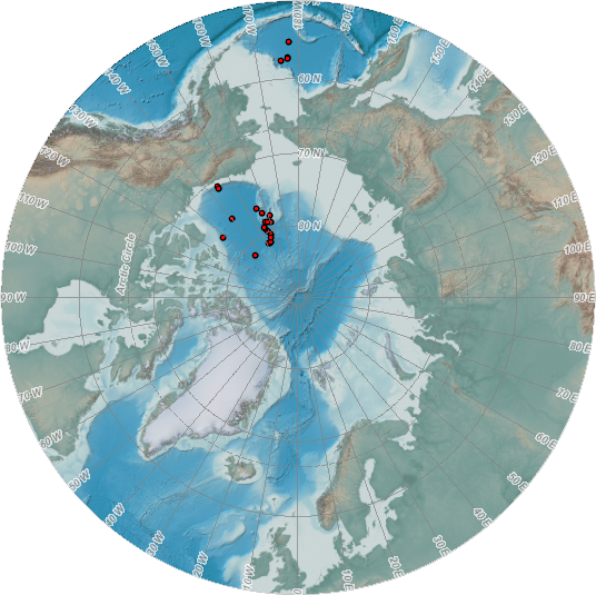