| Total Sediment Thickness of the World's Oceans & Marginal Seas, Version 2 |
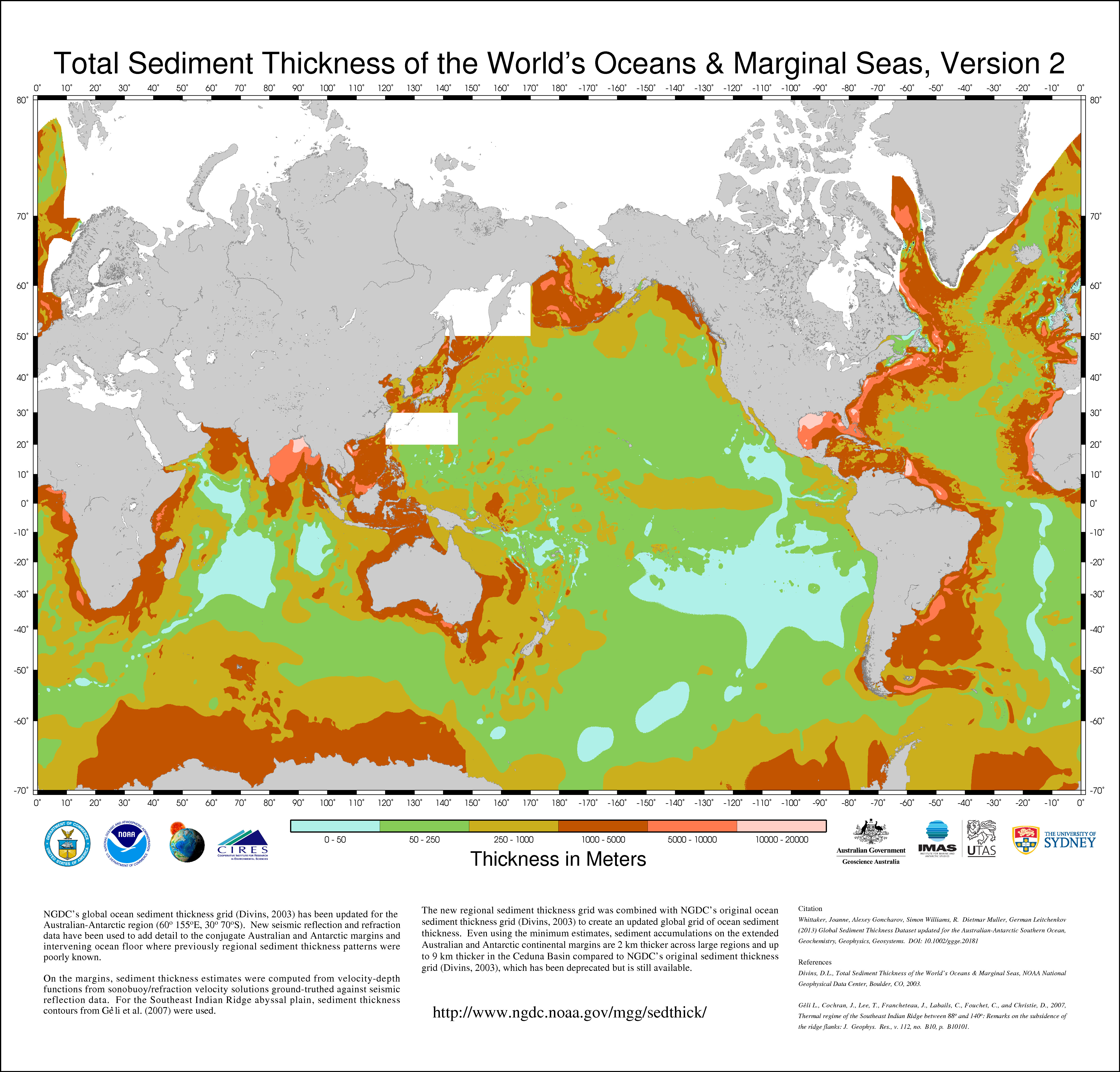 |
NGDC's global ocean sediment thickness grid (Divins, 2003) has been updated for the
Australian-Antarctic region (60° -155° E, 30° -70° S). New seismic reflection and
refraction data have been used to add detail to the conjugate Australian and Antarctic
margins and intervening ocean floor where previously regional sediment thickness patterns
were poorly known. On the margins, sediment thickness estimates were computed from
velocity-depth functions from sonobuoy/refraction velocity solutions ground-truthed
against seismic reflection data. For the Southeast Indian Ridge abyssal plain, sediment
thickness contours from Géli et al. (2007) were used. The new regional sediment thickness
grid was combined with NGDC's original ocean sediment thickness grid (Divins, 2003)
to create an updated global grid of ocean sediment thickness. Even using the minimum
estimates, sediment accumulations on the extended Australian and Antarctic continental
margins are 2 km thicker across large regions and up to 9 km thicker in the Ceduna
Basin compared to NGDC's original sediment thickness grid (Divins, 2003), which has
been deprecated but is still available. |
|