| GOES-R Series Solar Ultraviolet Imager (SUVI) Level 2 Products | identificationInfo|
|---|---|
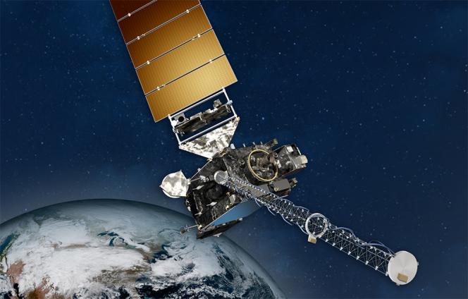
| (MI_Metadata) fileIdentifier: gov.noaa.ncei.swx:suvi-l2-goesr language: eng; USA characterSet: (MD_CharacterSetCode) utf8 hierarchyLevel: (MD_ScopeCode) dataset contact: (CI_ResponsibleParty) organisationName: NOAA National Centers for Environmental Information contactInfo: (CI_Contact) phone: (CI_Telephone) voice: 303-497-6223 address: (CI_Address) electronicMailAddress: goesr.spaceweatherdata@noaa.gov role: (CI_RoleCode) pointOfContact dateStamp: DateTime: 2022-09-27T05:18:48 metadataStandardName: ISO 19115-2 Geographic Information - Metadata - Part 2: Extensions for Imagery and Gridded Data metadataStandardVersion: ISO 19115-2:2009(E) return to top identificationInfo: (MD_DataIdentification) citation: (CI_Citation) title: GOES-R Series Solar Ultraviolet Imager (SUVI) Level 2 Products alternateTitle: GOES-R SUVI L2 date: (CI_Date) date: 2018-09-01 dateType: (CI_DateTypeCode) publication identifier: (MD_Identifier) code: Anchor: DOI doi:10.25921/D60Q-G238 identifier: (MD_Identifier) code: gov.noaa.ncei.swx:suvi-l2-goesr citedResponsibleParty: (CI_ResponsibleParty) organisationName: NOAA National Centers for Environmental Information role: (CI_RoleCode) publisher citedResponsibleParty: (CI_ResponsibleParty) individualName: Darnel, Jonathan organisationName: NOAA National Centers for Environmental Information positionName: Instrument Scientist contactInfo: (CI_Contact) address: (CI_Address) electronicMailAddress: goesr.suvi@noaa.gov role: (CI_RoleCode) principalInvestigator citedResponsibleParty: (CI_ResponsibleParty) individualName: Darnel, Jonathan organisationName: NOAA National Centers for Environmental Information positionName: Instrument Scientist contactInfo: (CI_Contact) address: (CI_Address) electronicMailAddress: goesr.suvi@noaa.gov role: (CI_RoleCode) author citedResponsibleParty: (CI_ResponsibleParty) individualName: Seaton, Daniel organisationName: NOAA National Centers for Environmental Information positionName: Solar Physicist role: (CI_RoleCode) collaborator citedResponsibleParty: (CI_ResponsibleParty) individualName: Seaton, Daniel organisationName: NOAA National Centers for Environmental Information positionName: Solar Physicist role: (CI_RoleCode) author citedResponsibleParty: (CI_ResponsibleParty) individualName: Hsu, Vicki organisationName: NOAA National Centers for Environmental Information positionName: Scientific Programmer role: (CI_RoleCode) collaborator citedResponsibleParty: (CI_ResponsibleParty) individualName: Hsu, Vicki organisationName: NOAA National Centers for Environmental Information positionName: Scientific Programmer role: (CI_RoleCode) author presentationForm: (CI_PresentationFormCode) imageDigital abstract: These SUVI Level 2 (L2) data are designed for use by the NOAA-NWS Space Weather Forecast Office and include several different products: composite images, thematic maps, bright regions, flare locations, coronal hole boundaries, coronal hole images, and fixed and running difference images. The SUVI Composite Image product is a weight average using the short and long exposures found in the SUVI Level-1b product to produce a high-dynamic range image. SUVI Fixed Difference images use a set "reference" image to produce difference images with respect to a particular event. SUVI Running Difference images use the most recent data to produce difference images showing short-term changes in the solar corona. The SUVI Thematic Map is a "mask" image that shows the automatically classified solar features. Composite images, as well as fixed and running difference images, are available in each of SUVI's six wavelengths. SUVI image products are available as FITS files. The SUVI Coronal Hole Boundary product contains lists of the boundary pixels in both image and heliographic coordinates for all coronal holes identified in the SUVI Thematic Map. The SUVI Bright Region Report uses the SUVI Thematic Map and SUVI Composite Image products to provide statistics on identified bright regions on the Sun. The SUVI Flare Location Report provides locations and statistics on flares identified by either the SUVI Thematic Map or the XRS Event Detection products. These products, Coronal Hole Boundaries, Bright Region Report, and Flare Location Report, are tabular data provided in netCDF-4 format. purpose: SUVI L2 data allow space weather forecasters and modelers to track solar activity such as flares and coronal mass ejections (CMEs). These events can cause geomagnetic storms, increased x-ray and ultraviolet irradiance, and an increase in solar energetic particles. These natural phenomena can in turn interfere with power grid operations, GPS communication, radio transmissions, and navigation devices. status: (MD_ProgressCode) onGoing pointOfContact: (CI_ResponsibleParty) individualName: Jonathan Darnel organisationName: NOAA National Centers for Environmental Information positionName: Instrument Scientist contactInfo: (CI_Contact) address: (CI_Address) electronicMailAddress: goesr.suvi@noaa.gov role: (CI_RoleCode) pointOfContact resourceMaintenance: (MD_MaintenanceInformation) maintenanceAndUpdateFrequency: (MD_MaintenanceFrequencyCode) continual graphicOverview: (MD_BrowseGraphic) fileName: https://www.ncei.noaa.gov/pub/data/metadata/images/noaa_goesr_series_satellite_illustration.jpg fileDescription: NOAA GOES Spacecraft fileType: JPEG descriptiveKeywords: (MD_Keywords) keyword: EARTH SCIENCE > SUN-EARTH INTERACTIONS > SOLAR ACTIVITY > SOLAR FLARES keyword: EARTH SCIENCE > SUN-EARTH INTERACTIONS > SOLAR ACTIVITY > SOLAR IMAGERY keyword: EARTH SCIENCE > SUN-EARTH INTERACTIONS > SOLAR ACTIVITY > CORONA keyword: EARTH SCIENCE > SPECTRAL/ENGINEERING > ULTRAVIOLET WAVELENGTHS > ULTRAVIOLET RADIANCE keyword: EARTH SCIENCE > SUN-EARTH INTERACTIONS > SOLAR ACTIVITY > CORONA HOLES keyword: EARTH SCIENCE > SUN-EARTH INTERACTIONS > SOLAR ACTIVITY > CORONAL MASS EJECTIONS keyword: EARTH SCIENCE > SUN-EARTH INTERACTIONS > SOLAR ACTIVITY > SOLAR PROMINENCES/SOLAR FILAMENTS keyword: EARTH SCIENCE > SUN-EARTH INTERACTIONS > SOLAR ACTIVITY > SOLAR ACTIVE REGIONS keyword: EARTH SCIENCE > SUN-EARTH INTERACTIONS > SOLAR ACTIVITY > SOLAR ULTRAVIOLET EMISSIONS keyword: EARTH SCIENCE > SUN-EARTH INTERACTIONS > SOLAR ACTIVITY > SUNSPOTS type: (MD_KeywordTypeCode) theme thesaurusName: (CI_Citation) title: NASA Global Change Master Directory (GCMD) Science and Services Keywords date: (CI_Date) date: 2015-08-04 dateType: (CI_DateTypeCode) revision edition: Version 8.1 citedResponsibleParty: (CI_ResponsibleParty) organisationName: NASA/GSFC/SED/ESD/GCDC/GCMD > Global Change Master Directory, Global Change Data Center, Earth Sciences Division, Science and Exploration Directorate, Goddard Space Flight Center, NASA contactInfo: (CI_Contact) onlineResource: (CI_OnlineResource) linkage: http://gcmd.gsfc.nasa.gov/learn/keywords.html protocol: HTTP applicationProfile: Web Browser name: NASA GCMD Keyword Community Page description: Overview of the NASA GCMD Keywords. function: (CI_OnLineFunctionCode) information role: (CI_RoleCode) publisher descriptiveKeywords: (MD_Keywords) keyword: SPACE > EARTH MAGNETIC FIELD > MAGNETOSPHERE (OTHER) type: (MD_KeywordTypeCode) place thesaurusName: (CI_Citation) title: NASA Global Change Master Directory (GCMD) Location Keywords date: (CI_Date) date: 2015-04-07 dateType: (CI_DateTypeCode) revision edition: Version 8.1 citedResponsibleParty: (CI_ResponsibleParty) organisationName: NASA/GSFC/SED/ESD/GCDC/GCMD > Global Change Master Directory, Global Change Data Center, Earth Sciences Division, Science and Exploration Directorate, Goddard Space Flight Center, NASA contactInfo: (CI_Contact) onlineResource: (CI_OnlineResource) linkage: http://gcmd.gsfc.nasa.gov/learn/keywords.html protocol: HTTP applicationProfile: Web Browser name: NASA GCMD Keyword Community Page description: Overview of the NASA GCMD Keywords. function: (CI_OnLineFunctionCode) information role: (CI_RoleCode) publisher descriptiveKeywords: (MD_Keywords) keyword: GOES > Geostationary Operational Environmental Satellites type: (MD_KeywordTypeCode) project thesaurusName: (CI_Citation) title: NASA Global Change Master Directory (GCMD) Project Keywords date: (CI_Date) date: 2015-09-10 dateType: (CI_DateTypeCode) revision edition: Version 8.1 citedResponsibleParty: (CI_ResponsibleParty) organisationName: NASA/GSFC/SED/ESD/GCDC/GCMD > Global Change Master Directory, Global Change Data Center, Earth Sciences Division, Science and Exploration Directorate, Goddard Space Flight Center, NASA contactInfo: (CI_Contact) onlineResource: (CI_OnlineResource) linkage: http://gcmd.gsfc.nasa.gov/learn/keywords.html protocol: HTTP applicationProfile: Web Browser name: NASA GCMD Keyword Community Page description: Overview of the NASA GCMD Keywords. function: (CI_OnLineFunctionCode) information role: (CI_RoleCode) publisher descriptiveKeywords: (MD_Keywords) keyword: Solar/Space Observing Instruments >> Ultraviolet Instruments > SUVI-GOESR type: (MD_KeywordTypeCode) instrument thesaurusName: (CI_Citation) title: NASA Global Change Master Directory (GCMD) Instrument Keywords date: (CI_Date) date: 2015-10-02 dateType: (CI_DateTypeCode) revision edition: Version 8.1 citedResponsibleParty: (CI_ResponsibleParty) organisationName: NASA/GSFC/SED/ESD/GCDC/GCMD > Global Change Master Directory, Global Change Data Center, Earth Sciences Division, Science and Exploration Directorate, Goddard Space Flight Center, NASA contactInfo: (CI_Contact) onlineResource: (CI_OnlineResource) linkage: http://gcmd.gsfc.nasa.gov/learn/keywords.html protocol: HTTP applicationProfile: Web Browser name: NASA GCMD Keyword Community Page description: Overview of the NASA GCMD Keywords. function: (CI_OnLineFunctionCode) information role: (CI_RoleCode) publisher descriptiveKeywords: (MD_Keywords) keyword: Solar/Space Observation Satellites > GOES (Geostationary Operational Environmental Satellite) type: (MD_KeywordTypeCode) platform thesaurusName: (CI_Citation) title: NASA Global Change Master Directory (GCMD) Platform Keywords date: (CI_Date) date: 2015-09-23 dateType: (CI_DateTypeCode) revision edition: Version 8.1 citedResponsibleParty: (CI_ResponsibleParty) organisationName: NASA/GSFC/SED/ESD/GCDC/GCMD > Global Change Master Directory, Global Change Data Center, Earth Sciences Division, Science and Exploration Directorate, Goddard Space Flight Center, NASA contactInfo: (CI_Contact) onlineResource: (CI_OnlineResource) linkage: http://gcmd.gsfc.nasa.gov/learn/keywords.html protocol: HTTP applicationProfile: Web Browser name: NASA GCMD Keyword Community Page description: Overview of the NASA GCMD Keywords. function: (CI_OnLineFunctionCode) information role: (CI_RoleCode) publisher resourceConstraints: (MD_LegalConstraints) useConstraints: (MD_RestrictionCode) otherRestrictions otherConstraints: Cite as: Darnel, Jonathan; Seaton, Daniel; Hsu, Vicki (2018): GOES-R Series Level 2 Solar Ultraviolet Imager (SUVI) Products. [indicate subset used]. NOAA National Centers for Environmental Information. https://doi.org/10.25921/D60Q-G238 [access date]. resourceConstraints: (MD_LegalConstraints) accessConstraints: (MD_RestrictionCode) otherRestrictions otherConstraints: Distribution liability: NOAA and NCEI make no warranty, expressed or implied, regarding these data, nor does the fact of distribution constitute such a warranty. NOAA and NCEI cannot assume liability for any damages caused by any errors or omissions in these data. If appropriate, NCEI can only certify that the data it distributes are an authentic copy of the records that were accepted for inclusion in the NCEI archives. resourceConstraints: (MD_LegalConstraints) useConstraints: (MD_RestrictionCode) otherRestrictions otherConstraints: Use liability: NOAA and NCEI cannot provide any warranty as to the accuracy, reliability, or completeness of furnished data. Users assume responsibility to determine the usability of these data. The user is responsible for the results of any application of this data for other than its intended purpose. resourceConstraints: (MD_Constraints) useLimitation: These GOES-16 data have reached provisional maturity and are still undergoing testing. Users receiving these data through any dissemination means assume all risk related to their use and NOAA disclaims any and all warranties, whether express or implied, including (without limitation) any implied warranties of merchantability or fitness for a particular purpose. language: eng; USA topicCategory: (MD_TopicCategoryCode) environment extent: (EX_Extent) description: Non-geographic dataset geographicElement: (inapplicable) temporalElement: (EX_TemporalExtent) extent: TimePeriod: description: ground condition beginPosition: 2018-05-04 endPosition: return to top distributionInfo: (MD_Distribution) distributor: (MD_Distributor) distributorContact: (CI_ResponsibleParty) organisationName: NOAA National Centers for Environmental Information contactInfo: (CI_Contact) address: (CI_Address) electronicMailAddress: goesr.spaceweatherdata@noaa.gov role: (CI_RoleCode) distributor distributionOrderProcess: (MD_StandardOrderProcess) fees: Electronic downloads of the data are free; however, fees may apply for data certifications and data distribution on physical media. distributorFormat: (MD_Format) name: netCDF-4 version: (missing) fileDecompressionTechnique: gzip distributorTransferOptions: (MD_DigitalTransferOptions) transferSize: Real: 1.3 onLine: (CI_OnlineResource) linkage: https://doi.org/10.25921/D60Q-G238 protocol: HTTPS applicationProfile: Landing Page name: NCEI landing page for this dataset description: Dataset landing page with general information and links to access the data. function: (CI_OnLineFunctionCode) information onLine: (CI_OnlineResource) linkage: https://data.ngdc.noaa.gov/platforms/solar-space-observing-satellites/goes/ protocol: HTTP applicationProfile: Download name: GOES-R Level 2 File Downloads description: Downloads for GOES-R Space Weather Level 2 (L2) products, including SUVI products function: (CI_OnLineFunctionCode) download onLine: (CI_OnlineResource) linkage: https://www.ngdc.noaa.gov/stp/satellite/goes-r.html protocol: HTTPS applicationProfile: Information name: GOES-R Space Weather Data Access Information Page description: Website for information on GOES-R space weather data function: (CI_OnLineFunctionCode) information return to top dataQualityInfo: (DQ_DataQuality) scope: (DQ_Scope) level: (MD_ScopeCode) dataset extent: #boundingExtent (EX_Extent) temporalElement: lineage: (LI_Lineage) statement: This dataset was produced by NESDIS, and is archived at the NOAA National Centers for Environmental Information (NCEI). processStep: (LE_ProcessStep) description: Please contact goesr.suvi@noaa.gov for information about the L2 processing algorithms. dateTime: (missing) processor: (CI_ResponsibleParty) organisationName: National Centers for Environmental Information (NCEI) role: (CI_RoleCode) processor source: sd001 processingInformation: (LE_Processing) identifier: (missing) algorithm: (LE_Algorithm) citation: (CI_Citation) title: GOES-R SUVI L2 Algorithm Theoretical Basis Documents (ATBDs) date: (CI_Date) date: 2019-01-01 dateType: (CI_DateTypeCode) publication citedResponsibleParty: (CI_ResponsibleParty) organisationName: DOC/NOAA/NESDIS/NCEI > National Centers for Environmental Information, NESDIS, NOAA, U.S. Department of Commerce role: (CI_RoleCode) distributor citedResponsibleParty: (CI_ResponsibleParty) organisationName: (missing) role: (missing) description: See Algorithm Citation processStep: (LE_ProcessStep) description: Creation of GOES-R SUVI L2 Products from GOES-R SUVI L1b Products. dateTime: (missing) processor: (CI_ResponsibleParty) organisationName: NOAA National Centers for Environmental Information role: (CI_RoleCode) processor source: sd002 processingInformation: (LE_Processing) identifier: (MD_Identifier) code: NCEI-CO's L2 algorithm routines processStep: (LE_ProcessStep) description: Creation of GOES-R SUVI L1b Products from GOES-R SUVI Level 0 (L0) Products by WCDAS (Wallops Command and Data Acquisition Station). dateTime: (missing) processor: (CI_ResponsibleParty) organisationName: WCDAS (Wallops Command and Data Acquisition Station, Chincoteague, VA) role: (CI_RoleCode) processor source: sd002 processingInformation: (LE_Processing) identifier: (MD_Identifier) code: Ground Processing Algorithms source: (LE_Source) description: GOES-R SUVI Level 1b data sourceCitation: (CI_Citation) title: Web site to extract Level 1b source data date: (missing) citedResponsibleParty: (CI_ResponsibleParty) organisationName: National Centers for Environmental Information (NCEI), NOAA, U.S. Department of Commerce role: (CI_RoleCode) distributor citedResponsibleParty: (CI_ResponsibleParty) organisationName: (missing) contactInfo: (CI_Contact) onlineResource: (CI_OnlineResource) linkage: https://www.ngdc.noaa.gov/stp/satellite/goes-r.html protocol: HTTP applicationProfile: Web Browser function: (CI_OnLineFunctionCode) information role: (missing) sourceExtent: (EX_Extent) temporalElement: (EX_TemporalExtent) extent: TimePeriod: beginPosition: 2017-12-19 endPosition: sourceStep: ps002 return to top dataQualityInfo: (DQ_DataQuality) scope: (DQ_Scope) level: (MD_ScopeCode) repository levelDescription: (MD_ScopeDescription) other: NOAA National Centers for Environmental Information lineage: (LI_Lineage) processStep: (LE_ProcessStep) description: NOAA created the National Centers for Environmental Information (NCEI) by merging NOAA's National Climatic Data Center (NCDC), National Geophysical Data Center (NGDC), and National Oceanographic Data Center (NODC), including the National Coastal Data Development Center (NCDDC), per the Consolidated and Further Continuing Appropriations Act, 2015, Public Law 113-235. NCEI launched publicly on April 22, 2015. dateTime: DateTime: 2015-04-22T00:00:00 return to top metadataMaintenance: (MD_MaintenanceInformation) maintenanceAndUpdateFrequency: (MD_MaintenanceFrequencyCode) asNeeded | |