|
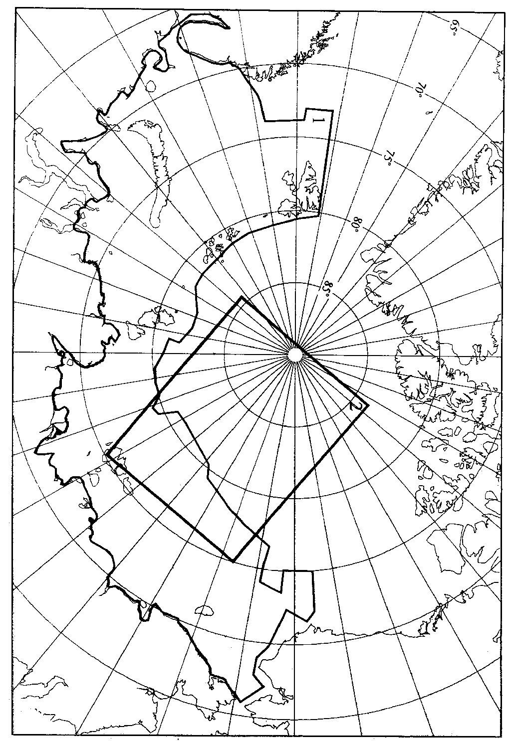
Figure 1. Portions of the Arctic Ocean seabed that are included in the integrated bathymetric grid produced at VNIIOkeangeologia. 1: Northern Eurasian Shelf. 2: Central Arctic Basin. (Maschenkov)
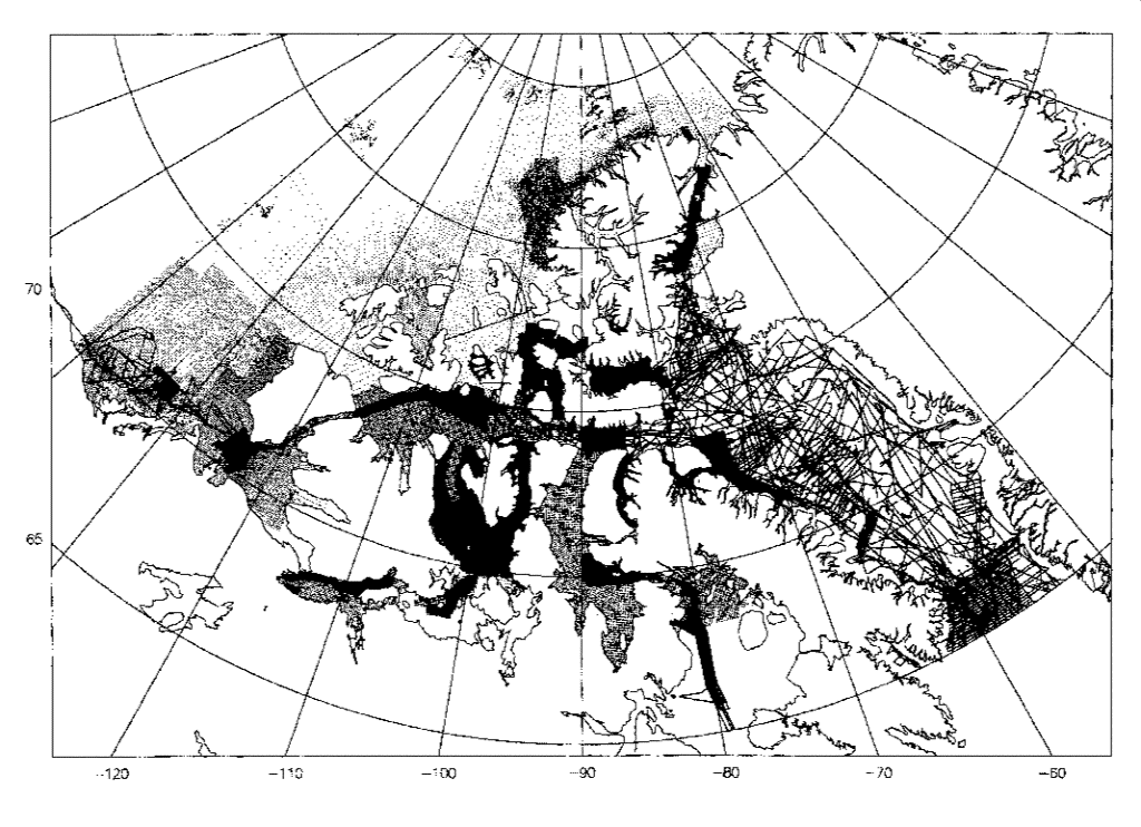
Figure 2. Locations of depth observations in and around the Canadian Arctic Archipelago, extracted from the digital archives of the Geological Survey of Canada and the Canadian Hydrographic Service. (Macnab)
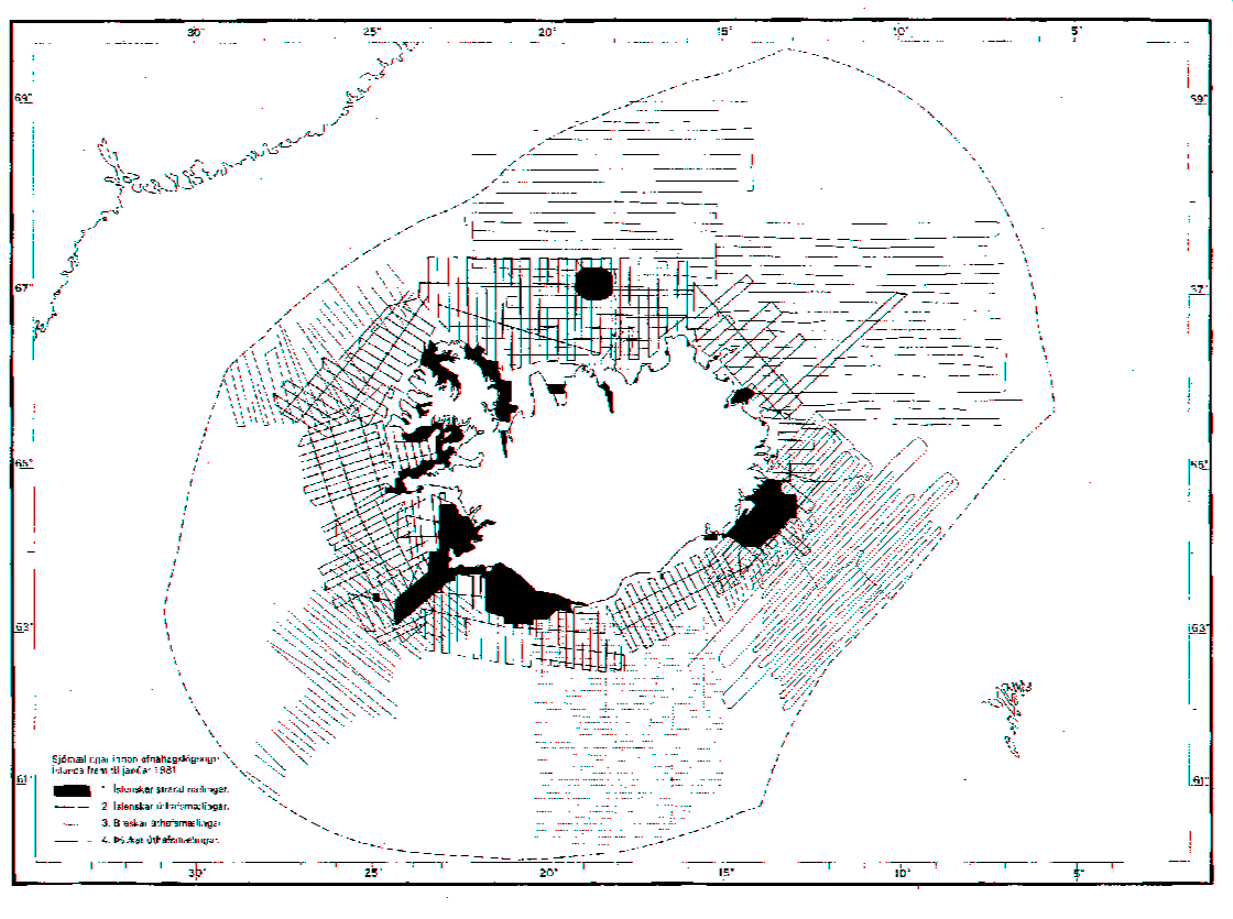
Figure 3. Sounding lines off Iceland. Black areas near the coast are not current. (Helgason)
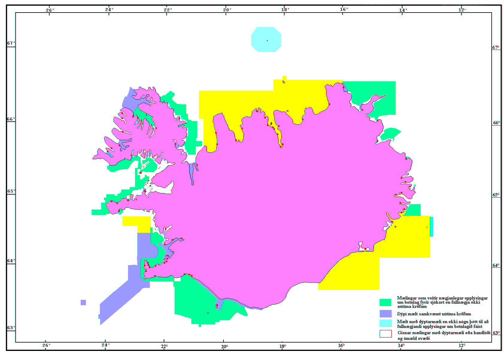
Figure 4. Near-shore sounding coverage off Iceland. (Helgason)
Figure 5. Relief map portraying a grid developed from published bathymetric maps, complemented by the GTOPO30 topographic grid. (Jakobsson)
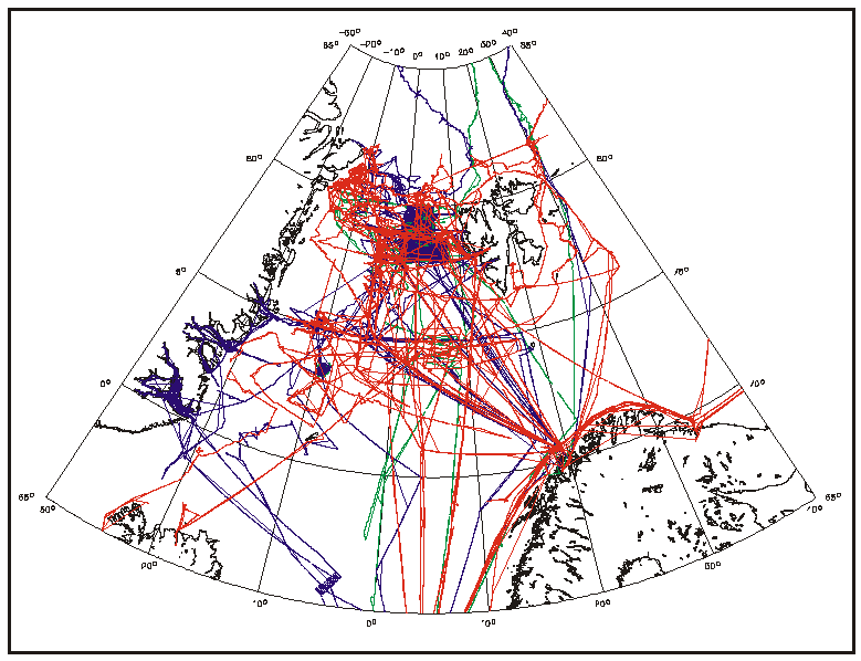
Figure 6. Sounding tracks of US Navy submarines from 1983 to 1988; data sets exist in digital form. (Anderson)
Figure 7. Sounding tracks of US Navy submarines from 1983 to 1988; data sets exist in analog form. (Anderson)
Figure 8. Narrow beam (red) and multibeam (green & blue) sounding tracks of Polarstern cruises in Fram Strait, from 1984 to 1997. (Dijkstra)
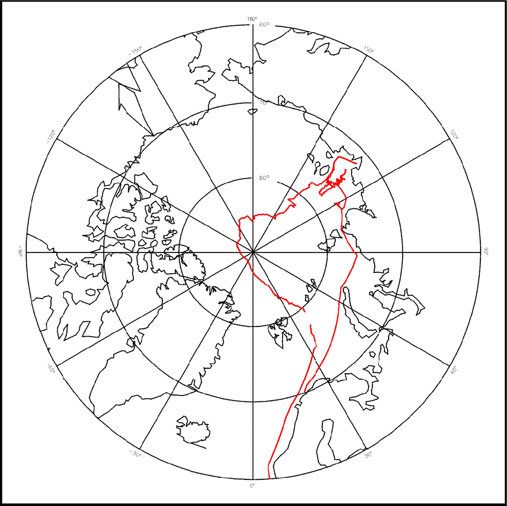
Figure 9. Sounding track of Polarstern cruise to the Arctic, 1998. (Dijkstra)
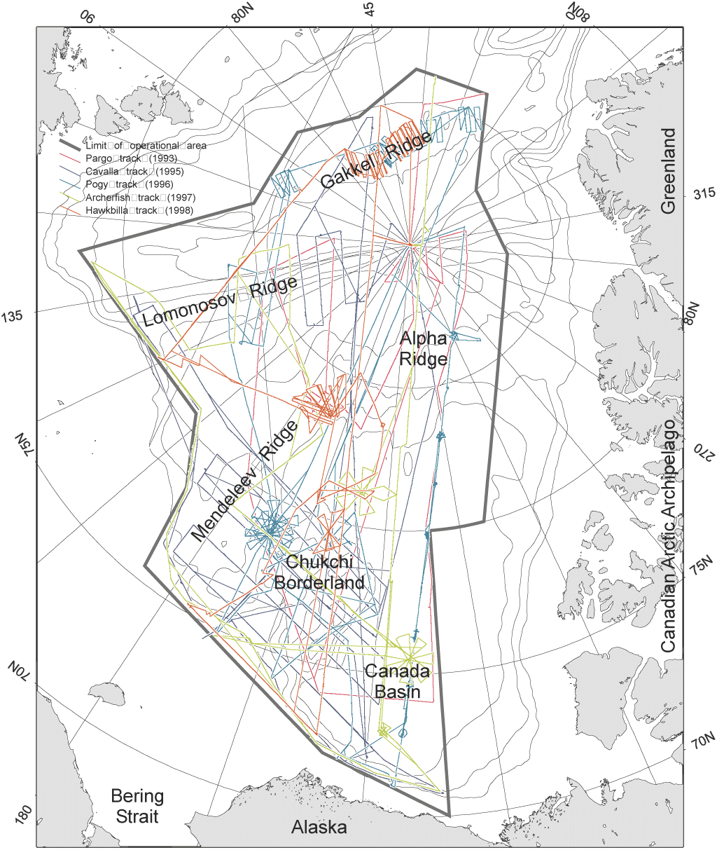
Figure 10. Sounding tracks of the US Navy's unclassified SCICEX expeditions from 1993 to 1998. (Coakley)
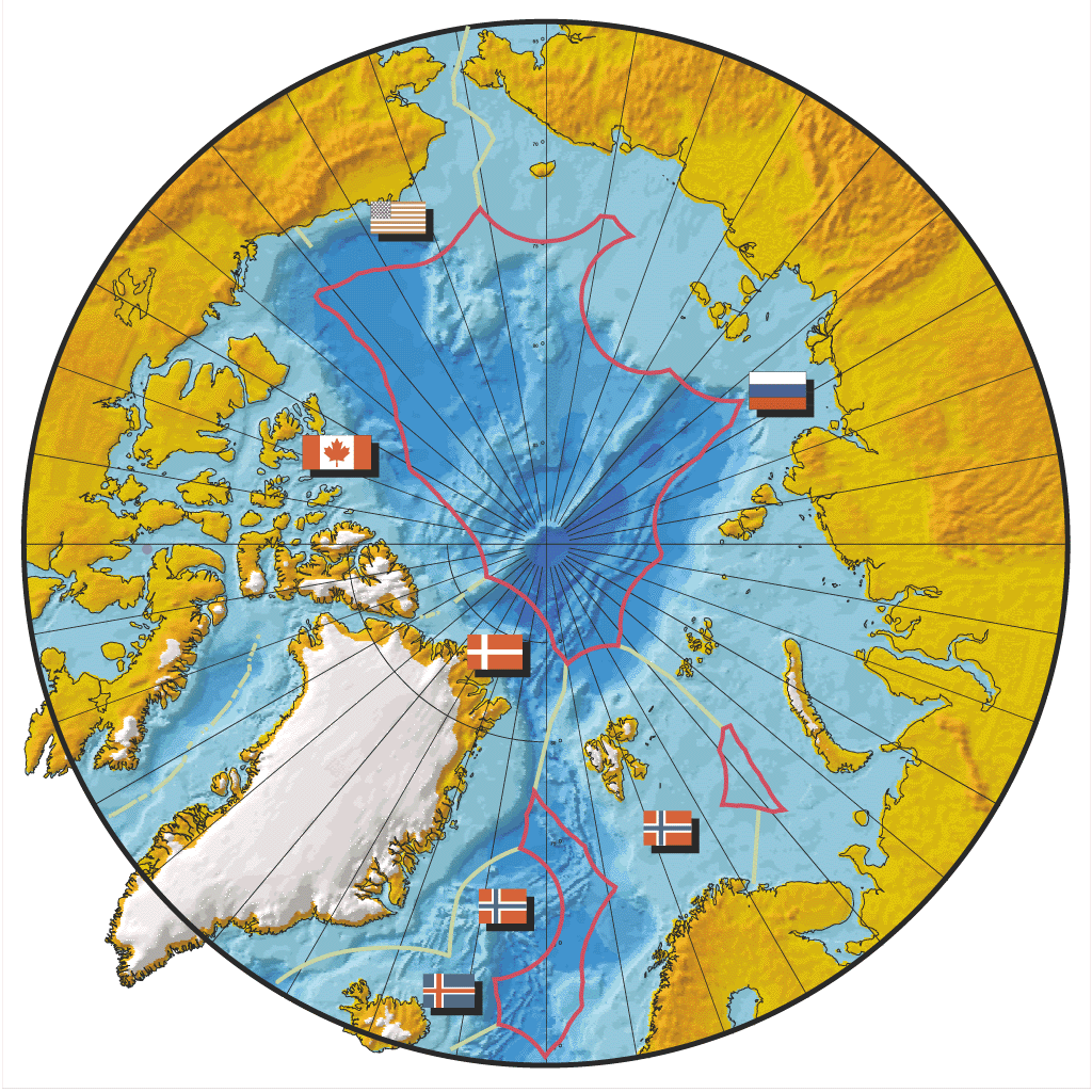
Figure 11. Approximate limits of the Exclusive Economic Zones (EEZ's) of the Arctic coastal states, illustrating a proposed scheme for partitioning the project. Bilateral limits are shown in green, High Seas limits in pink. Each coastal state would assume responsibility for managing the compilation of public-domain and proprietary bathymetry within its own EEZ. Contiguous states would assume a cooperative responsibility for compiling public-domain data in each of the three High Seas Zones. (Macnab) |