NOAA logo, National Centers for Environmental Information, National Oceanic and Atmospheric Administration NSF logo, National Science Foundation, Division of Ocean Sciences

Core Data from the Deep Sea Drilling Project


DSDP holes in the Greenland Sea

leg 38 hole 338 leg 38 hole 339 leg 38 hole 340 leg 38 hole 341 leg 38 hole 342 leg 38 hole 343 leg 38 hole 344 leg 38 hole 345 leg 38 hole 346 leg 38 hole 347 leg 38 hole 348 leg 38 hole 349 leg 38 hole 350 leg 38 hole 351
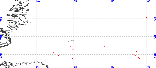
Red dots represent sites. Overprinted locations include links to adjacent sites.
hole	leg	latitude	longitude

344	38 	 76.1497	   7.8753	

Introduction


Cite as: Deep Sea Drilling Project (1989): Archive of Core and Site/Hole Data and Photographs from the Deep Sea Drilling Project (DSDP). National Geophysical Data Center, NOAA. doi:10.7289/V54M92G2 [access date]

These Web pages are from the Core Data from the Deep Sea Drilling Project Legs 1-96 CD-ROM produced in 1989 and modified in 2000 by the U.S. Department of Commerce, National Oceanic and Atmospheric Administration, National Environmental Satellite, Data, and Information Service, National Geophysical Data Center (now part of the National Centers for Environmental Information), and collocated World Data Center for Marine Geology and Geophysics, Boulder (now part of the World Data Service for Geophysics). Data were compiled in cooperation with the U.S. Science Support Program, of the Joint Oceanographic Institutions, Inc. (now the Consortium for Ocean Leadership), and the U.S. National Science Foundation.

Please see NOAA's privacy and disclaimer information. Send questions or comments to mgg.info@noaa.gov.

Department of Commerce > NOAA > NESDIS > NCEI > doi:10.7289/V54M92G2