
DEM data is typically displayed on geospatial grids divided into cells that represent the average of the elevation measurements taken within the cell’s boundaries. Grids are often structured, meaning that the data is interpolated create an even, regular framework of equally sized cells. Unstructured cell sizes fluctuate based on the data density of the area or depth represented.
Structured grids typically have square cells, though they may use other shapes. Structured square-cell grids have two different registration types: grid/node and cell/pixel. Cell-registration are typically used in images to prevent edge pixels from being cut in half along the boundaries, while grid-registration is more common for discrete point data representation.
- Grid/Node:
- Ranges refer to the centers of the cells on the outside border of the grid (Panel A), and the footprints of the cells extend 1/2 cell width outside the range.
- Cell/Pixel:
- Ranges refer to the outside edges of the boundaries of the grid (Panel B).
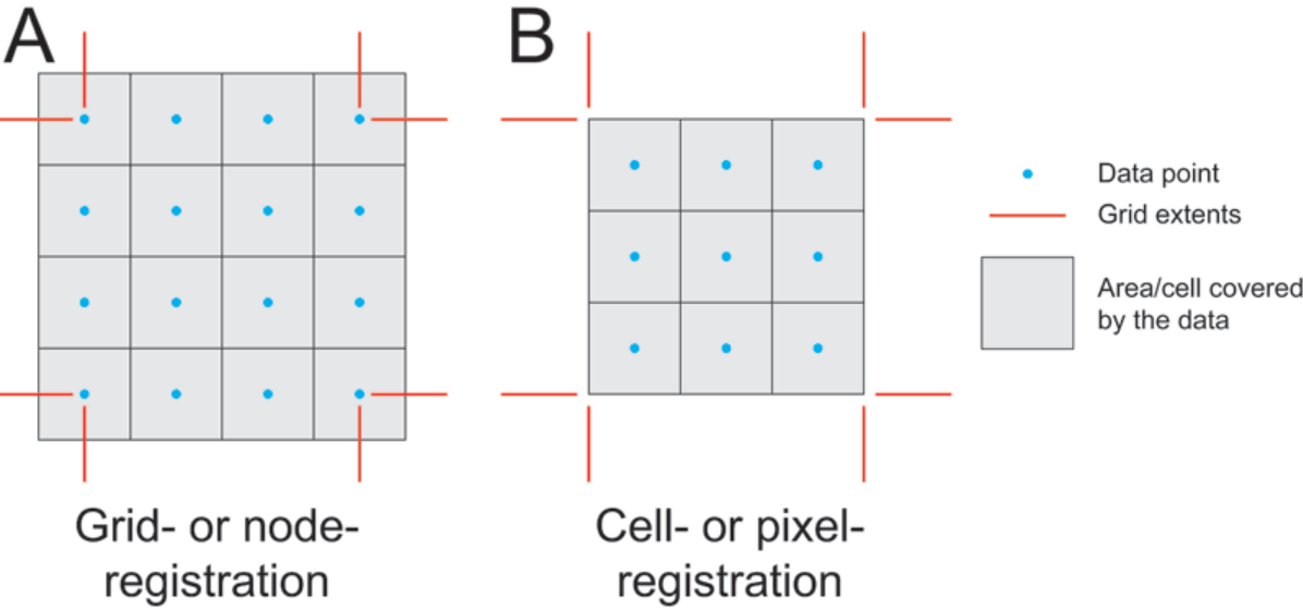
A grid-registered grid has one more row and one more column than a cell-registered version with an identical range. For example, a global, grid-registered grid will have cells that lay directly on top of the North and South Poles, while a cell-registered grid will touch edge of the poles without covering them.
Grids can be converted from one registration to another, though this results in a degree of relief flattening (Figure 2). Each cell in one registration type overlies the corners of four cells in the other. The cell value in the new grid will be an average of the four overlapped cells in the initial grid. Local highs, such as the 90 in the center of Panel A, are reduced in the new grid (Panel B), whose central cell values are lower due to averaging. Repeating the conversion, to return to a grid-registered grid, does not produce the original relief (Panel C). There are ways to reduce this registration-conversion effect, but converting between registration types is one-way and should be minimized.
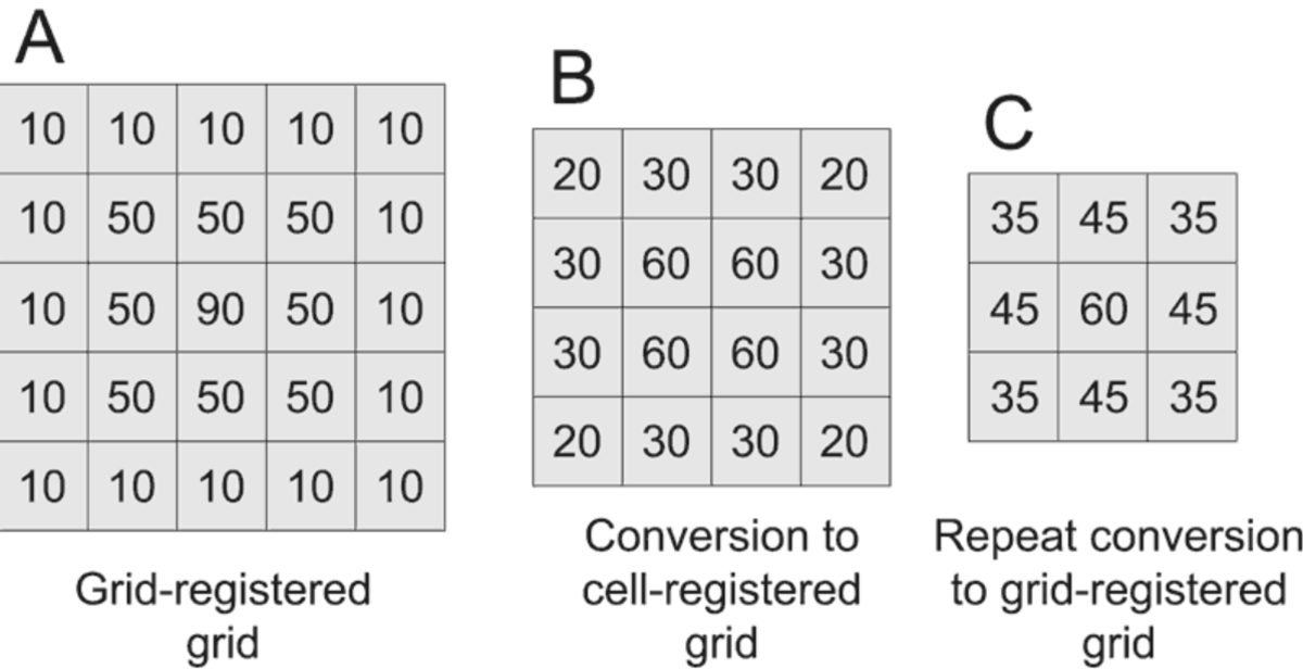
Note: Mistaking one grid type for another can shift cell locations and data. Most grid applications recognize both types.