Marine Seismic Reflection
USGS OFR82-1090
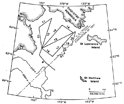
L6-80-BS Lines 9-21
During 1980 (cruise L6-80-BS) the U.S. Geological Survey collected 1800 km of 24-fold seismic reflection data in the Gulf of Anadyr and across Navarin Basin. The profiles were collected on the R/V S.P. Lee using a sound source of five air guns totaling 1,324 in3. The recording equipment consists of a 24-channel streamer, 2400 meters long, with a group interval of 100m, and a GUS (Global Universal Science) Model 4200 digital recording system. Shot records were recorded at a 2 millisecond sample rate, and later processes at a 4 millisecond rate. Navigational control of the survey was by satellite fixes integrated with Loran C (Rho-Rho) and Doppler-sonar-bottom-track navigation.
The seismic reflection records vary from 10 to 12 seconds in length depending upon water depth and geologic structure. The first 10 seconds of the shote records were edited, stacked, deconvolved, filtered, and displayed on an electrostatic plot.
|

|

