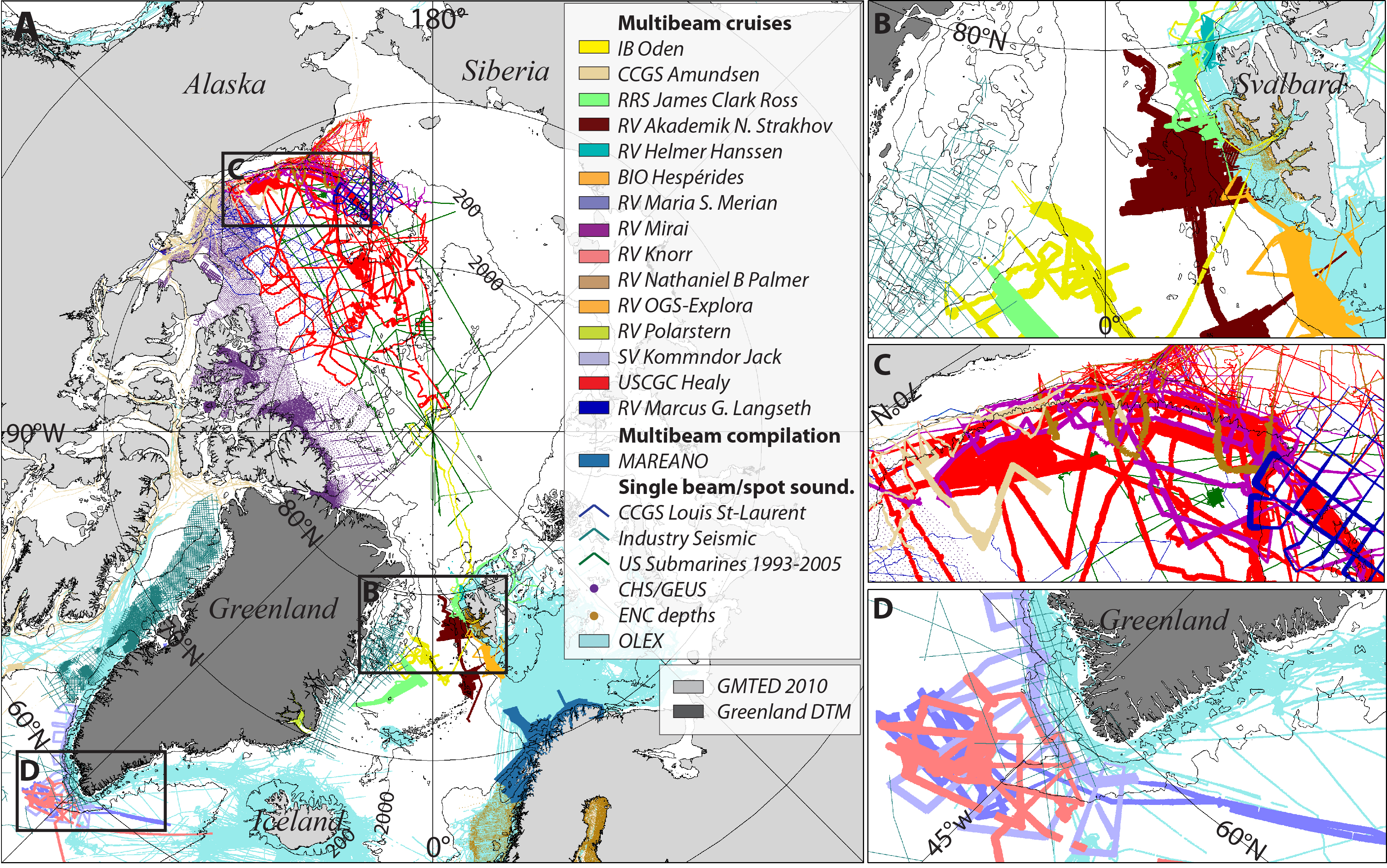
IBCAO Version 3.0 represents the largest improvement since 1999 taking advantage of new data sets collected by the circum-Arctic nations, opportunistic data collected from fishing vessels, data acquired from US Navy submarines and from research ships of various nations. Built using an improved gridding algorithm, this new grid is on a 500 meter spacing, revealing much greater details of the Arctic seafloor than IBCAO Version 1.0 (2.5 km) and Version 2.0 (2.0 km). The area covered by multibeam surveys has increased from ~6 % in Version 2.0 to ~11% in Version 3.0. The compilation of IBCAO Version 3.0 is described in a Geophysical Research Letter article available for download below.
Please acknowledge the following citation when using the IBCAO grids and maps:
Jakobsson, M., L. A. Mayer, B. Coakley, J. A. Dowdeswell, S. Forbes, B. Fridman, H. Hodnesdal, R. Noormets, R. Pedersen, M. Rebesco, H.-W. Schenke, Y. Zarayskaya A, D. Accettella, A. Armstrong, R. M. Anderson, P. Bienhoff, A. Camerlenghi, I. Church, M. Edwards, J. V. Gardner, J. K. Hall, B. Hell, O. B. Hestvik, Y. Kristoffersen, C. Marcussen, R. Mohammad, D. Mosher, S. V. Nghiem, M. T. Pedrosa, P. G. Travaglini, and P. Weatherall, The International Bathymetric Chart of the Arctic Ocean (IBCAO) Version 3.0, Geophysical Research Letters, doi: 10.1029/2012GL052219.
[Auxiliary Material]
For a listing of data types, please see the IBCAO_V3_README.txt file.