|
Bathymetric and Lidar Data
Compiled by the Geological Survey of Ireland

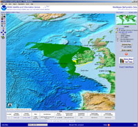
NCEI, in cooperation with the Geological Survey of Ireland (GSI) is archiving and making available over 5 terabytes of multibeam bathymetric data collected under the Irish National Seabed (INSS) and the Integrated Mapping for the Sustainable Development of Ireland's Marine Resources (INFOMAR) program, jointly managed by both GSI and the Irish Marine Institute (MI).
This international cooperation provides a mechanism for exposing these data to a greater community of interest. In today's global network of information, this alliance will pave the way for future endeavors, via a borderless Internet, through data sharing. NCEI and the Geological Survey of Ireland hope that these data can be used and reused for all types of projects and that the results of those potential projects will in turn be made available for all to study.
Access Irish data via NCEI:
https://maps.ngdc.noaa.gov/viewers/bathymetry/, or by the Irish web service
https://jetstream.gsi.ied/iwdds/.
For questions about the data, please contact Archie Donovan at the Geological Survey of Ireland
or the Multibeam Data Manager
.
|


|