Privacy policies of the above site may differ from NCEI's. Links do not constitute endorsement.
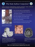
Why Study Sea Floor Composition?
Our sincerest thanks to the scientists who contributed ideas for the summary below.
How can data derived from sea floor samples be used?
- To study past climate change for environmental prediction.
- To understand the impact of benthic habitat on fisheries and other biological communities.
- To study offshore pollution patterns and mechanisms to help sustain healthy coasts.
- To find sources of dredged material for beach replenishment.
- To evaluate the impacts of proposed offshore waste disposal.
- To learn about and estimate the impacts of events such as gas hydrate releases related to slope stability.
- To locate strategic offshore mineral resources.
- To determine sites for seabed communications cables, drilling platforms, and other structures.
- To provide groundtruth values for remotely sensed/satellite data, helping refine new techniques for environmental assessment and prediction.
- To learn more about how the Earth and its environmental systems function.
- More about the role of sea floor sediment in understanding the processes of environmental change.
Also see: Why Collect Rocks?
An Overview on Geologic Objectives for the NOAA Okeanos Explorer 2015 Hohonu Moana Expedition
Why are data from the sea floor important to NOAA's Mission and Strategic Goals?
NOAA's Mission:
"Science, Service, and Stewardship. To understand and predict changes in climate, weather, oceans, and coasts, to share that knowledge and information with others, and to conserve and manage coastal and marine ecosystems and resources"
Some of NOAA's Goals:
- Climate Adaptation and Mitigation
Sea floor sediment provide an invaluable key to past climate change.
Finely varved sediments from areas of rapid deposition provide a high-resolution
record of past climate variation, and volcanic ash layers contribute to the
comprehensive study of climate change on relatively short timescales. Analysis
of sediment for components such as carbonates and isotopes provide baseline
information for global modeling of environmental change.
- Healthy Oceans and Resilient Coastal Communities and Economies
Sediment composition and physical properties are key factors in evaluating benthic habitat for fisheries. To quote from a September 1999 technical memorandum issued by the National Marine Fisheries Service:
"The texture of surficial sediments, defined as the size-frequency distribution
of unconsolidated grains, is an important attribute of the coastal ocean
environment. In addition to purely geological applications, data of this type
have great utility in habitat studies seeking to explain the distribution and
abundance of important biological resources." "Sediment texture is one of many
potential factors influencing the distribution and abundance of groundfish.
The relative distribution of grain sizes affects sediment properties such as
porosity, permeability, and resistance to displacement (Allen 1985, Selley 1988).
These properties, in turn, may directly (e.g., self-burial to reduce exposure
to predators) or indirectly (e.g., suitability for essential prey organisms)
affect fish habitat quality, as measured by rates of growth, survival, reproduction,
and recruitment."(1)
Coastal sediment data analyses play a role in understanding coastal habitat and help determine the extent, nature, and transport of pollutants. Sediment data assist in determining sources of appropriate material for beach replenishment, and are an integral data layer in GIS analysis of coastal environments for a variety of purposes.
"In addition to key environmental analysis and assessment roles, sea floor studies have other economic value. Sediment properties are crucial in placement of seabed cables, data from exploratory wells are necessary to evaluate sites for offshore drilling, and geochemical studies are necessary for evaluation of offshore hard mineral resources." (2)
(1) Smith, K.R. and R.A. McConnaughey, 1999. Surficial sediments of the eastern Bering Sea continental shelf: EBSSED database documentation. U.S. Dep. Commer., NOAA Tech. Memo. NMFS-AFSC-104, 41 p.
(2)Our Seabed Frontier: Challenges and Choices, 1989. National Academy of Sciences.
download a 2.5mbyte .pdf poster
More Educational Links | The Index to Marine and Lacustrine Geological Samples (IMLGS) | Marine Geology
|