Bathymetry of Lake Michigan
Products Available:
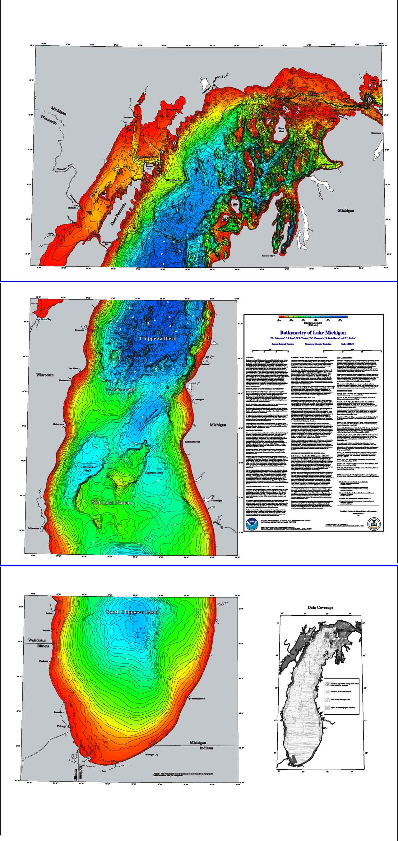
Bathymetry of Lake Michigan has been compiled as a component of a NOAA project to rescue Great Lakes lake floor geological and geophysical data and make it more accessible to the public. The project is a cooperative effort between investigators at the NOAA National Centers for Environmental Information (NCEI) and the NOAA Great Lakes Environmental Research Laboratory (GLERL). was compiled utilizing the entire historic sounding database. This bathymetry resolves physiography of the lake floor to an extent that known features are revealed more accurately and features never before seen are revealed for the first time. Bathymetry has been compiled using the entire array of good-quality historical hydrographic soundings collected in support of nautical charting over a 120-year period by the NOAA National Ocean Service and its predecessor agency for Great Lakes surveying, the Army Corps of Engineers. More than 600,000 bathymetric soundings were employed, of which approximately 60 per cent were already in digital form, 25 per cent were digitized in conjunction with this effort, and the remaining 15 per cent were available only on paper survey sheets.
GEODAS Desktop Software can be used to view, revise, subset and re-format GRD98, ARC ASCII and Binary grids. |
 |
|
| All Bathy/Relief | Coastal DEMs | Fishing | Global | Lakes | Multibeam | NOS |
