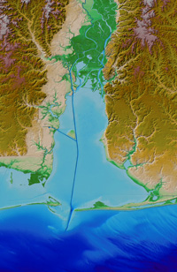
NCEI builds and distributes high-resolution, coastal digital elevation models (DEMs) that integrate ocean bathymetry and land topography supporting NOAA's mission to understand and predict changes in Earth's environment, and conserve and manage coastal and marine resources to meet our Nation's economic, social, and environmental needs.
DEMs are used for coastal process modeling (tsunami inundation, storm surge, sea-level rise, contaminant dispersal, etc.), ecosystems management and habitat research, coastal and marine spatial planning, and hazard mitigation and community preparedness.
Data sources: NOAA National Ocean Service, U.S. Geological Survey, U.S. Army Corps of Engineers, Federal Emergency Management Agency, and other government agencies, academic institutions, and private companies. DEMs are referenced to a variety of horizontal and vertical datums, which are defined by specific project requirements; spatial resolution ranges from 1/9 arc-second (~3 meters) to 3 arc-seconds (~90 meters).


